
 United Kingdom
 France
 Germany
 Netherlands
 Sweden
 USA
USA
 Italy
Italy
 Spain
Spain
More From Contributor


Malta - Gozo F&B
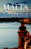
Malta and Gozo on a road map at 1:30, 000 from Freytag & Berndt with a booklet attached to the cover containing an index, street plans of Valetta, Bugibba and Rabat, plus descriptions of best sights prominently highlighted on the map.Topography is vividly presented by contours at 20m intervals, with altitude colouring and bold additional shading and graphics to highlight steep and rocky areas, particularly along the coastline. Road network includes country tracks, indicates scenic routes, shows locations of fuel supplies, and gives driving distances on main and secondary roads. The map also highlights many hiking trails. Ferry lines between the three islands and within the Valletta harbour are also shown. Best sights on Malta, Gozo and Comino are prominently marked, with their
photos and descriptions provided in the booklet attached to the map cover. Large icons indicate various other places of interest and tourist facilities: campsites, churches, monasteries and pilgrimage sites, windmills, castles and museums, caves, golf courses, marinas, etc. The map has a UTM grid for GPS navigation.The index booklet also provides street plans of Bugibba, Rabat with an additional enlargement of its old town, plus a multi-page plan of Valetta, also with an enlargement of its historic centre. Map legend and all the text include English.
photos and descriptions provided in the booklet attached to the map cover. Large icons indicate various other places of interest and tourist facilities: campsites, churches, monasteries and pilgrimage sites, windmills, castles and museums, caves, golf courses, marinas, etc. The map has a UTM grid for GPS navigation.The index booklet also provides street plans of Bugibba, Rabat with an additional enlargement of its old town, plus a multi-page plan of Valetta, also with an enlargement of its historic centre. Map legend and all the text include English.

Product Description
Reviews/Comments
Add New
Vouchers
No voucher codes found.
Do you know a voucher code for this product or supplier? Add it to Insights for others to use.
Do you know a voucher code for this product or supplier? Add it to Insights for others to use.
 Denmark