More From Contributor

£8.99
Kick Start is a new series of handy, pocket-size guides developed for the business traveler. Each guide is researched & written for a specific country & is designed to help readers kick-start themselves into action as soon as they arrive. Essential details are covered, including what to expect from the transportation system, where to get the best rate of exchange, & what to wear, as well as information on tax-free zones & local customs & etiquette. The guides are also helpful tools for entrepreneurs on the lookout for overseas business opportunities.

Malaysia is one of the world's most rapidly developing countries & prime places for entrepreneurs. The stock market is booming, real estate & construction is at a record high, & manufacturing & economic growth is set to stay at more than 6% to 7% into the next century.

Did you know...
-- Malaysia devotes one-fifth of all its public spending to education
-- The Malaysian handshake consists of touching the palms together & bringing the left hand to the heart (salaam)
-- You should never wear yellow at royal functions or at the palace -- it is the color reserved for royalty


...
Archived Product
£9.99
Malaysia on a double-sided, indexed map from ITMB showing the western, peninsular part at 1:750, 000, with Sarawak & Sabah at 1:1, 100, 000, plus large clear, street plans of central Kuala Lumpur, Kuching, Bandar Seri Bengawan & Kota Kinabalu, & an enlargement of the Mount Kinabalu Trail. Altitude colouring with elevation in feet shows the topography, & the map has numerous spot heights, particularly in the mountainous regions. Graphics indicate swamp areas & sand dunes. National parks & wildlife reserves are highlighted. Road network indicates toll motorways &

Includes::
selected local tracks. Railway lines are included & domestic airports are marked. The map also shows internal administrative boundaries & names of the provinces. Symbols highlight various places of interest. Latitude & longitude lines are drawn at 30’ intervals in Peninsular Malaysia & at 1° intervals in Borneo. Each side has a separate index. The map also has large, very clear street plans of central Kuala Lumpur, Kuching, Bandar Seri Bengawan & Kota Kinabalu, indicating numerous hotels, various sights & facilities, etc. An enlargement at 1:50, 000 approx & with contours at 500 feet intervals presents the trail to the summit of Mount Kinabalu.

...
Archived Product
£8.95
Malaysia on a double-sided map/guide from Odyssey Books, with extensive text accompanied by colour photos providing additional tourist information. Peninsular Malaysia 1:1, 300, 000 with Sarawak & Sabah at 1:2, 600, 000 are presented on both sides of the map – on one side with shading and/or colouring showing the topography & on the reverse vegetation. The map shows the network of main road & rail connections, plus regional airports. Relatively fewer smaller towns & villages are marked than on other maps of the country, so that places most visited by tourists are easy to find. National parks, reserves & wildlife sanctuaries are prominently highlighted. The map has no geographical coordinates. Both sides of the map carry numerous descriptions of Malaysia’s most interesting locations, national parks, etc, illustrated with 61 colour photos. Also included is a time line from pre-history to the present day. ...
Archived Product
£6.99
Malaysia on a double-sided map by Periplus, with enlargements for its most visited regions plus street plans for central Kuala Lumpur, Melaka, Georgetown, Johor Bahru, Kota Kinabalu & Kuching. Peninsular Malaysia is shown at 1:1, 500, 000, with Sabah & Sarawak at 1:2, 000, 000, accompanied by a map showing these two parts of the country in proper geographical context at 1:6, 500, 000. The network of main roads & railways is shown on a base with bold relief shading & spot heights for the main peaks. Local airports are marked & numerous places of interest highlighted, including historic sites, beaches, diving sites & national parks. The mapping also shows internal administrative divisions with names of the provinces. Latitude & longitude lines are drawn at intervals of 2° on the main country maps. The map also
Includes::* Enlargements of the Johor Bahru region with Singapore (1:200, 000) & of the Penang Island (1:80, 000)* Greater Kuala Lumpur area at 1:230, 000 plus a large street plan of central Kuala Lumpur at 1:15, 000* Street plans of central Georgetown (1:15, 000), Melaka (1:15, 000), Johor Bahru (1:20, 000), Kuching (1:17, 500) & Kota Kinabalu (1:30, 000). Like the main maps & the enlargements, street plans are also all annotated with various places of interest, plus numerous hotels, etc. None of the maps or plans are indexed. Also provided is a distance table.
...
Archived Product
£4.99
Malaysia in the Pocket Guide series from Berlitz; a collection of handy, pocket-sized guides dedicated to an extensive range of cities, regions & countries worldwide. Written in narrative form, individual guides explore the history, main sights & attractions, food & drink, accommodation & local culture of the destination in detail. Each Berlitz pocket guide has a similar format, with colour-coded sections helping readers locate information quickly in addition to distinctive chapters exploring the city or region. An introduction outlines the destination for visitors & a section dedicated to 'A Brief History' actually explores the area in relative depth. A where to go chapter is organized by region & city & is written in prose form with references to individual sites highlighted in bold for clarity. There are also further suggestions on where & when to eat. Recommendations for leisure activities in the region, including sport, nightlife & shopping, are also provided & tailored accordingly for each destination. Handy travel tips are listed alphabetically in a dedicated section, providing practical guidance & helping visitors make the most of their stay. The main hotels, particularly for cities, are also listed in an accommodation section, offering a brief overview with approximate price bandings & relevant contact details. ...
Archived Product
£6.99
Berlitz Pocket Guide Malaysia is a concise, full-colour travel guide that combines lively text with vivid photography to highlight the very best that this diverse country has to offer. The Where To Go chapter details all the key sights on a tour of both Peninsular Malaysia & Malaysia Borneo, from the dazzling architecture of Kuala Lumpur & the World Heritage Sites of Georgetown & Melaka, to the natural splendours of Mount Kinabalu & the world's largest orangutan sanctuary in Sabah. Handy maps on the cover help you to get around with ease. To inspire you, the book offers a rundown of the Top 10 Attractions in Malaysia, followed by an itinerary for a Perfect Tour of the country. The What to Do chapter is a snapshot of ways to spend your spare time, from shopping & sports to traditonal Malay dance & theatre. You'll also be armed with background information, including a brief history of the country & an Eating Out chapter covering its mouth-watering cuisine. There are carefully chosen listings of the best hotels & restaurants, & an A-Z to give you all the practical information you will need. ...
Archived Product
£11.50
Malaysia at 1:800, 000 for the peninsular part of the country & at 1:1, 100, 000 for Sarawak & Sabah (Northern Borneo) on an indexed road map with topographic & tourist information, printed on light, waterproof & tear-resistant plastic paper. The map, part of Reise Know-How’s highly acclaimed World Mapping Project, is double-sided to provide the best balance between a good scale & a convenient size sheet. On one side is the Peninsular Malaysia shown at 1:800, 000, with on the reverse the country’s two provinces on northern Borneo, Sarawak & Sabah, & Brunei. Topography is indicated by altitude colouring with spot heights, names of mountain ranges & peaks, swamps, mangroves & coral reefs in the coastal waters. National parks & other protected areas are highlighted. Road network

Includes::
local roads & selected tracks. Intermediate driving distances are shown on main routes. Railway lines & ferry connections are included & local airports or airfields are marked. Also indicated are internal administrative boundaries with names of the provinces. Symbols highlight various places of interest, including mosques & Hindu or Buddhist temples, caves, beaches & diving sites, etc. Latitude & longitude lines are drawn at 12° intervals & the map has an extensive index of localities. Map legend

Includes::
English.


...
Archived Product
£4.99
This portable map of Malaysia guarantees you won`t go anywhere without the information you need! This first edition wall map of Malaysia is handsome enough to hang up & display, while sufficiently compact to carry on hand for easy access. It is scaled at 1:2, 000, 000 & features a simple-to-use legend for quick reference. When not in use, the map can be folded to a compact 7 1/2 x 10 3/4 inches, & stored in the included protective pocket with a cardstock cover. However, when opened, it hangs for easy display. This Malaysia map emphasizes essential points of interest such as: Transportation (airports, ferries, highways & secondary roads, etc.) Recreational amenities (beaches, museums, golf courses, etc.) Places of worship, educational facilities, lighthouses, & towers Geographic features (ponds, rivers, lakes) & more! Never be caught off-guard with this thorough & up-to-date map & Malaysia atlas from Periplus, the number one publisher of maps for foreign travelers in Asia. ...
Archived Product
£7.95
Peninsular Malaysia at 1:1, 500, 000 & a street plan of Singapore at 1:15, 000 from Nelles Verlag, with a smaller size sheet offering a convenient format for use when travelling. Also included are several other street plans & enlargements. On one side is a road map of the western, peninsular part of Malaysia. Vivid relief shading, numerous spot & names of mountain ranges, plus graphics for marshlands present the topography. National parks & other protected area are marked. Road network distinguishes between highways in good & poor condition &

Includes::
partially paved roads & cart tracks, with distances shown on main routes. Railway lines & local airports are included, & the map also shows internal administrative boundaries with names of the states. Numerous places of interest are prominently marked. Latitude & longitude margin ticks are at 1

...
Archived Product
£10.99
Road map fro Nelles Verlag presenting the Peninsular Malaysia at 1:1, 500, 000 with additional street plans & enlargements, plus on the reverse an indexed street plan of Singapore City & maps of Singapore Island & an enlargement of Sentosa Isl&. Smaller size sheet offers a convenient format for use when travelling & map legend for all the sections of this title

Includes::
English. On one side is a road map of the western, peninsular part of Malaysia. Vivid relief shading, spot & names of mountain ranges, plus graphics for marshlands present the topography. National parks & other protected area are marked. Road network distinguishes between highways in good & poor condition &

Includes::
partially paved roads & cart tracks, with distances shown on main routes. Railway lines & local airports are included, & the map also shows internal administrative boundaries with names of the states. Numerous places of interest are prominently marked. Latitude & longitude margin ticks are at 1


...
Archived Product

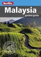
Malaysia Pocket Guide

Berlitz Pocket Guide Malaysia is a concise, full-colour travel guide that combines lively text with vivid photography to highlight the very best that this diverse country has to offer. The Where To Go chapter details all the key sights on a tour of both Peninsular Malaysia and Malaysia Borneo, from the dazzling architecture of Kuala Lumpur and the World Heritage Sites of Georgetown and Melaka, to the natural splendours of Mount Kinabalu and the world`s largest orangutan sanctuary in Sabah. Handy maps on the cover help you to get around with ease. To inspire you, the book offers a rundown of the Top 10 Attractions in Malaysia, followed by an itinerary for a Perfect Tour of the country. The What to Do chapter is a snapshot of ways to spend your spare time, from shopping and sports to
traditonal Malay dance and theatre. You`ll also be armed with background information, including a brief history of the country and an Eating Outchapter covering its mouth-watering cuisine.There are carefully chosen listings of the best hotels and restaurants, and an A-Z to give you all the practical information you will need Malaysia`s diverse wildlife, tropical beaches and dynamic capital city of Kuala Lumpur are attracting more and more visitors each year, with a record number of 24.7 million tourists in 2011 (Tourism Malaysia). Berlitz Pocket Guide Malaysia is the ideal handy guide to this diverse and fascinating country, combining concise information on where to go and what to do with great photography and full-colour, fold-out maps.
RIP - This product is no longer available on our network. It was last seen on 25.09.2019

This page now acts as a permanent archive for this product. Add more information using the comments box below to ensure it can still be found by future generations.

Use our search facility to see if it is available from an alternative contributor.
  • External links may include paid for promotion
  • Availability: Out Of Stock
  • Supplier: Stanfords
  • SKU: 9781780048796
Availability: In Stock
£6.99

Product Description

Berlitz Pocket Guide Malaysia is a concise, full-colour travel guide that combines lively text with vivid photography to highlight the very best that this diverse country has to offer. The Where To Go chapter details all the key sights on a tour of both Peninsular Malaysia & Malaysia Borneo, from the dazzling architecture of Kuala Lumpur & the World Heritage Sites of Georgetown & Melaka, to the natural splendours of Mount Kinabalu & the world`s largest orangutan sanctuary in Sabah. Handy maps on the cover help you to get around with ease. To inspire you, the book offers a rundown of the Top 10 Attractions in Malaysia, followed by an itinerary for a Perfect Tour of the country. The What to Do chapter is a snapshot of ways to spend your spare time, from shopping & sports to traditonal Malay dance & theatre. You`ll also be armed with background information, including a brief history of the country & an Eating Outchapter covering its mouth-watering cuisine. There are carefully chosen listings of the best hotels & restaurants, & an A-Z to give you all the practical information you will need Malaysia`s diverse wildlife, tropical beaches & dynamic capital city of Kuala Lumpur are attracting more & more visitors each year, with a record number of 24.7 million tourists in 2011 (Tourism Malaysia). Berlitz Pocket Guide Malaysia is the ideal handy guide to this diverse & fascinating country, combining concise information on where to go & what to do with great photography & full-colour, fold-out maps.

Reviews/Comments

Add New

Intelligent Comparison

Oooops!
We couldn't find anything!
Perhaps this product's unique.... Or perhaps we are still looking for comparisons!
Click to bump this page and we'll hurry up.

Price History

Vouchers

No voucher codes found.
Do you know a voucher code for this product or supplier? Add it to Insights for others to use.

Facebook

Jargon Buster

Key - A physical or virtual device or code used for opening something
History - Anything that happens in the past. An acedemic subject.
World - A physical grouping, commonly used to describe earth and everything associated with ti
Colour - The categorised spectrum of light visable to humans
Year - The time it takes the planet earth to orbit the sun. This takes around 365.25 days.
Natural - not manmade
Tropical - Coming fro the work "tropics" a hot and humid area of the world.
Practical - Weather a task is easy to carry out and realistically succeed.
Year - 365 days (366 days in a leap year), the time taken for planet earth to make one full revolution around the sun.
Pocket - A bag shaped insert in clothing used to carry items
Ideal - Something that satisfies a perfect criteria.

Supplier Information

Stanfords
Stanfords was established in 1853 and opened their iconic Covent Garden flagship store in 1901. They have become the top retailer of maps, travel books and accessories in the UK and arguably offer the largest selection of maps and travel books worldwide. Famous names such as Captain Robert Falcon Scott, Ranulph Fiennes and Michael Palin have purchased from Stanfords. They now have a shop in Bristol and both stores together with other venues operate a calendar of events including talks, book signings and exhibitions. As a specialist map retailer, the map selection is comprehensive and includes road maps, street maps and walking maps from worldwide destinations, as well as a selection of world atlases and wall maps. Books include travel guides and travel literature. Stanfords also stock globes, from miniatures made of blue marble to magnificent floor-standing globes. The website features a selection of interesting articles on travel topics.
Page Updated: 2023-11-12 20:15:36

Community Generated Product Tags

Oh No! The productWIKI community hasn't generated any tags for this product yet!
Menu