More From Contributor

£6.99
Malaysia & Indonesia at 1:2, 000, 000 on a large, double-sided map from Marco Polo Travel Publishing with an extensive index which also lists topographic features, national parks, etc, plus special aids for route planning.A fold-out flap in the jacket makes route planning easier by placing the main map in proper geographical context with the remainder of South East Asia, Philippines & the northern coast of Australia. Popular locations are highlighted & the grid reference system in the margins makes it easier to find places on the main map. A set of seven peel-on/peel-off stickers, removable from the map without damaging its surface, is included for making special locations more prominent. To provide the coverage of the whole area at 1:2, 000, 000, the map is divided along approx. 118°30’ west, with the easternmost tip of Borneo & part Sumbawa shown on the reverse side with the eastern part of the Indonesian archipelago. Relief shading with names of mountain ranges & peaks or spot height shows the topography, with additional graphics for swamps or marshl&. The map shows the region’s road & rail networks, local airports & ferry connections between the islands. Also marked are internal administrative boundaries with names of the provinces, as well as the division into time zones. National parks & places of interest are highlighted. The map has latitude & longitude grid at intervals of 1° degree. Map legend

Includes::
English. A separate 40-page booklet attached to the map cover contains an extensive index of place names: towns & villages, islands, seas, topographic features such as rivers & lakes, places of interest, national parks, etc.

...
Archived Product
£13.99
Malaysia in Marshall Cavendish's Culture Shock! Series; comprising a range of guides that inform visitors of the finer points & details relating to social etiquette, traditions & customs; bringing visitors to a sensitive yet substantial understanding of the country or city in question. The series targets those who are planning long stays in the destination or extended periods of residence. The guides are written by authors who have experienced the joys & pitfalls of cultural adaptation, & so are ideally placed to provide informative & relevant advice. Each title contains insights into local culture & traditions, guidance on adapting to the local environment, linguistic help & lots of general advice about local culture & idiosyncrasies to help prepare readers for their visit. Each title is structured similarly, beginning with the first impressions a visitor might expect to have. The guides aim to help readers understand the local culture through first appreciating the motivations, beliefs & attitudes of the local people. Practical advice on settling in is provided, with focused sections on accommodation, utilities, health, education & telecommunications. There is also extensive information on the destination ...
Archived Product
£10.99
Malaysia on a double-sided, indexed map from Freytag & Berndt, covering both parts of the country at the same scale of 1:900, 000; on one side Peninsular Malaysia, with Sarawak & Sabah on the reverse. Very effective relief shading with spot heights & graphics for swamps or mangrove areas & coral reefs provide good representation of the country’s topography. Road network

Includes::
selected local tracks; intermediate distances are given on main routes. Railways, local airports & ferry routes are shown, as well as the country’s internal administrative boundaries with names of the provinces. National parks & other protected areas are highlighted, & icons mark locations of various places of interest, including temples, beaches, caves, etc. The map has a latitude & longitude grid at intervals of 1º & an index. Map legend

Includes::
English.


...
Archived Product
£8.99
Kick Start is a new series of handy, pocket-size guides developed for the business traveler. Each guide is researched & written for a specific country & is designed to help readers kick-start themselves into action as soon as they arrive. Essential details are covered, including what to expect from the transportation system, where to get the best rate of exchange, & what to wear, as well as information on tax-free zones & local customs & etiquette. The guides are also helpful tools for entrepreneurs on the lookout for overseas business opportunities.

Malaysia is one of the world's most rapidly developing countries & prime places for entrepreneurs. The stock market is booming, real estate & construction is at a record high, & manufacturing & economic growth is set to stay at more than 6% to 7% into the next century.

Did you know...
-- Malaysia devotes one-fifth of all its public spending to education
-- The Malaysian handshake consists of touching the palms together & bringing the left hand to the heart (salaam)
-- You should never wear yellow at royal functions or at the palace -- it is the color reserved for royalty


...
Archived Product
£9.99
Malaysia on a double-sided, indexed map from ITMB showing the western, peninsular part at 1:750, 000, with Sarawak & Sabah at 1:1, 100, 000, plus large clear, street plans of central Kuala Lumpur, Kuching, Bandar Seri Bengawan & Kota Kinabalu, & an enlargement of the Mount Kinabalu Trail. Altitude colouring with elevation in feet shows the topography, & the map has numerous spot heights, particularly in the mountainous regions. Graphics indicate swamp areas & sand dunes. National parks & wildlife reserves are highlighted. Road network indicates toll motorways &

Includes::
selected local tracks. Railway lines are included & domestic airports are marked. The map also shows internal administrative boundaries & names of the provinces. Symbols highlight various places of interest. Latitude & longitude lines are drawn at 30’ intervals in Peninsular Malaysia & at 1° intervals in Borneo. Each side has a separate index. The map also has large, very clear street plans of central Kuala Lumpur, Kuching, Bandar Seri Bengawan & Kota Kinabalu, indicating numerous hotels, various sights & facilities, etc. An enlargement at 1:50, 000 approx & with contours at 500 feet intervals presents the trail to the summit of Mount Kinabalu.

...
Archived Product
£6.99
Malaysia on a double-sided map by Periplus, with enlargements for its most visited regions plus street plans for central Kuala Lumpur, Melaka, Georgetown, Johor Bahru, Kota Kinabalu & Kuching. Peninsular Malaysia is shown at 1:1, 500, 000, with Sabah & Sarawak at 1:2, 000, 000, accompanied by a map showing these two parts of the country in proper geographical context at 1:6, 500, 000. The network of main roads & railways is shown on a base with bold relief shading & spot heights for the main peaks. Local airports are marked & numerous places of interest highlighted, including historic sites, beaches, diving sites & national parks. The mapping also shows internal administrative divisions with names of the provinces. Latitude & longitude lines are drawn at intervals of 2° on the main country maps. The map also
Includes::* Enlargements of the Johor Bahru region with Singapore (1:200, 000) & of the Penang Island (1:80, 000)* Greater Kuala Lumpur area at 1:230, 000 plus a large street plan of central Kuala Lumpur at 1:15, 000* Street plans of central Georgetown (1:15, 000), Melaka (1:15, 000), Johor Bahru (1:20, 000), Kuching (1:17, 500) & Kota Kinabalu (1:30, 000). Like the main maps & the enlargements, street plans are also all annotated with various places of interest, plus numerous hotels, etc. None of the maps or plans are indexed. Also provided is a distance table.
...
Archived Product
£4.99
Malaysia in the Pocket Guide series from Berlitz; a collection of handy, pocket-sized guides dedicated to an extensive range of cities, regions & countries worldwide. Written in narrative form, individual guides explore the history, main sights & attractions, food & drink, accommodation & local culture of the destination in detail. Each Berlitz pocket guide has a similar format, with colour-coded sections helping readers locate information quickly in addition to distinctive chapters exploring the city or region. An introduction outlines the destination for visitors & a section dedicated to 'A Brief History' actually explores the area in relative depth. A where to go chapter is organized by region & city & is written in prose form with references to individual sites highlighted in bold for clarity. There are also further suggestions on where & when to eat. Recommendations for leisure activities in the region, including sport, nightlife & shopping, are also provided & tailored accordingly for each destination. Handy travel tips are listed alphabetically in a dedicated section, providing practical guidance & helping visitors make the most of their stay. The main hotels, particularly for cities, are also listed in an accommodation section, offering a brief overview with approximate price bandings & relevant contact details. ...
Archived Product
£6.99
Berlitz Pocket Guide Malaysia is a concise, full-colour travel guide that combines lively text with vivid photography to highlight the very best that this diverse country has to offer. The Where To Go chapter details all the key sights on a tour of both Peninsular Malaysia & Malaysia Borneo, from the dazzling architecture of Kuala Lumpur & the World Heritage Sites of Georgetown & Melaka, to the natural splendours of Mount Kinabalu & the world`s largest orangutan sanctuary in Sabah. Handy maps on the cover help you to get around with ease. To inspire you, the book offers a rundown of the Top 10 Attractions in Malaysia, followed by an itinerary for a Perfect Tour of the country. The What to Do chapter is a snapshot of ways to spend your spare time, from shopping & sports to traditonal Malay dance & theatre. You`ll also be armed with background information, including a brief history of the country & an Eating Outchapter covering its mouth-watering cuisine. There are carefully chosen listings of the best hotels & restaurants, & an A-Z to give you all the practical information you will need Malaysia`s diverse wildlife, tropical beaches & dynamic capital city of Kuala Lumpur are attracting more & more visitors each year, with a record number of 24.7 million tourists in 2011 (Tourism Malaysia). Berlitz Pocket Guide Malaysia is the ideal handy guide to this diverse & fascinating country, combining concise information on where to go & what to do with great photography & full-colour, fold-out maps. ...
Archived Product
£6.99
Berlitz Pocket Guide Malaysia is a concise, full-colour travel guide that combines lively text with vivid photography to highlight the very best that this diverse country has to offer. The Where To Go chapter details all the key sights on a tour of both Peninsular Malaysia & Malaysia Borneo, from the dazzling architecture of Kuala Lumpur & the World Heritage Sites of Georgetown & Melaka, to the natural splendours of Mount Kinabalu & the world's largest orangutan sanctuary in Sabah. Handy maps on the cover help you to get around with ease. To inspire you, the book offers a rundown of the Top 10 Attractions in Malaysia, followed by an itinerary for a Perfect Tour of the country. The What to Do chapter is a snapshot of ways to spend your spare time, from shopping & sports to traditonal Malay dance & theatre. You'll also be armed with background information, including a brief history of the country & an Eating Out chapter covering its mouth-watering cuisine. There are carefully chosen listings of the best hotels & restaurants, & an A-Z to give you all the practical information you will need. ...
Archived Product
£11.50
Malaysia at 1:800, 000 for the peninsular part of the country & at 1:1, 100, 000 for Sarawak & Sabah (Northern Borneo) on an indexed road map with topographic & tourist information, printed on light, waterproof & tear-resistant plastic paper. The map, part of Reise Know-How’s highly acclaimed World Mapping Project, is double-sided to provide the best balance between a good scale & a convenient size sheet. On one side is the Peninsular Malaysia shown at 1:800, 000, with on the reverse the country’s two provinces on northern Borneo, Sarawak & Sabah, & Brunei. Topography is indicated by altitude colouring with spot heights, names of mountain ranges & peaks, swamps, mangroves & coral reefs in the coastal waters. National parks & other protected areas are highlighted. Road network

Includes::
local roads & selected tracks. Intermediate driving distances are shown on main routes. Railway lines & ferry connections are included & local airports or airfields are marked. Also indicated are internal administrative boundaries with names of the provinces. Symbols highlight various places of interest, including mosques & Hindu or Buddhist temples, caves, beaches & diving sites, etc. Latitude & longitude lines are drawn at 12° intervals & the map has an extensive index of localities. Map legend

Includes::
English.


...
Archived Product

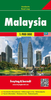
Malaysia Odyssey Map

Malaysia on a double-sided map/guide from Odyssey Books, with extensive text accompanied by colour photos providing additional tourist information. Peninsular Malaysia 1:1, 300, 000 with Sarawak and Sabah at 1:2, 600, 000 are presented on both sides of the map – on one side with shading and/or colouring showing the topography and on the reverse vegetation. The map shows the network of main road and rail connections, plus regional airports. Relatively fewer smaller towns and villages are marked than on other maps of the country, so that places most visited by tourists are easy to find. National parks, reserves and wildlife sanctuaries are prominently highlighted. The map has no geographical coordinates. Both sides of the map carry numerous descriptions of Malaysia’s most interesting
locations, national parks, etc, illustrated with 61 colour photos. Also included is a time line from pre-history to the present day.
RIP - This product is no longer available on our network. It was last seen on 25.09.2019

This page now acts as a permanent archive for this product. Add more information using the comments box below to ensure it can still be found by future generations.

Use our search facility to see if it is available from an alternative contributor.
  • External links may include paid for promotion
  • Availability: Out Of Stock
  • Supplier: Stanfords
  • SKU: 9789622178564
Availability: In Stock
£8.95

Product Description

Malaysia on a double-sided map/guide from Odyssey Books, with extensive text accompanied by colour photos providing additional tourist information. Peninsular Malaysia 1:1, 300, 000 with Sarawak & Sabah at 1:2, 600, 000 are presented on both sides of the map – on one side with shading and/or colouring showing the topography & on the reverse vegetation. The map shows the network of main road & rail connections, plus regional airports. Relatively fewer smaller towns & villages are marked than on other maps of the country, so that places most visited by tourists are easy to find. National parks, reserves & wildlife sanctuaries are prominently highlighted. The map has no geographical coordinates. Both sides of the map carry numerous descriptions of Malaysia’s most interesting locations, national parks, etc, illustrated with 61 colour photos. Also included is a time line from pre-history to the present day.

Reviews/Comments

Add New

Intelligent Comparison

Oooops!
We couldn't find anything!
Perhaps this product's unique.... Or perhaps we are still looking for comparisons!
Click to bump this page and we'll hurry up.

Price History

Vouchers

No voucher codes found.
Do you know a voucher code for this product or supplier? Add it to Insights for others to use.

Facebook

Jargon Buster

History - Anything that happens in the past. An acedemic subject.
Colour - The categorised spectrum of light visable to humans
Day - The time it takes a planet or other space objects to complete one rotation.
Network - A link and communication between things. Often computers or people.
Road - a manmade lane or a path that is used to speed up travel.
Regional - An adjective to describe a set geographic area.

Supplier Information

Stanfords
Stanfords was established in 1853 and opened their iconic Covent Garden flagship store in 1901. They have become the top retailer of maps, travel books and accessories in the UK and arguably offer the largest selection of maps and travel books worldwide. Famous names such as Captain Robert Falcon Scott, Ranulph Fiennes and Michael Palin have purchased from Stanfords. They now have a shop in Bristol and both stores together with other venues operate a calendar of events including talks, book signings and exhibitions. As a specialist map retailer, the map selection is comprehensive and includes road maps, street maps and walking maps from worldwide destinations, as well as a selection of world atlases and wall maps. Books include travel guides and travel literature. Stanfords also stock globes, from miniatures made of blue marble to magnificent floor-standing globes. The website features a selection of interesting articles on travel topics.
Page Updated: 2023-11-12 20:15:36

Community Generated Product Tags

Oh No! The productWIKI community hasn't generated any tags for this product yet!
Menu