
 United Kingdom
 France
 Germany
 Netherlands
 Sweden
 USA
USA
 Italy
Italy
 Spain
Spain
More From Contributor


Madeira Walking
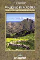
Walking in Madeira is accomplished walker Paddy Dillon’s Cicerone guide to walking on the volcanic islands of Madeira and Porto Santo in the Atlantic Ocean. The walks covered stretch from sea level to the highest peaks on the islands and explore the cliff coastline, wander from village to village along level levada paths, penetrating dense laurisilva forests and traversing stone-paved paths from peak to peak in the high mountains. This new edition takes account of the sweeping change on Madeira in terms of its new network of underground road tunnels, bus routes and accommodation and food and drink options on and around the walks.The guide is structured in seven main sections - Eastern Madeira, Funchal to Santana, The High Mountains, Jardim da Serra, Paul de Serra, Western Madeira
and Porto Santo - detailing a total of 60 walks on the islands. Each walk has an Information Box with details of starting and finishing points, distance, total ascent and descent, time, the relevant maps, terrain, refreshments and local transport options. A detailed introduction gives practical guidance on getting to and around Madeira, accommodation, food and drink, weather, health issues and emergencies. There is also an overview of the island’s location, geology, history and landscape and details about native trees, flowers, birds and animals. Detailed walk descriptions are accompanied by sketch diagrams mapping the route in addition to colour photographs illustrating some of the highlights of the islands.
and Porto Santo - detailing a total of 60 walks on the islands. Each walk has an Information Box with details of starting and finishing points, distance, total ascent and descent, time, the relevant maps, terrain, refreshments and local transport options. A detailed introduction gives practical guidance on getting to and around Madeira, accommodation, food and drink, weather, health issues and emergencies. There is also an overview of the island’s location, geology, history and landscape and details about native trees, flowers, birds and animals. Detailed walk descriptions are accompanied by sketch diagrams mapping the route in addition to colour photographs illustrating some of the highlights of the islands.

Product Description
Reviews/Comments
Add New
Vouchers
No voucher codes found.
Do you know a voucher code for this product or supplier? Add it to Insights for others to use.
Do you know a voucher code for this product or supplier? Add it to Insights for others to use.
 Denmark