
 United Kingdom
 France
 Germany
 Netherlands
 Sweden
 USA
USA
 Italy
Italy
 Spain
Spain
More From Contributor
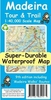


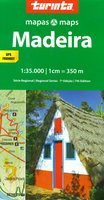
Madeira Turinta
Madeira at 1:35, 000 on a brightly coloured, double-sided road map from the Portuguese publishers Turinta emphasising the island’s main roads and places of interest, plus a large street plan of central Funchal and a map of the nearby Porto Santo at 1:90, 000.The map divides Madeira east/west, with a good overlap between the sides. Place names are in large, easy-to-read print. Bright altitude colouring with contours at 50m intervals shows the island’s topography, with build-up areas also prominently coloured. Road network emphasises principal and regional routes. Driving distances are shown on principal routes only and locations of petrol stations are marked. The map also indicates locations and roads with bus connections. Icons show places of interest, including campsites,
viewpoints, beaches, etc. The map has latitude and longitude lines at 3’ intervals. A street plan of Funchal highlights main traffic arteries, names selected streets and indicates various facilities including car parks, petrol stations, etc.
viewpoints, beaches, etc. The map has latitude and longitude lines at 3’ intervals. A street plan of Funchal highlights main traffic arteries, names selected streets and indicates various facilities including car parks, petrol stations, etc.

Product Description
Reviews/Comments
Add New
Vouchers
No voucher codes found.
Do you know a voucher code for this product or supplier? Add it to Insights for others to use.
Do you know a voucher code for this product or supplier? Add it to Insights for others to use.
 Denmark