
 United Kingdom
 France
 Germany
 Netherlands
 Sweden
 USA
USA
 Italy
Italy
 Spain
Spain
More From Contributor


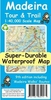


Madeira Tour And Trail PAPER
Madeira Tour and Trail is an updated, double sided, indexed, map at a scale of 1:40, 000 designed primarily for walkers but will be of use to motorists on the island as well. A large number of walking routes are marked on the map.Main and minor roads, dirt tracks, footpaths, trails are all very clearly marked, as are regional boundaries. Vertiginous sections on are especially marked, as are tunnels and cable cars. Additional information concerning routes currently in construction is also provided. Petrol stations and dedicated parking facilities are shown, as are rest stops and picnic areas. Camp sites and hotels are indicated, as well as the island's famous gardens and historical sites. Longitude and latitude co-ordinates are given at one minute intervals, detailed relief
shading and contours are shown, as are spot heights. An indexed street plan of central Funchal is provided as an inset on the larger map.Current edition of this map was published in 2009.
shading and contours are shown, as are spot heights. An indexed street plan of central Funchal is provided as an inset on the larger map.Current edition of this map was published in 2009.
Product Description
Reviews/Comments
Add New
Intelligent Comparison
Archived Product
Madeira Tour And Trail Map PAPER Stanfords
£5.99
Archived Product
Menorca Tour And Trail PAPER Stanfords
£5.99
Archived Product
Madeira Tour And Trail WATERPROOF Stanfords
£8.99
Archived Product
Madeira Tour And Trail Map WATERPROOF Stanfords
£8.99
Archived Product
Lanzarote Tour And Trail PAPER Stanfords
£5.99
Archived Product
Menorca Tour And Trail WATERPROOF Stanfords
£8.99
Archived Product

Madeira Tour & Trail Paper Map Stanfords
£5.99
Vouchers
No voucher codes found.
Do you know a voucher code for this product or supplier? Add it to Insights for others to use.
Do you know a voucher code for this product or supplier? Add it to Insights for others to use.
 Denmark