More From Contributor

£23.99
Map No. 10072, Lesja, in the new topographic survey of Norway at 1:50, 000 covering the country on 195 double-sided sheets & first published by Nordeca in 2011
- 2012; fully GPS compatible, indicating waymarked footpaths, campsites, tourist huts, illuminated ski runs, etc. The maps, now published by Nordeca, the successors to Statens Kartverk & its subsequent owners the Ugland Group, are printed on light, waterproof & tear-resistant synthetic paper. Each map covers an area of 62x 45 kilometres (39 x 28 miles approx.), with a 2-km overlap between the sheets. The maps have contours at 20m intervals (10m glacier contours), plus colouring & graphics to show cultivated areas, bogs, forests, etc. In addition to all the information expected of topographic mapping at this scale the maps distinguish between waymarked & unmarked footpaths & show campsites, tourist huts (serviced/self service/no supplies), country hotels & restaurants, & illuminated ski trails. The series uses EUREF89 (WGS84) datum & the maps have a 1-km UTM grid. Map legend is in Norwegian & English. Each title comes in a sturdy protective card envelope.
...
Archived Product
£9.95
Lesotho at 1: 350, 000 on a GPS-compatible, indexed map from the South African publishers Map Studio, with road information indicating sections which are difficult and/or impassable after heavy rain, plus a street plan of central Maseru, etc. The map shows the topography by altitude colouring with names of mountain ranges & peaks, plus spot heights & symbols for mountain passes. Road network is classified as main roads, other all- or fair-weather roads & 4WD tracks. Also marked are ...
Archived Product
£13.95
This title is from the mists of Basotho legend
- from the time of King Moshoeshoe. The tiny country of Lesotho is entirely surrounded
...
Archived Product
£13.99
Lesotho on a road map from South African publishers International Motoring Productions with GPS waypoints for selected small towns or settlements, road junctions & recommended accommodation or campsites. The map, one of a series of similar maps covering countries & selected regions of southern Africa, has rather simple cartography with somewhat basic elevation tinting, spot heights, rivers & lakes & names of main peaks & mountain ranges. Main protected areas are highlighted. Roads are classified as main, tarred, gravel 2WD or 4WD tracks & show driving distances on selected routes & locations of fuel stations. Border crossings to South Africa are shown with opening times. Local airfields are marked & symbols indicate various places of interest & accommodation. The map has lists of GPS waypoints for selected villages & road junctions. GPS coordinates are also provided for recommended accommodation, some with contact details & symbols indicating what facilities can be found there. An enlargement shows the Lekhatje/ Jobo Mountain area, there is also a basic plan of Maseru with accommodation, facilities, etc. Also included are notes on travelling in the country, customs regulations, etc. ...
Archived Product
£10.99
Lesotho at 1: 375, 000 on an indexed map from the South African publishers Map Studio, with GPS coordinates for important road junctions, locations with tourist accommodation or fuel supplies, etc, plus a street plan of central Maseru. The map uses satellite imagery enhanced by altitude colouring to present the topography of this mountainous country. Road network differentiates between tarred & untarred roads &

Includes::
selected tracks. Locations of border crossings & of fuel stations are marked & driving distances are shown on main routes. Many road junctions are annotated with their GPS waypoints. Symbols indicate locations with access by air transport, tourist accommodation including campsites & caravan parks, medical facilities, etc. The map is indexed & has latitude & longitude lines at intervals of 30’. The plan of central Maseru names selected streets & highlights important buildings.

...
Archived Product
£12.99
Topographic survey of France at 1:25, 000 in IGN`s excellent TOP25 / Série Bleue series. All the maps are GPS compatible, with a 1km UTM grid plus latitude & longitude lines at 5’ intervals. Contours are at 5m intervals except for mountainous areas where the maps have contours at 10m intervals, vividly enhanced by hill shading & graphics for rocky terrain. Colouring with graphics indicates different types of vegetation or land use (deciduous or coniferous forests, moors, orchards, vineyards, etc). PLEASE NOTE: coverage of France at this scale is currently being revised – the format & the presentation of each title are indicated by the letters at the end of its Sheet Reference number (e.g. 0416ET, 3531ETR, 1923SB, etc.)MAPS WITH FULL TOURIST OVERPRINT & AN ENGLISH MAP LEGEND: all TOP25 maps & the SB editions of Série Bleue have an overprint highlighting waymarked walking trails including long-distance GR routes &, where appropriate, ski routes. Symbols indicate campsites, gîtes d’etape, refuges, equestrian centres & other recreational facilities or sites, tourist information centres, cultural heritage, etc. Towns & locations of particular interest are highlighted.- ET or OT = single-sided TOP25 map covering approx. 29x 21 km / 18x 13 miles.- ETR or OTR = waterproof & tear resistant TOP25 map covering the same area as the corresponding ET or OT number, but double-sided, printed on a smaller size sheet with a good overlap between the sides.- SB = Série Bleue map with full tourist overprint; these maps, first introduced in summer 2014, each cover approx. 29x 24km / 18x 15 miles.SÉRIE BLEUE maps with numbers ending in E (Est) or O (Ouest): most editions now indicate the GR routes, but do not show any other tourist information. Map legend is in French only. Each map covers approx. 14x 20km / 9x 12 miles. ...
Archived Product
£8.99
WINNER OF THE PULITZER PRIZE FOR FICTION 2018` Marvellously, endearingly, unexpectedly funny` Gary Shteyngart` Bedazzling, bewitching & be-wonderful` New York Times Book Review`A fast & rocketing read... a wonderful, wonderful book!` Karen Joy Fowler Arthur Less is a failed novelist about to turn fifty. A wedding invitation arrives in the post: it is from an ex-boyfriend of nine years who is engaged to someone else. Arthur can`t say yes
- it would be too awkward; he can`t say no
- it would look like defeat. So, he begins to accept the invitations on his desk to half-baked literary events around the world. From France to India, Germany to Japan, Arthur almost falls in love, almost falls to his death, & puts miles between him & the plight he refuses to face. Less is a novel about mishaps, misunderstandings & the depths of the human heart.

...
Archived Product
£16.99
Topographic survey of Sweden at 1:50, 000, the Terrängkartan, from the Lantmäteriet, covering most of the country in 244 double-sided maps. Please note: the mountainous regions of central & northern Sweden are not covered by this series but presented in a separate “ Fjällkartan
- Mountain Map” series also listed on our website. Each 1:50, 000 topographic survey map covers an area of 37.5 x 40km. The maps have contours at 5 metre intervals, plus relief shading & graphics for rocky outcrops & boulders. Further graphics and/or colouring show different types of land use or vegetation (forests, arable l&, orchards, marshes, peat bogs, etc). An unusual feature of this survey is the colouring indicating buildings below or above two storeys high & “leisure/holiday homes”. The maps indicate privately maintained roads & include all other information expected of topographic survey at this scale. The maps have a 1-km UTM grid, plus latitude & longitude lines 5’ intervals. Map legend

Includes::
English. For coverage of the country’s most visited hiking areas in central & northern Sweden please see Lantmäteriet’s Mountain Map series, listed separately on our website.


...
Archived Product
£14.95
Map No. K-27B in the TPC series: military topographic survey mapping covering the world's land masses & significant islands at 1:500, 000. The maps are useful as general topographical coverage where nothing else is available, although they are designed primarily as flying charts for military aircraft. TPC stands for Tactical Pilotage Chart. Relief is portrayed by a combination of contours (basic interval 500ft, intermediate contours shown where appropriate), elevation tinting & relief shading, plus spot heights. Towns, villages, major roads, railways & airports are shown but please note that many of the smaller settlements are not named & the road information is not necessarily up to date, as compilation & revision dates vary. Some air navigation information also appears on the map, such as radio beacons & restricted flying zones. Each TPC chart has both UTM & latitude/longitude grids overprinted on it, with additional margin ticks. IMPORTANT
- PLEASE NOTE: The series is gradually being withdrawn from sale to the general public & some sheets may no longer be available when ordered by us. Due to the nature of the map projection assembling these sheets to make a larger map is not recommended. in addition, colours used for relief are not constant throughout the series. In some areas of central Africa & South America the maps have blank spaces, reflecting localized deficiencies or inconsistencies in the survey data.
...
Archived Product

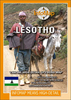
Lesotho Map Studio Adventure Map

Lesotho at 1: 375, 000 on an indexed map from the South African publishers Map Studio, with GPS coordinates for important road junctions, locations with tourist accommodation or fuel supplies, etc, plus a street plan of central Maseru.The map uses satellite imagery enhanced by altitude colouring to present the topography of this mountainous country. Road network differentiates between tarred and untarred roads and includes selected tracks. Locations of border crossings and of fuel stations are marked and driving distances are shown on main routes. Many road junctions are annotated with their GPS waypoints. Symbols indicate locations with access by air transport, tourist accommodation including campsites and caravan parks, medical facilities, etc. The map is indexed and has latitude
and longitude lines at intervals of 30’. The plan of central Maseru names selected streets and highlights important buildings.
RIP - This product is no longer available on our network. It was last seen on 25.09.2019

This page now acts as a permanent archive for this product. Add more information using the comments box below to ensure it can still be found by future generations.

Use our search facility to see if it is available from an alternative contributor.
  • Availability: Out Of Stock
  • Supplier: Stanfords
  • SKU: 9781770269842
Availability: In Stock
£10.99

Product Description

Lesotho at 1: 375, 000 on an indexed map from the South African publishers Map Studio, with GPS coordinates for important road junctions, locations with tourist accommodation or fuel supplies, etc, plus a street plan of central Maseru. The map uses satellite imagery enhanced by altitude colouring to present the topography of this mountainous country. Road network differentiates between tarred & untarred roads &

Includes::
selected tracks. Locations of border crossings & of fuel stations are marked & driving distances are shown on main routes. Many road junctions are annotated with their GPS waypoints. Symbols indicate locations with access by air transport, tourist accommodation including campsites & caravan parks, medical facilities, etc. The map is indexed & has latitude & longitude lines at intervals of 30’. The plan of central Maseru names selected streets & highlights important buildings.

Reviews/Comments

Add New

Intelligent Comparison

Oooops!
We couldn't find anything!
Perhaps this product's unique.... Or perhaps we are still looking for comparisons!
Click to bump this page and we'll hurry up.

Price History

Vouchers

No voucher codes found.
Do you know a voucher code for this product or supplier? Add it to Insights for others to use.

Facebook

Jargon Buster

GPS - Global Positioning System - Global position using satellites
fuel - A material used to generate energy.
Network - A link and communication between things. Often computers or people.
Adventure - an undertaking of an exciting challenge or experience.
Road - a manmade lane or a path that is used to speed up travel.
Altitude - Something that can be quite high in relation to sea or ground level.
Accommodation - A room in which someone can live in, for example in a hotel
Transport - Something that carries people or goods.

Supplier Information

Stanfords
Stanfords was established in 1853 and opened their iconic Covent Garden flagship store in 1901. They have become the top retailer of maps, travel books and accessories in the UK and arguably offer the largest selection of maps and travel books worldwide. Famous names such as Captain Robert Falcon Scott, Ranulph Fiennes and Michael Palin have purchased from Stanfords. They now have a shop in Bristol and both stores together with other venues operate a calendar of events including talks, book signings and exhibitions. As a specialist map retailer, the map selection is comprehensive and includes road maps, street maps and walking maps from worldwide destinations, as well as a selection of world atlases and wall maps. Books include travel guides and travel literature. Stanfords also stock globes, from miniatures made of blue marble to magnificent floor-standing globes. The website features a selection of interesting articles on travel topics.
Page Updated: 2023-11-12 20:15:36

Community Generated Product Tags

Oh No! The productWIKI community hasn't generated any tags for this product yet!
Menu