More From Contributor

£17.99
Physical map of the country on two sheets from the Israeli national survey organization. Altitude colouring, graded at 100m intervals to over 300m below the sea level, vividly shows the depression of the Jordan Valley & around the Dead Sea. The map indicates marshes, mudflats, sand dunes, perennial & dry wadis, etc., & gives plenty of names of geographical features. Cross stitching indicates areas of Palestinian control or joint responsibility & the course of the separation wall is indicated as it stood 2005 when the latest edition of this map was prepared. International boundaries show various demarcation lines. Road network is less clearly defined than on the publisher’s touring set &, similarly, this map

Includes::
less additional information on places of interest, etc. The map has a 10km Israel survey grid with both old & new coordinates, plus margin ticks for latitude & longitude at 1’. Map legend is in English & all place names are shown in Roman alphabet. No index is provided.

...
Archived Product
£23.95
Road Atlas from Israel at 1:160, 000 from the Jerusalem-based Carta with street plans of Tel Aviv & Jerusalem & pages annotated with radio reception information. Road network

Includes::
local roads, shows junction names & gives driving distances on main routes. The maps also have 1km margin ticks for calculating distances. Railway lines are shown with stations & local airfields & landing strips are marked. The atlas also shows the course of the

...
Archived Product
£17.00
Israel road map Carta covering most of the country at 1:265, 000 & the Negev at 1:425, 000, indexed & with on the reverse indexed street plans of central Jerusalem & Tel Aviv. Colouring indicates autonomous Palestinian areas. The map covers the bulk of the country at 1:265, 000, with the area south of Beersheba shown on a separate panel next to the main map at 1:425, 000. The map shows the road network, from toll roads to selected local tracks, with names of road junctions ...
Archived Product
£10.99
Israel road map from Carta covering most of the country at 1:265, 000 & the Negev at 1:425, 000, indexed & with on the reverse indexed street plans of central Jerusalem & Tel Aviv. Colouring indicates autonomous Palestinian areas. The map covers the bulk of the country at 1:265, 000, with the area south of Beersheba shown on a separate panel next to the main map at 1:425, 000. The map shows the road network, from toll roads to selected local tracks, with names of road junctions – indispensible when travelling in Israel. Railway lines & local airports are included & the map shows the course of the “ Israel Trail”. Palestinian autonomous areas are indicated & the course of the Separation Wall is marked (although this information is not shown in the map legend). The map also shows crossing points to Egypt & Jordan. Various places of interest are highlighted. All the place names are in Latin alphabet. The map has the coordinates of the Israeli national grid. The index is on the reverse. Map legend is in English. On the reverse are indexed street plans of central Jerusalem & Tel Aviv. Current edition of this title was published in 2014. ...
Archived Product
£34.95
Indexed road atlas of Israel with street plans of Jerusalem & Tel Aviv. Each page of road maps is annotated with brief descriptions of places of interest, including instructions for access, & similar information for street plans gives opening hours & phone numbers. Road network, presented with clear, easy to read cartography,

Includes::
local & unpaved roads. Junction names & designated access routes within the West Bank are highlighted. Railway lines are shown with stations & local airfields & landing strips are marked. The atlas also indicates the course of the

...
Archived Product
£9.99
The handy pocket-size guide is packed with useful in- formation, tips & recommendations, accompanied by colour photographs, charts & maps for the first-time traveller who wants to experience the major highlights that Israel has to offer. The fold-out map of Israel is ideal for tourists & visitors. The highly successful Globetrotter Travel Series, which

Includes::
Travel Guides, Travel Maps, Road Atlases, Best Of Pocket Guides & In Your Pocket Language Guides, presently covers more than 90 destinations worldwide. The Packs are excellent value, including both a guidebook & a softcover version of the fold- out Globetrotter map of the region, in a printed plastic wallet.

...
Archived Product
£7.99
DK Eyewitness Top 10 Travel Guide: Israel, Sinai & Petra will lead you straight to the very best on offer. Whether you`re looking for the things not to miss at the Top 10 sights, or want to find the best nightspots; this guide is the perfect pocket-sized companion. Rely on dozens of Top 10 lists
- from the Top 10 museums to the Top 10 events & festivals
- there`s even a list of the Top 10 things to avoid. The guide is divided by area with restaurant reviews for each, as well as recommendations for hotels, bars & places to shop. You`ll find the insider knowledge every visitor needs & explore every corner effortlessly with DK Eyewitness Top 10 Travel Guide: Israel, Sinai & Petra & its Free pull-out map. DK Eyewitness Top 10 Travel Guide: Israel, Sinai & Petra
- showing you what others only tell you.


...
Archived Product
£7.99
Israel, Sinai & Petra in the Eyewitness Top 10 series from Dorling Kindersley is a condensed format guide book featuring dozens of illustrated, top ten lists for the traveller regardless of their disposable budget. To save you time & money a Top 10 Things to Avoid is also included. Top 10 lists are given for things to see & do both in & around town, as well as the top ten features of particular locations or events. Practicalities are not forgotten as Top 10s are also provided for topics such as planning your trip, getting around & shopping. Accommodation lists provide the ten most recommended places to stay for a range of budgets, whilst restaurant top tens feature as the guide works its way through the location in question. Simple, small street plans illustrate the location of the top ten recommends within their neighbourhoods & basic, fold out maps form the inside covers. An additional pull out feature of the guide suggests ideas on how to spend your day. ...
Archived Product
£17.99
Detailed topographic mapping from the Survey of Israel, in Hebrew, with some Roman alphabet equivalents overprinted on the maps. Coverage

Includes::
the whole of the West Bank & the Gaza Strip (pre-1967 boundaries are not shown). Most sheets were revised in the late 1990s
- early 2000s, & although the areas of Palestinian Autonomy or shared responsibility are indicated, the political information & the effect of barrier on the road network may not necessarily be up to date. Relief is shown by contours at 25m intervals (20m on some sheets) & spot heights, with various types of terrain & l&-use indicated by colours & symbols e.g. cliffs, s&, mudflats, orchards, olive groves, scrub, forest, nature reserves. Hydrographic information

Includes::
wadis, springs & wells. The maps show various grades of roads, tracks & paths, as well as the country’s rail, indicating standard or narrow gauge lines. Symbols mark archaeological sites, ruins, synagogues & other places of worship, etc. The Israeli grid is shown at 1km intervals, with latitude & longitude given for the sheet corners. Map legend is in Hebrew & English. Some of the place names in Hebrew are printed in very small letters. Please note: There is a 4-6 month waiting time for your delivery of these maps.


...
Archived Product
£9.99
Cougar, Tiger, & Rattlesnake Mountain Parks in Washington State in an extensive series of GPS compatible, contoured hiking maps of USA’s national & state parks or forests & other popular recreational areas. Cartography based on the national topographic survey, with additional tourist information. The maps, with most titles now printed on light, waterproof & tear-resistant plastic paper, highlight walking trails along with campsites & other accommodation, picnic sites, areas for various recreational pursuits such as horse riding or skiing, drinking water sources, & many other facilities of interest to the outdoor enthusiast. Cartography is based on information from the USGS (United States Geological Survey
- the country’s national survey organization), revised by the National Geographic Maps in cooperation with the National Park Service, USDA Forest Service, etc. Topography is excellently presented by contours (interval varies according to scale), enhanced by relief shading & colouring/graphics for wood cover, glaciers, etc. All heights are given in feet. The maps have a UTM grid plus latitude & longitude margin ticks & GPS waypoints for selected important locations. Each map is double-sided to give either maximum coverage of the chosen area or additional enlargements of its important sections. Accompanying notes provide useful information on relevant regulations, safety precautions, contact addresses, etc.IMPORTANT
- PLEASE NOTE: the series is very extensive, ranging in scale from 1:400, 000 for the vast national parks of Alaska to 1:25, 000 for local map in several states. We recommend, therefore, viewing the series by state rather than the whole list.

...
Archived Product

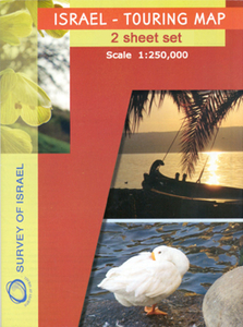
Israel Touring Map 2-Sheets

Attractively coloured map from the Israeli national survey organization, presenting the country on two sheets. The communications network, with seven types of roads from toll highways to local tracks plus the railway lines, is presented on a base map with subtle but effective relief shading and plenty of names of geographical features. Colours indicate areas of Palestinian control or joint responsibility and the course of the separation wall is indicated as it stood in December 2006 when the latest edition of this map was prepared. International boundaries show various demarcation lines.A wide range of symbols shows various places of interest including campsites and youth hostels, archaeological, historical and religious sites (including Druze and Bahai holy places), beaches and
diving sites, museums, etc. Also marked is the course of the Israel National Trail, weaving its way from Upper Galilee to the Red Sea. The map has a 10km Israel survey grid, with margin ticks for latitude and longitude at 10’ and UTM coordinates. Map legend is in English and all place names are shown in Roman alphabet. No index is provided.
RIP - This product is no longer available on our network. It was last seen on 25.09.2019

This page now acts as a permanent archive for this product. Add more information using the comments box below to ensure it can still be found by future generations.

Use our search facility to see if it is available from an alternative contributor.
  • External links may include paid for promotion
  • Availability: Out Of Stock
  • Supplier: Stanfords
  • SKU: XL00000009120
Availability: In Stock
£17.99

Product Description

Attractively coloured map from the Israeli national survey organization, presenting the country on two sheets. The communications network, with seven types of roads from toll highways to local tracks plus the railway lines, is presented on a base map with subtle but effective relief shading & plenty of names of geographical features. Colours indicate areas of Palestinian control or joint responsibility & the course of the separation wall is indicated as it stood in December 2006 when the latest edition of this map was prepared. International boundaries show various demarcation lines.A wide range of symbols shows various places of interest including campsites & youth hostels, archaeological, historical & religious sites (including Druze & Bahai holy places), beaches & diving sites, museums, etc. Also marked is the course of the Israel National Trail, weaving its way from Upper Galilee to the Red Sea. The map has a 10km Israel survey grid, with margin ticks for latitude & longitude at 10’ & UTM coordinates. Map legend is in English & all place names are shown in Roman alphabet. No index is provided.

Reviews/Comments

Add New

Price History

Vouchers

No voucher codes found.
Do you know a voucher code for this product or supplier? Add it to Insights for others to use.

Facebook

Jargon Buster

Wall - A physical barrier between two areas
Red - One of the three primary colours
Network - A link and communication between things. Often computers or people.
Wide - Something with a large width.
Subtle - Something that is delicate and not to harsh, can be difficult to describe.

Supplier Information

Stanfords
Stanfords was established in 1853 and opened their iconic Covent Garden flagship store in 1901. They have become the top retailer of maps, travel books and accessories in the UK and arguably offer the largest selection of maps and travel books worldwide. Famous names such as Captain Robert Falcon Scott, Ranulph Fiennes and Michael Palin have purchased from Stanfords. They now have a shop in Bristol and both stores together with other venues operate a calendar of events including talks, book signings and exhibitions. As a specialist map retailer, the map selection is comprehensive and includes road maps, street maps and walking maps from worldwide destinations, as well as a selection of world atlases and wall maps. Books include travel guides and travel literature. Stanfords also stock globes, from miniatures made of blue marble to magnificent floor-standing globes. The website features a selection of interesting articles on travel topics.
Page Updated: 2023-11-12 20:15:36

Community Generated Product Tags

Oh No! The productWIKI community hasn't generated any tags for this product yet!
Menu