
 United Kingdom
 France
 Germany
 Netherlands
 Sweden
 USA
USA
 Italy
Italy
 Spain
Spain
More From Contributor


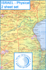


Israel Super Touring Map
Israel road map from Carta covering most of the country at 1:265, 000 and the Negev at 1:425, 000, indexed and with on the reverse indexed street plans of central Jerusalem and Tel Aviv. Colouring indicates autonomous Palestinian areas.The map covers the bulk of the country at 1:265, 000, with the area south of Beersheba shown on a separate panel next to the main map at 1:425, 000. The map shows the road network, from toll roads to selected local tracks, with names of road junctions – indispensible when travelling in Israel. Railway lines and local airports are included and the map shows the course of the “Israel Trail”.Palestinian autonomous areas are indicated and the course of the Separation Wall is marked (although this information is not shown in the map legend). The map
also shows crossing points to Egypt and Jordan. Various places of interest are highlighted. All the place names are in Latin alphabet. The map has the coordinates of the Israeli national grid. The index is on the reverse. Map legend is in English.On the reverse are indexed street plans of central Jerusalem and Tel Aviv. Current edition of this title was published in 2014.
also shows crossing points to Egypt and Jordan. Various places of interest are highlighted. All the place names are in Latin alphabet. The map has the coordinates of the Israeli national grid. The index is on the reverse. Map legend is in English.On the reverse are indexed street plans of central Jerusalem and Tel Aviv. Current edition of this title was published in 2014.

Product Description
Reviews/Comments
Add New
Vouchers
No voucher codes found.
Do you know a voucher code for this product or supplier? Add it to Insights for others to use.
Do you know a voucher code for this product or supplier? Add it to Insights for others to use.
 Denmark