
 United Kingdom
 France
 Germany
 Netherlands
 Sweden
 USA
USA
 Italy
Italy
 Spain
Spain
More From Contributor

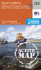
Islay
Map No. 60, Islay, in the Ordnance Survey Landranger series at 1:50, 000, including Bunnahabhain, Port Askaig, Ballygrant, Bridgend, Bowmore, Glenegedale, Port Ellen, Ardbeg, Craigens, Kilchoman, Bruichladdich, Port Charlotte, Nearbus and Portnahaven, with The Oa, Mull of Oa, Beinn Bheigier, Ardnave Point, Coul Point and Loch Gorm, plus Loch Indaal, Laggan Bay, Rhubh' a' Mhail, Texa and Dubh Bheinn on Jura. Edition B2; Revised for selected changes 2007; Copyright date 2007 This title is also available on our website in a waterproof and tear-resistant version.Maps in this series are only published folded. Stanfords can also print flat versions of Ordnance Survey maps through the OS Select system, centring the map on a location of your choice and with a picture
provided by you on the cover. For more information please click on the link at the bottom of this description.About Ordnance Survey
provided by you on the cover. For more information please click on the link at the bottom of this description.About Ordnance Survey
Product Description
Reviews/Comments
Add New
Intelligent Comparison
Archived Product
Islam Stanfords
£4.99
Archived Product

Island Stanfords
£9.99
Archived Product
Island Stanfords
£9.95
Vouchers
No voucher codes found.
Do you know a voucher code for this product or supplier? Add it to Insights for others to use.
Do you know a voucher code for this product or supplier? Add it to Insights for others to use.
 Denmark