More From Contributor

£13.99
Serenity now
- & all year long. Showcasing hundreds of lush island retreats photographed in vibrant full colour, Islands celebrates
...
Archived Product
£7.99
Thailand’s 13 island destinations, from Phuket & Samui to less well known islands, presented on a double-sided map from Thinknet highlighting sights, accommodation & other tourist facilities, plus ferry timetables, etc. The map presents each island as a separate panel, covering: Samet (1:29, 000), Lan (1:30, 000), Chang (1:100, 000), Kood (1;90, 000), Mak (1:50, 000), Phuket (1:100, 000), Phiphi Don (1:40, 000), Phi Phi Islands (1:150, 000) Lanta (1:140, 000), Yao Noi & Yao Yai (1:200, 000), Tao (1:48, 000) Phangan (1:100, 000) & Samui (1:57, 000). Each map shows the island’s road network & highlights local sights, tourist accommodation & restaurants, public institutions & various facilities, etc. A separate index lists selected locations on each isl&. Also provided are information/timetables for ferry services between the mainland & the islands or within island groups, accompanied by an overview map of the Thai coast & insets for various groups. All the information is in Thai & English. PLEASE NOTE: print size, of both names & symbols, is smaller than usually found on maps. ...
Archived Product
£8.99
This is the last book Hemingway wrote before he died, the story of Thomas Hudson, an artist & adventurer. Living a bacherlor`s life on an island in the Gulf Stream during the thirties, Hudson`s existence is dictated by the waves & tides. But when his sons come to visit, Hudson must grapple with the role of father & the unfamiliar demands of family. A late work by one of America`s greatest writers. ...
Archived Product
£14.95
Islands of the Galician Coast National Park (PN Marítimo-Terrestre de las Islas Atlánticas de Galicia) at 1:25, 000 on a contoured & GPS compatible map from IGN/CNIG with cartography from their topographic survey of Spain. The four groups of islands which form this national park are presented as a separate panel: Illa de Cortagada with the adjoining mainland around O Carril, Illa de Ons, Illa de Sálvora with the surrounding smaller islands, & Illas Cíes (Monte Agudo, Faro & San Martino). Also provided is a panel with a road map of the adjoining mainland around Pontevedra & Vigo. The map is accompanied by a 58-page Spanish language guide with general information, notes on access from the mainl&, details of accommodation facilities, as well as descriptions of recommended walks. The mapping at 1:25, 000 has contours at 10m intervals enhanced by relief shading, plus colouring & graphics to show different types of vegetation, a 1km UTM grid & margin ticks for latitude & longitude. Map legend is in Spanish only. To see other titles in this series please click on the series link. ...
Archived Product
£37.50
This eleventh edition of Islas Baleares, covering Ibiza, Formentera, Mallorca, Cabrera & Menorca, has been revised & updated for the RCC Pilotage Foundation by David & Susie Baggaley, whose Beneteau 42, Kookaburra has been based in Addaya, Menorca for several years. In their research for this edition, over two seasons, the authors confess to having enjoyed a new purpose to their cruising in the islands, & they share their knowledge enthusiastically & authoritatively. A selection of completely new plans is included, & pre-existing plans have been updated throughout. There are also many attractive new photographs which are informative to the navigator. The only fully comprehensive pilot guide to the islands in English, Islas Baleares remains the best-selling RCC Pilotage Foundation cruising guide, which is testament to the lasting appeal of this popular cruising ground, both to those cruising their own boats & to those who are visiting the islands on a yacht charter. ...
Archived Product
£17.99
Topographic mapping from Mexico’s national survey agency, Instituto Nacional de Estadística, Geografía e Informática. The maps have contours at 20m intervals with relief shading & indicate various types of terrain & vegetation, e.g. dense vegetation, cultivated areas, swamps, sand dunes, salt pans, etc. UTM grid is at 10km intervals, with latitude & longitude shown by margin ticks at intervals of 5`. Map legend is in Spanish only. To see the other titles in this series please click on the series link. ...
Archived Product
£5.59
Map No. 60, Islay, in the Ordnance Survey Landranger series at 1:50, 000, including Bunnahabhain, Port Askaig, Ballygrant, Bridgend, Bowmore, Glenegedale, Port Ellen, Ardbeg, Craigens, Kilchoman, Bruichladdich, Port Charlotte, Nearbus & Portnahaven, with The Oa, Mull of Oa, Beinn Bheigier, Ardnave Point, Coul Point & Loch Gorm, plus Loch Indaal, Laggan Bay, Rhubh' a' Mhail, Texa & Dubh Bheinn on Jura. Edition B2; Revised for selected changes 2007; Copyright date 2007 This title is also available on our website in a waterproof & tear-resistant version. Maps in this series are only published folded. Stanfords can also print flat versions of Ordnance Survey maps through the OS Select system, centring the map on a location of your choice & with a picture provided by you on the cover. For more information please click on the link at the bottom of this description. About Ordnance Survey ...
Archived Product
£34.95
Islay & Kintyre Postcode Sector Map at 1:150, 000, encapsulated version, in a series of postcode sector maps showing the first part of the postcode & the first number of the second part, the Inward Code. Coverage extends north to Durran, south to Sands Isl&, east to Kilmacolm & west to Portnahaven. Map Marketing’s series of postcode sector maps covers Great Britain & Northern Ireland on 36 titles, each available only as a flat map, either on paper or encapsulated for greater durability. Presentation

Includes::
postcode changes in the most recent Royal Mail Postcode updates. The series covers Great Britain at 1:150, 000 (1” to 2.4 miles), with Northern Ireland shown at 1:210, 000 & London at two scales: 1:60, 000 for the area within the M25 & in more detail at 1:15, 000 for central London. Postcode area, district & sector boundaries & numbers/letters are shown in red, with County & Unitary Authority boundaries in green. The map base shows motorways, primary, ‘A’ & down to unclassified roads, with conurbation shapes & city plan insets showing street level detail for major cities. To see the list of all the titles in this series please click on the series link.LAMINATED & ENCAPSULATED WALL MAPS:- LAMINATED wall maps have a thin layer of plastic usually applied to the printed side only. They can be written on with suitable marker pens without any damage to the map but, unless laminated on both sides, they are not damp-proof.- ENCAPSULATED wall maps are sealed between two sheets of plastic. They are more rigid & heavier than laminated maps of the same size. They are damp-proof & do not crinkle in humid conditions. Encapsulation gives the map a shiny surface, similar to being displayed behind glass.- PLEASE NOTE: many publishers & retailers often use these two terms interchangeably. Our map titles & descriptions follow the definitions provided above.

...
Archived Product
£24.95
Islay & Kintyre Postcode Sector Map at 1:150, 000, paper version, in a series of postcode sector maps showing the first part of the postcode & the first number of the second part, the Inward Code. Coverage extends north to Durran, south to Sands Isl&, east to Kilmacolm & west to Portnahaven. Map Marketing’s series of postcode sector maps covers Great Britain & Northern Ireland on 36 titles, each available only as a flat map, either on paper or encapsulated for greater durability. Presentation

Includes::
postcode changes in the most recent Royal Mail Postcode updates. The series covers Great Britain at 1:150, 000 (1” to 2.4 miles), with Northern Ireland shown at 1:210, 000 & London at two scales: 1:60, 000 for the area within the M25 & in more detail at 1:15, 000 for central London. Postcode area, district & sector boundaries & numbers/letters are shown in red, with County & Unitary Authority boundaries in green. The map base shows motorways, primary, ‘A’ & down to unclassified roads, with conurbation shapes & city plan insets showing street level detail for major cities. To see the list of all the titles in this series please click on the series link.

...
Archived Product
£6.39
A detailed topographic map of Islay North from the Ordnance Survey Explorer series, covering Port Askaig, Bridgend & Port Charlotte / Port Asgaig, Beul an Atha & Port Sgioba. Edition A1; Publication date October 2006 About this series: These highly detailed maps show all the administrative boundaries, settlements as small as isolated farms, the road network down to unfenced roads & country tracks, & field boundaries (hedges & drystone walls) which make navigation across the countryside much easier. Steep gradients on roads are indicated. Various landmarks, e.g. powerlines, archaeological sites, windmills, churches & lighthouses are shown & additional graphics indicate natural terrain features such as cliffs, scree, mud & vegetation variations. The contour interval is 5 metres in the lower parts of the country & 10 metres in the uplands, & spot heights are marked. Each map covers an area of 30 x 20km (i.e. approx. 19 x 12 miles), with some double-sided maps covering more, as indicated in the individual descriptions. The maps are fully GPS compatible, with the National Grid shown at 1km intervals & latitude & longitude indicated by margin ticks at 1'. The Explorer series has replaced the earlier, green-cover Pathfinder maps. The Explorer series is now complete & covers all of Engl&, Wales & Scotl&. Some sheets for popular areas like the National Parks are still branded as Outdoor Leisure (OL) maps, but are now included in this series as the cartography is the same as that in the Explorer Maps. The Explorer maps offer a substantial improvement on the Pathfinder series, with greater use of colour, larger area per map, & stronger emphasis on information for ramblers & tourists. This series is ideal for walking & other outdoor pursuits & each map shows a large amount of information for ramblers & tourists. Public rights of way are shown (except in Scotland), together with other routes with public access: National Trails & Recreational Paths, permitted paths & bridleways, & selected cycle routes. Open access land created under the Countryside & Rights of Way Act 2000 is marked. Tourist information

Includes::
caravan & camp sites, Park & Ride locations, recreation/leisure/sport centres, museums, historic buildings, English Heritage & National Trust sites, rural pubs, etc. The map legend is in English only, except for the tourist information content which is also in French & German.

...
Archived Product

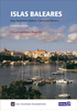
Islas Baleares Pilot

This is the only fully comprehensive pilot guide in English to Spain's Balearic Islands. This new edition of Islas Baleares - Ibiza, Formentera, Mallorca, Cabrera and Menorca - has been thoroughly revised for the RCC Pilotage Foundation by Graham Hutt who has visited the islands during 2009 and 2010. Throughout, the plans and technical data have been brought up to date. He (Graham Hutt) has diligently researched both the coastline and the inland areas to make this edition a useful and comprehensive yachtsman's guide. - Cruising
RIP - This product is no longer available on our network. It was last seen on 25.09.2019

This page now acts as a permanent archive for this product. Add more information using the comments box below to ensure it can still be found by future generations.

Use our search facility to see if it is available from an alternative contributor.
  • External links may include paid for promotion
  • Availability: Out Of Stock
  • Supplier: Stanfords
  • SKU: 9781846232831
Availability: In Stock
£32.50

Product Description

This is the only fully comprehensive pilot guide in English to Spain's Balearic Islands. This new edition of Islas Baleares
- Ibiza, Formentera, Mallorca, Cabrera & Menorca
- has been thoroughly revised for the RCC Pilotage Foundation by Graham Hutt who has visited the islands during 2009 & 2010. Throughout, the plans & technical data have been brought up to date. He (Graham Hutt) has diligently researched both the coastline & the inland areas to make this edition a useful & comprehensive yachtsman's guide.
- Cruising

Reviews/Comments

Add New

Intelligent Comparison

Oooops!
We couldn't find anything!
Perhaps this product's unique.... Or perhaps we are still looking for comparisons!
Click to bump this page and we'll hurry up.

Price History

Vouchers

No voucher codes found.
Do you know a voucher code for this product or supplier? Add it to Insights for others to use.

Facebook

Jargon Buster

Date - A day on a calendar
Date - A social activity whith a current or potential partner
Spain - A country within the EU.
foundation - A flesh toned cosmetic applied to the face to create an even complexion.
technical - Something that relates to a good level of skill and methods.
Pilot - Someone who is qualified to fly a plane.

Supplier Information

Stanfords
Stanfords was established in 1853 and opened their iconic Covent Garden flagship store in 1901. They have become the top retailer of maps, travel books and accessories in the UK and arguably offer the largest selection of maps and travel books worldwide. Famous names such as Captain Robert Falcon Scott, Ranulph Fiennes and Michael Palin have purchased from Stanfords. They now have a shop in Bristol and both stores together with other venues operate a calendar of events including talks, book signings and exhibitions. As a specialist map retailer, the map selection is comprehensive and includes road maps, street maps and walking maps from worldwide destinations, as well as a selection of world atlases and wall maps. Books include travel guides and travel literature. Stanfords also stock globes, from miniatures made of blue marble to magnificent floor-standing globes. The website features a selection of interesting articles on travel topics.
Page Updated: 2023-11-12 20:15:36

Community Generated Product Tags

Oh No! The productWIKI community hasn't generated any tags for this product yet!
Menu