More From Contributor

£9.99
Like most journeys this book moves between light & shade, funny & deadly serious, mundane & inspirational. It reflects on some common themes, such as childhood, schooling, & the unique good fortune of the post war generation
- & how it played its h&.
...
Archived Product
£14.95
Peter Conrad, who was born in Tasmania, has produced an original & highly personal account of the role islands play in our dreams & nightmares. With his customary wide range of reference & quick wit, he visits every corner of the globe to explain why islands appeal to us, & on the way covers everything from the myth of Atlantis to Watteaus erotic Cytherea, from Prosperos magical kingdom to Nelson Mandelas prison. Whether we live on an island or merely fancy escaping to one, we can all learn something from this thought-provoking book. ...
Archived Product
£15.00
Everyone has to learn to see the West Indies tropics for himself, wrote V.S. Naipaul in The Middle Passage. The landscape has never been recorded...the depth of sky, the brilliancy of light, the insubstantiality of colour in the tropics. The more gifted painters have ceased to record the landscape: the patterns of the leaves are too beguiling. The Islands & the Sea

Includes::
dozens of writers--poets & novelists, naturalists & explorers--who, like Naipaul help us to see the beguiling Caribbean through their eyes.
Editor John Murray opens this anthology, the first of its kind, with an informed essay that provides a perspective on the region in history & literature. Murray then presents writers ranging from Daniel Defoe to Barry Lopez, from Charles Darwin to Edward O. Wilson. In these selections, one can step ashore with Columbus on San Salvador Island in 1492, travel up the forbidding Orinoco River with Sir Walter Raleigh, & explore ancient Mayan ruins along the coast with swashbuckling John Stephens in 1843. Ernest Hemingway, writing to Maxwell Perkins from Key West, Florida, describes the aftermath of the famous Matecumbe hurricane: Indian Key absolutely swept clean, not a blade of grass, & over the high center of it were scattered live conchs that came in with the sea, craw fish, & dead morays. The whole bottom of the sea blew over it. Other contemporary writers include Barry Lopez, Derek Walcott, Rachel Carson, Jamaica Kincaid, & Roger Caras. With each selection Murray

Includes::
an informative introduction.
A Republic of Rivers, John Murray's anthology of nature writing on Alaska & the Yukon, was hailed for its judicious selections, deft editing, &, most importantly, its ability to capture & communicate a sense of place. In The Islands & the Sea, he once again gathers an enthralling collection of writings that convey the beauty Caribbean's luminous waters, its rich, green hillsides, teeming reefs, & remarkable varied people.


...
Archived Product
£13.99
Serenity now
- & all year long. Showcasing hundreds of lush island retreats photographed in vibrant full colour, Islands celebrates
...
Archived Product
£7.99
Thailand’s 13 island destinations, from Phuket & Samui to less well known islands, presented on a double-sided map from Thinknet highlighting sights, accommodation & other tourist facilities, plus ferry timetables, etc. The map presents each island as a separate panel, covering: Samet (1:29, 000), Lan (1:30, 000), Chang (1:100, 000), Kood (1;90, 000), Mak (1:50, 000), Phuket (1:100, 000), Phiphi Don (1:40, 000), Phi Phi Islands (1:150, 000) Lanta (1:140, 000), Yao Noi & Yao Yai (1:200, 000), Tao (1:48, 000) Phangan (1:100, 000) & Samui (1:57, 000). Each map shows the island’s road network & highlights local sights, tourist accommodation & restaurants, public institutions & various facilities, etc. A separate index lists selected locations on each isl&. Also provided are information/timetables for ferry services between the mainland & the islands or within island groups, accompanied by an overview map of the Thai coast & insets for various groups. All the information is in Thai & English. PLEASE NOTE: print size, of both names & symbols, is smaller than usually found on maps. ...
Archived Product
£14.95
Islands of the Galician Coast National Park (PN Marítimo-Terrestre de las Islas Atlánticas de Galicia) at 1:25, 000 on a contoured & GPS compatible map from IGN/CNIG with cartography from their topographic survey of Spain. The four groups of islands which form this national park are presented as a separate panel: Illa de Cortagada with the adjoining mainland around O Carril, Illa de Ons, Illa de Sálvora with the surrounding smaller islands, & Illas Cíes (Monte Agudo, Faro & San Martino). Also provided is a panel with a road map of the adjoining mainland around Pontevedra & Vigo. The map is accompanied by a 58-page Spanish language guide with general information, notes on access from the mainl&, details of accommodation facilities, as well as descriptions of recommended walks. The mapping at 1:25, 000 has contours at 10m intervals enhanced by relief shading, plus colouring & graphics to show different types of vegetation, a 1km UTM grid & margin ticks for latitude & longitude. Map legend is in Spanish only. To see other titles in this series please click on the series link. ...
Archived Product
£37.50
This eleventh edition of Islas Baleares, covering Ibiza, Formentera, Mallorca, Cabrera & Menorca, has been revised & updated for the RCC Pilotage Foundation by David & Susie Baggaley, whose Beneteau 42, Kookaburra has been based in Addaya, Menorca for several years. In their research for this edition, over two seasons, the authors confess to having enjoyed a new purpose to their cruising in the islands, & they share their knowledge enthusiastically & authoritatively. A selection of completely new plans is included, & pre-existing plans have been updated throughout. There are also many attractive new photographs which are informative to the navigator. The only fully comprehensive pilot guide to the islands in English, Islas Baleares remains the best-selling RCC Pilotage Foundation cruising guide, which is testament to the lasting appeal of this popular cruising ground, both to those cruising their own boats & to those who are visiting the islands on a yacht charter. ...
Archived Product
£32.50
This is the only fully comprehensive pilot guide in English to Spain's Balearic Islands. This new edition of Islas Baleares
- Ibiza,
...
Archived Product
£17.99
Topographic mapping from Mexico’s national survey agency, Instituto Nacional de Estadística, Geografía e Informática. The maps have contours at 20m intervals with relief shading & indicate various types of terrain & vegetation, e.g. dense vegetation, cultivated areas, swamps, sand dunes, salt pans, etc. UTM grid is at 10km intervals, with latitude & longitude shown by margin ticks at intervals of 5`. Map legend is in Spanish only. To see the other titles in this series please click on the series link. ...
Archived Product
£5.59
Map No. 60, Islay, in the Ordnance Survey Landranger series at 1:50, 000, including Bunnahabhain, Port Askaig, Ballygrant, Bridgend, Bowmore, Glenegedale, Port Ellen, Ardbeg, Craigens, Kilchoman, Bruichladdich, Port Charlotte, Nearbus & Portnahaven, with The Oa, Mull of Oa, Beinn Bheigier, Ardnave Point, Coul Point & Loch Gorm, plus Loch Indaal, Laggan Bay, Rhubh' a' Mhail, Texa & Dubh Bheinn on Jura. Edition B2; Revised for selected changes 2007; Copyright date 2007 This title is also available on our website in a waterproof & tear-resistant version. Maps in this series are only published folded. Stanfords can also print flat versions of Ordnance Survey maps through the OS Select system, centring the map on a location of your choice & with a picture provided by you on the cover. For more information please click on the link at the bottom of this description. About Ordnance Survey ...
Archived Product

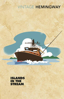
Islands In The Stream

This is the last book Hemingway wrote before he died, the story of Thomas Hudson, an artist and adventurer. Living a bacherlor`s life on an island in the Gulf Stream during the thirties, Hudson`s existence is dictated by the waves and tides. But when his sons come to visit, Hudson must grapple with the role of father and the unfamiliar demands of family. A late work by one of America`s greatest writers.
RIP - This product is no longer available on our network. It was last seen on 25.09.2019

This page now acts as a permanent archive for this product. Add more information using the comments box below to ensure it can still be found by future generations.

Use our search facility to see if it is available from an alternative contributor.
  • Availability: Out Of Stock
  • Supplier: Stanfords
  • SKU: 9781784872045
Availability: In Stock
£8.99

Product Description

This is the last book Hemingway wrote before he died, the story of Thomas Hudson, an artist & adventurer. Living a bacherlor`s life on an island in the Gulf Stream during the thirties, Hudson`s existence is dictated by the waves & tides. But when his sons come to visit, Hudson must grapple with the role of father & the unfamiliar demands of family. A late work by one of America`s greatest writers.

Reviews/Comments

Add New

Intelligent Comparison

Oooops!
We couldn't find anything!
Perhaps this product's unique.... Or perhaps we are still looking for comparisons!
Click to bump this page and we'll hurry up.

Price History

Vouchers

No voucher codes found.
Do you know a voucher code for this product or supplier? Add it to Insights for others to use.

Facebook

Jargon Buster

Family - A group of people that live together made up from parents and children.

Supplier Information

Stanfords
Stanfords was established in 1853 and opened their iconic Covent Garden flagship store in 1901. They have become the top retailer of maps, travel books and accessories in the UK and arguably offer the largest selection of maps and travel books worldwide. Famous names such as Captain Robert Falcon Scott, Ranulph Fiennes and Michael Palin have purchased from Stanfords. They now have a shop in Bristol and both stores together with other venues operate a calendar of events including talks, book signings and exhibitions. As a specialist map retailer, the map selection is comprehensive and includes road maps, street maps and walking maps from worldwide destinations, as well as a selection of world atlases and wall maps. Books include travel guides and travel literature. Stanfords also stock globes, from miniatures made of blue marble to magnificent floor-standing globes. The website features a selection of interesting articles on travel topics.
Page Updated: 2023-11-12 20:15:36

Community Generated Product Tags

Oh No! The productWIKI community hasn't generated any tags for this product yet!
Menu