
 United Kingdom
 France
 Germany
 Netherlands
 Sweden
 USA
USA
 Italy
Italy
 Spain
Spain
More From Contributor


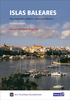
Islands Of The Galician Coast National Park 25K CNIG Map/Guide
Islands of the Galician Coast National Park (PN Marítimo-Terrestre de las Islas Atlánticas de Galicia) at 1:25, 000 on a contoured and GPS compatible map from IGN/CNIG with cartography from their topographic survey of Spain. The four groups of islands which form this national park are presented as a separate panel: Illa de Cortagada with the adjoining mainland around O Carril, Illa de Ons, Illa de Sálvora with the surrounding smaller islands, and Illas Cíes (Monte Agudo, Faro and San Martino). Also provided is a panel with a road map of the adjoining mainland around Pontevedra and Vigo. The map is accompanied by a 58-page Spanish language guide with general information, notes on access from the mainland, details of accommodation facilities, as well as descriptions of recommended
walks.The mapping at 1:25, 000 has contours at 10m intervals enhanced by relief shading, plus colouring and graphics to show different types of vegetation, a 1km UTM grid and margin ticks for latitude and longitude. Map legend is in Spanish only.To see other titles in this series please click on the series link.
walks.The mapping at 1:25, 000 has contours at 10m intervals enhanced by relief shading, plus colouring and graphics to show different types of vegetation, a 1km UTM grid and margin ticks for latitude and longitude. Map legend is in Spanish only.To see other titles in this series please click on the series link.
Product Description
Reviews/Comments
Add New
Vouchers
No voucher codes found.
Do you know a voucher code for this product or supplier? Add it to Insights for others to use.
Do you know a voucher code for this product or supplier? Add it to Insights for others to use.
 Denmark