
 United Kingdom
 France
 Germany
 Netherlands
 Sweden
 USA
USA
 Italy
Italy
 Spain
Spain
More From Contributor


Guide Bridge 1918
Guide Bridge in 1918 in a fascinating series of reproductions of old Ordnance Survey plans in the Alan Godfrey Editions, ideal for anyone interested in the history of their neighbourhood or family. The map covers the eastern part of Audenshaw and then crosses the River Tame to include part of Dukinfield in Cheshire. Railways are dominant features, for the map includes Guide Bridge station and its various junctions, plus Dewsnap Sidings, the Great Central Carriage and Wagon Works, Brookside Sidings; also the LNWR lines running through and by-passing Guide Bridge, including Hooley Hill station. Other features include Peak Forest Canal, Shepley Bridge, Shepley Hall, Dukinfield Hall, Old Hall Mill, Dukinfield Town Hall, St Luke`s church, St Mark`s church, Chapel Field Ropery,
Barnmeadow Works, Guide Mills, Oxford Mills, tramways, Birch Mills, St Stephen`s church, several other mills, Boothcote Farm, Guide Bridge Mills, New Moss Colliery, Guide Bridge Iron Works, etc. On the reverse is a contemporary directory for Dukinfield.About the Alan Godfrey Editions of the 25” OS Series:Selected towns in Great Britain and Ireland are covered by maps showing the extent of urban development in the last decades of the 19th and early 20th century. The plans have been taken from the Ordnance Survey mapping and reprinted at about 15 inches to one mile (1:4, 340). On the reverse most maps have historical notes and many also include extracts from contemporary directories. Most maps cover about one mile (1.6kms) north/south, one and a half miles (2.4kms) across;
adjoining sheets can be combined to provide wider coverage.FOR MORE INFORMATION AND A COMPLETE LIST OF ALL AVAILABLE TITLES PLEASE CLICK ON THE SERIES LINK.

Product Description
Reviews/Comments
Add New
Intelligent Comparison
Archived Product
Tame Bridge 1901 Stanfords
£3.50
Archived Product
Heap Bridge 1908 Stanfords
£2.95
Archived Product
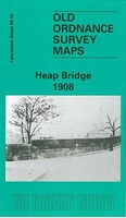
Heap Bridge 1908 Stanfords
£3.50
Vouchers
No voucher codes found.
Do you know a voucher code for this product or supplier? Add it to Insights for others to use.
Do you know a voucher code for this product or supplier? Add it to Insights for others to use.
 Denmark