
 United Kingdom
 France
 Germany
 Netherlands
 Sweden
 USA
USA
 Italy
Italy
 Spain
Spain
More From Contributor


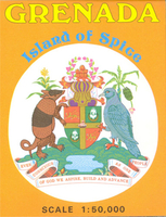
Grenada
Topographic survey map of the island, with larger scale inset of the south-west peninsula and a street plan of St George’s. Relief is portrayed by vivid hill shading, with spot heights and contours at 200 feet intervals. Forest, mangrove and swamp areas are indicated. Road classification distinguishes surfaced and unsurfaced roads, 4WD trails and footpaths. The international airport, buildings and built-up areas are marked as well as ruins and antiquities, and other notable buildings e.g. hospitals, post offices, churches. The South-West Peninsula, shown at 1:25, 000 with more detail, is indexed for selected notable buildings and locations. The simple street plan of St George’s is at 1:10, 000 and is also indexed for various locations and buildings. Latitude and longitude
margin ticks are at 5’ intervals and a UTM grid is drawn over the map.*Please note:*This map last revised in 1992 and reprinted 1998 by the now defunct Ordnance Survey International.
margin ticks are at 5’ intervals and a UTM grid is drawn over the map.*Please note:*This map last revised in 1992 and reprinted 1998 by the now defunct Ordnance Survey International.

Product Description
Reviews/Comments
Add New
Vouchers
No voucher codes found.
Do you know a voucher code for this product or supplier? Add it to Insights for others to use.
Do you know a voucher code for this product or supplier? Add it to Insights for others to use.
 Denmark