
 United Kingdom
 France
 Germany
 Netherlands
 Sweden
 USA
USA
 Italy
Italy
 Spain
Spain
More From Contributor


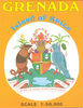

Grenada North
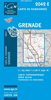
Detailed topographical survey map of the north half of the island, showing roads, tracks and paths. Even the smallest settlements are shown, with individual important buildings named. The map shows contours at 50 foot intervals. A local grid is shown at 1km intervals, latitude and longitude being shown by margin ticks at intervals of 1'.nb. This sheet is the only remaining part of a set of two sheets which covered the island - the DOS 342 series. The southern sheet is no longer in print.
Product Description
Reviews/Comments
Add New
Intelligent Comparison
Archived Product
Graz North Stanfords
£8.95
Archived Product
Ireland North Stanfords
£3.99
Archived Product
Ireland North Stanfords
£5.90
Archived Product
Greenland: North 68 Stanfords
£14.95
Archived Product
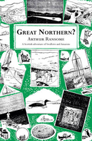
Great Northern? Stanfords
£7.99
Archived Product
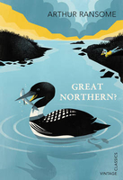
Great Northern? Stanfords
£7.99
Vouchers
No voucher codes found.
Do you know a voucher code for this product or supplier? Add it to Insights for others to use.
Do you know a voucher code for this product or supplier? Add it to Insights for others to use.
 Denmark