More From Contributor
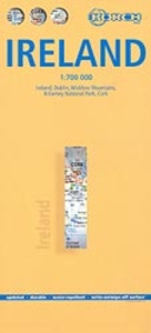
£15.99
Ireland in the Green Guide series from Michelin; detailed guides exploring the major sights & attractions of a range of cities, regions & countries. Drawing on a long publishing history, Michelin guides are renowned for their individual ‘star rating’, ranking restaurants, sights & attractions. Listings in each guide are organised alphabetically, allowing readers to access information quickly as well as being designed for practical use on the road. With an emphasis on cultural activities & history, each sight is graded & has extensive background information. Practical visitor information is clearly highlighted with symbols. Predominantly recognised for their extensive coverage of French regions (shown on our website in a separate series), the Green Guides also cover international destinations. An extensive introductory section on planning your trip provides information on when & where to go, useful pre-trip information, getting there, where to stay & eat & what to do & see. There are also individual sections on Nature, History & Art ad Culture & a selection of driving tours of the area. Fold-out maps at the front & back of the book give an overview of the area covered by the guide. The structure of each guide varies depending on the type of destination. National & regional guides cover regions alphabetically, each with their own accommodation, sights & food & drink listings, while City guides cover sights alphabetically with one city-wide section for listings. Accommodation & food & drink listings are both concise & comprehensive, aiming to cater for all budgets & tastes. Both sights & listings often include information specific to travelling with kids. Each of the places covered in the guide is listed alphabetically & three Michelin star ratings
- highly recommended, recommended & interesting, which have been used for more than 100 years
- help readers identify places of interest, restaurants & notable local attractions. Individual listings include principal sights for each city or town, local walking & driving tours in addition to tips on local excursions. There is also an ‘address book’ information box in each section including recommendations for the best restaurants & accommodation in the area, as well as any relevant leisure activities. A series of overview regional & city plans also helps navigation & orientation for each region.

...
Archived Product
£17.99
A wall map of Ireland with Northern Ireland at 1:550, 000, 76 x 91cm (2ft 6” x 3ft approx) – encapsulated version, from the National Geographic Society in their traditional “classic” style & with county boundaries. Where appropriate, both Irish & English place names are shown. The map presents the island of Ireland on a pale base with light relief shading to indicate mountain ranges & shows the network of road & rail connections. Also shown are airports with scheduled services, ferry connections to Britain & important historical or other sites. County boundaries are clearly marked & within the Irish Republic county names are shown in both English & Irish. Also shown, but without boundaries, are the names of the four traditional regions of Ireland: Ulster, Connacht, Leinster & Munster. Throughout the map, but particularly in the predominantly Irish-speaking parts names of towns are shown in both English & Irish. * This map is also available on paper without the encapsulation.*LAMINATED & ENCAPSULATED WALL MAPS:*- *laminated* wall maps have a thin layer of plastic usually applied to the printed side only. They can be written on with suitable marker pens without any damage to the map but, unless laminated on both sides, they are not damp-proof.- *encapsulated* wall maps are sealed between two sheets of plastic. They are more rigid & heavier than laminated maps of the same size. They are damp-proof & do not crinkle in humid conditions. Encapsulation gives the map a shiny surface, similar to being displayed behind glass.- *please note:* many publishers & retailers often use these two terms interchangeably. Our map titles & descriptions follow the definitions provided above. ...
Archived Product
£12.99
A wall map of Ireland with Northern Ireland at 1:550, 000, 76 x 91cm (2ft 6” x 3ft approx) – paper version, from the National Geographic Society in their traditional “classic” style & with county boundaries. Where appropriate, both Irish & English place names are shown. The map presents the island of Ireland on a pale base with light relief shading to indicate mountain ranges & shows the network of road & rail connections. Also shown are airports with scheduled services, ferry connections to Britain & important historical or other sites. County boundaries are clearly marked & within the Irish Republic county names are shown in both English & Irish. Also shown, but without boundaries, are the names of the four traditional regions of Ireland: Ulster, Connacht, Leinster & Munster. Throughout the map, but particularly in the predominantly Irish-speaking parts names of towns are shown in both English & Irish. * This map is also available encapsulated. ...
Archived Product
£17.99
A wall map of Ireland with Northern Ireland at 1:550, 000, 76 x 91cm (2ft 6” x 3ft approx) – encapsulated version, from the National Geographic Society in their executive style designed to present current information in colouring reminiscent of antique maps with shades of beige & brown. Where appropriate, both Irish & English place names are shown. The map presents the island of Ireland on a base with relief shading to indicate mountain ranges & shows the network of road & rail connections. Also shown are airports with scheduled services, ferry connections to Britain & important historical or other sites. County boundaries are marked & within the Irish Republic county names are shown in both English & Irish. Also shown, but without boundaries, are the names of the four traditional regions of Ireland: Ulster, Connacht, Leinster & Munster. Throughout the map, but particularly in the predominantly Irish-speaking parts names of towns are shown in both English & Irish. * This map is also available on paper without the encapsulation.*LAMINATED & ENCAPSULATED WALL MAPS:*- *laminated* wall maps have a thin layer of plastic usually applied to the printed side only. They can be written on with suitable marker pens without any damage to the map but, unless laminated on both sides, they are not damp-proof.- *encapsulated* wall maps are sealed between two sheets of plastic. They are more rigid & heavier than laminated maps of the same size. They are damp-proof & do not crinkle in humid conditions. Encapsulation gives the map a shiny surface, similar to being displayed behind glass.- *please note:* many publishers & retailers often use these two terms interchangeably. Our map titles & descriptions follow the definitions provided above. ...
Archived Product
£12.99
A wall map of Ireland with Northern Ireland at 1:550, 000, 76 x 91cm (2ft 6” x 3ft approx) – paper version, from the National Geographic Society in their executive style designed to present current information in colouring reminiscent of antique maps with shades of beige & brown. Where appropriate, both Irish & English place names are shown. The map presents the island of Ireland on a base with relief shading to indicate mountain ranges & shows the network of road & rail connections. Also shown are airports with scheduled services, ferry connections to Britain & important historical or other sites. County boundaries are marked & within the Irish Republic county names are shown in both English & Irish. Also shown, but without boundaries, are the names of the four traditional regions of Ireland: Ulster, Connacht, Leinster & Munster. Throughout the map, but particularly in the predominantly Irish-speaking parts names of towns are shown in both English & Irish. * This map is also available encapsulated. ...
Archived Product
£5.90
Ireland North in a series of four road maps at 1:250, 000 covering both the Republic of Ireland & Northern Irel&, with detailed road classification, altitude colouring & tourist information, published by OSI, the Ordnance Survey of Irel&, with the northern sheet produced in cooperation with the Ordnance Survey of Northern Irel&. Topography of the island is shown by altitude colouring, with additional spot heights & names of mountain or hill ranges & other geographical features. Additional graphics show different types of woodlands. Road network shows six grades of roads; gradients for steep roads are indicated only in Northern Irel&. Railway lines are shown with stations.A range of symbols highlights camping & caravan sites, nature reserves, National Trust & An Taisce properties or l&, gold courses (indicating the number of holes), historical sites, etc. The maps have 10-km Irish national grid, plus latitude & longitude margin ticks at 10 ...
Archived Product
£7.99
Driving Map of Ireland at 1:450, 000 from OSI, the Ordnance Survey of Irel&, presenting the whole island (Eire & Northern Ireland) with enlargements showing in greater detail road access & main routes in Dublin, Cork, Limerick, Galway & Belfast. Current edition of this title was published in August 2014. Road network is presented on a plain base with no topographic shading or colouring. Motorways indicate toll sections & clearly show junction numbers. Third class local roads are included & driving distances are marked on national & regional routes. Railway lines are shown with stations & local airports are marked. The map has no geographical coordinates. The index is next to the map. Enlargements present in greater detail road access & main routes in Dublin, Cork, Limerick, Galway & Belfast. Also provided is a distance table.PLEASE NOTE: the same presentation of the road network but in addition with scenic routes & places of interest is provided by OSI’s Touring Map of Irel&. ...
Archived Product
£12.50
This new 7th edition is published in conjunction with Ordnance Survey Northern Ireland & the Road Safety Authority (RSA) & features Collision Zones, Speed Detection Zones & Tolled Roads. (This product is produced with the co-operation of Ordnance Survey Northern Irel&, OSNI). ...
Archived Product
£4.99
Philip`s Ireland Road Map shows the whole of Ireland at a scale of 9 miles to 1 inch (1 cm on the map = 5.5 km on the ground). The map

Includes::
a comprehensive index of place names, plus detailed town plans of Belfast, Cork, Derry/ Londonderry & Dublin, with tourist information clearly marked. The map has been specially prepared for touring, picking out major routes & destinations in bold colours for easy journey planning & route-finding, & is a convenient size for use in a vehicle. The digital mapping gives excellent clarity, showing road networks in exceptional detail for this scale. High-quality travel information

Includes::
a wealth of useful detail marking car ferries, national parks, historic houses & gardens, museums, cathedrals, castles, ancient monuments, theme parks, & many other places of interest. A comprehensive index

Includes::
all towns & villages shown on the map.


...
Archived Product
£4.99
Ireland in the Pocket Guide series from Berlitz; a collection of handy, pocket-sized guides dedicated to an extensive range of cities, regions & countries worldwide. Written in narrative form, individual guides explore the history, main sights & attractions, food & drink, accommodation & local culture of the destination in detail. Each Berlitz pocket guide has a similar format, with colour-coded sections helping readers locate information quickly in addition to distinctive chapters exploring the city or region. An introduction outlines the destination for visitors & a section dedicated to 'A Brief History' actually explores the area in relative depth. A where to go chapter is organized by region & city & is written in prose form with references to individual sites highlighted in bold for clarity. There are also further suggestions on where & when to eat. Recommendations for leisure activities in the region, including sport, nightlife & shopping, are also provided & tailored accordingly for each destination. Handy travel tips are listed alphabetically in a dedicated section, providing practical guidance & helping visitors make the most of their stay. The main hotels, particularly for cities, are also listed in an accommodation section, offering a brief overview with approximate price bandings & relevant contact details. ...
Archived Product

Ireland North

Ireland North road map from Collins at 1:350, 000, displaying major roads, counties and districts, and many places of interest on a single-sided, indexed map. Suitable for touring and route planning.Motorways, primary, secondary / A roads and regional / B roads and many minor roads are shown. For practical navigation, dual carriageways, junctions (with restrictions) and toll roads are marked. Also includes speed cameras, speed enforcement zones, and park and ride facilities.. Markers indicate distances between selected points. Airports, railways and major ferry routes and terminals are highlighted.International borders are shown, and counties and districts are named and demarcated. Additional text indicates geographical regions such as mountain and hill ranges, for which
relief shading adds greater definition. Spot heights show major peaks, and major lakes and rivers are shown. National parks, forest parks and woodland are marked.Many places of interest are annotated on the map for tourists and visitors, ranging from historic sites, castles and museums to golf courses, racecourses, gardens, and Green Coast and Blue Flag graded beaches. Selected tourist routes are marked on the road network.Includes the whole of Northern Ireland and the Republic of Ireland as far south as Galway and Dublin. Part of a two-map series of road maps of Ireland, the other dealing with the South.An index lists place names and places of interest.
RIP - This product is no longer available on our network. It was last seen on 25.09.2019

This page now acts as a permanent archive for this product. Add more information using the comments box below to ensure it can still be found by future generations.

Use our search facility to see if it is available from an alternative contributor.
  • External links may include paid for promotion
  • Availability: Out Of Stock
  • Supplier: Stanfords
  • SKU: 9780007273874
Availability: In Stock
£3.99

Product Description

Ireland North road map from Collins at 1:350, 000, displaying major roads, counties & districts, & many places of interest on a single-sided, indexed map. Suitable for touring & route planning. Motorways, primary, secondary / A roads & regional / B roads & many minor roads are shown. For practical navigation, dual carriageways, junctions (with restrictions) & toll roads are marked. Also

Includes::
speed cameras, speed enforcement zones, & park & ride facilities.. Markers indicate distances between selected points. Airports, railways & major ferry routes & terminals are highlighted. International borders are shown, & counties & districts are named & demarcated. Additional text indicates geographical regions such as mountain & hill ranges, for which relief shading adds greater definition. Spot heights show major peaks, & major lakes & rivers are shown. National parks, forest parks & woodland are marked. Many places of interest are annotated on the map for tourists & visitors, ranging from historic sites, castles & museums to golf courses, racecourses, gardens, & Green Coast & Blue Flag graded beaches. Selected tourist routes are marked on the road network.
Includes: the whole of Northern Ireland & the Republic of Ireland as far south as Galway & Dublin. Part of a two-map series of road maps of Irel&, the other dealing with the South. An index lists place names & places of interest.

Reviews/Comments

Add New

Price History

Vouchers

No voucher codes found.
Do you know a voucher code for this product or supplier? Add it to Insights for others to use.

Facebook

Jargon Buster

Forest - A area with a high density of trees
Blue - A primary colour
flag - A piece of material flown from a mast used symbolically for identification.
Railways - A set of tracks that have been laid for the purpose of trains to travel up and down them
speed - A measurement of how fast an object travels between two points
Network - A link and communication between things. Often computers or people.
Road - a manmade lane or a path that is used to speed up travel.
Golf - A sport played on a large outside grass course, the aim to hit a small ball with a club into small holes.
Practical - Weather a task is easy to carry out and realistically succeed.
Regional - An adjective to describe a set geographic area.
Primary - the beginning of something, of chief importance.
Borders - A line that sometimes can be built up separating off an area, e.g. countries "the welsh boarder"

Supplier Information

Stanfords
Stanfords was established in 1853 and opened their iconic Covent Garden flagship store in 1901. They have become the top retailer of maps, travel books and accessories in the UK and arguably offer the largest selection of maps and travel books worldwide. Famous names such as Captain Robert Falcon Scott, Ranulph Fiennes and Michael Palin have purchased from Stanfords. They now have a shop in Bristol and both stores together with other venues operate a calendar of events including talks, book signings and exhibitions. As a specialist map retailer, the map selection is comprehensive and includes road maps, street maps and walking maps from worldwide destinations, as well as a selection of world atlases and wall maps. Books include travel guides and travel literature. Stanfords also stock globes, from miniatures made of blue marble to magnificent floor-standing globes. The website features a selection of interesting articles on travel topics.
Page Updated: 2023-11-12 20:15:36

Community Generated Product Tags

Oh No! The productWIKI community hasn't generated any tags for this product yet!
Menu