
 United Kingdom
 France
 Germany
 Netherlands
 Sweden
 USA
USA
 Italy
Italy
 Spain
Spain
More From Contributor


Ireland South
Ireland South in a series of four road maps at 1:250, 000 covering both the Republic of Ireland and Northern Ireland, with detailed road classification, altitude colouring and tourist information, published by OSI, the Ordnance Survey of Ireland, with the northern sheet produced in cooperation with the Ordnance Survey of Northern Ireland.Topography of the island is shown by altitude colouring, with additional spot heights and names of mountain or hill ranges and other geographical features. Additional graphics show different types of woodlands. Road network shows six grades of roads; gradients for steep roads are indicated only in Northern Ireland. Railway lines are shown with stations.A range of symbols highlights camping and caravan sites, nature reserves, National Trust and An
Taisce properties or land, gold courses (indicating the number of holes), historical sites, etc. The maps have 10-km Irish national grid, plus latitude and longitude margin ticks at 10’ intervals. No index is provided.
Taisce properties or land, gold courses (indicating the number of holes), historical sites, etc. The maps have 10-km Irish national grid, plus latitude and longitude margin ticks at 10’ intervals. No index is provided.

Product Description
Reviews/Comments
Add New
Intelligent Comparison
Archived Product
Ireland South Stanfords
£4.99
Archived Product

Ireland Southwest Stanfords
£13.99
Archived Product
Ireland North Stanfords
£5.90
Archived Product

Poland South Stanfords
£9.99
Archived Product

Flevoland South Stanfords
£7.25
Archived Product

Iceland South West Stanfords
£15.99
Archived Product
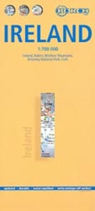
Ireland Borch Stanfords
£9.99
Archived Product

Finland South Stanfords
£11.50
Vouchers
No voucher codes found.
Do you know a voucher code for this product or supplier? Add it to Insights for others to use.
Do you know a voucher code for this product or supplier? Add it to Insights for others to use.
 Denmark