
 United Kingdom
 France
 Germany
 Netherlands
 Sweden
 USA
USA
 Italy
Italy
 Spain
Spain
More From Contributor


Ireland South
Indexed road map of Southern Ireland at 1:250, 000 from AA publishing, with city and town plans. Road detail shows toll and toll-free motorways, dual carriageways, A, B, and local roads, as well as scenic routes; motorway numbers are shown and distances are marked in kilometres. Railway lines and stops, ferry routes, and airports are highlighted, with car transportation indicated where available.Points of interest such as national parks, museums, and castles are clearly marked; administrative and national boundaries are prominently highlighted. The map is GPS compatible with the National grid overprinted on the map.The reverse has plans of Dublin, Cork, Galway, Limerick, Kilkenny, Killarney, and Waterford, showing one-way streets, points of interest and local facilities;
there is also a small route-planning map of Ireland with a road distance chart, as well as brief descriptions of six recommended tourist spots in Southern Ireland. Basic overview plans of main ferry ports are given. The map is indexed, with Irish language areas marked on the mapping with their English equivalents.
there is also a small route-planning map of Ireland with a road distance chart, as well as brief descriptions of six recommended tourist spots in Southern Ireland. Basic overview plans of main ferry ports are given. The map is indexed, with Irish language areas marked on the mapping with their English equivalents.
Product Description
Reviews/Comments
Add New
Intelligent Comparison
Archived Product

Ireland South Stanfords
£7.99
Archived Product

Ireland Southwest Stanfords
£13.99
Archived Product
Ireland North Stanfords
£5.90
Archived Product

Poland South Stanfords
£9.99
Archived Product

Flevoland South Stanfords
£7.25
Archived Product

Iceland South West Stanfords
£15.99
Archived Product
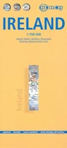
Ireland Borch Stanfords
£9.99
Archived Product

Finland South Stanfords
£11.50
Vouchers
No voucher codes found.
Do you know a voucher code for this product or supplier? Add it to Insights for others to use.
Do you know a voucher code for this product or supplier? Add it to Insights for others to use.
 Denmark