More From Contributor
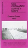
£14.95
This latest edition is aimed specifically at those travellers who not only want independence of movement, but also a measure of reassurance that they will get the best out of their holiday & be well looked after wherever they choose to go from B& Bs, game lodges, farms & guest houses to self catering cottages & uncategorisable others. There is also the useful resource of several maps & directions to the accommodation included within the guide. The Greenwood Guides team spend five months each year researching the best available accommodation & select only those places which excel in character, friendliness & hostly arts. The accommodation recommendations are described by Greenwood Guides, & not by the owners. ...
Archived Product
£9.99
` Don`t judge Australia just by the Australians.` Dame Edna Everadge Welcome to Australia. One of the most far-flung & beautiful destinations in the world. Home to the dreamiest coastlines & cityscapes human beings have ever clapped their eyes on. Home of dags, bingles, snags & sangers, Australia boasts some of the planet`s most exotic, dangerous & unique species of animal & insect &, irrefutably, the most inspiring outback terrain & ocean vistas known to man. It is the country referred to as the land of the plenty, God`s Own Country. & it`s true. It is. But God`s been a bit absent lately. Which is why, now, after all these years, Australia has started to look a little shitty. A little overgrown. A little bit long in the tooth. It is, in short, a country in need of a good hose down.. .and a hug. This is a hilarious collection of photographs of one of the world`s most ridiculous countries at its worst. The photos reveal the eccentricities, bleakness & humour of every nook & cranny of the entire country
- the dry bleak deserts & the over-the-top natives. Shit Australia is a warts-&-all walk around the world`s most crazy country, seen through the eyes of its own locals & Patrick Dalton
- the quintessential Englishman down under. Word count: 3, 000

...
Archived Product
£20.00
John Steinbeck famously christened Route 66 America`s ” Mother Road” in The Grapes of Wrath, & that chapter about Tom Joad`s exodus is just one of the classic pieces collected in this ultimate anthology. Here`s history, roadside attractions, pop culture, ghost stories-even recipes from famous greasy spoons. & it`s all illustrated with the largest collection of vintage art, postcards, travel decals, collectibles, & other memorabilia every amassed. This is a truly a worthy tribute to the Main Street of America. ...
Archived Product
£19.50
Get creative with this Greetings Rubber Stamps set from Cavallini & Co.! Comprising of ten high quality wood-block & rubber stamps with accompanying black ink pad, all housed in a well presented brush-metal case, the Greetings Rubber Stamps set is ideal for adorning cards, labels & letters
- & makes a great gift in-itself! Each of these well crafted wood-block & rubber stamps are individually sized according to the design, an example of which is presented on each block. Add a personal touch to your letters & cards!
...
Archived Product
£3.50
Greets Green in 1902 in a fascinating series of reproductions of old Ordnance Survey plans in the Alan Godfrey Editions, ideal for anyone interested in the history of their neighbourhood or family. The map covers the Greets Green area, west of West Bromwich, & extends westward to Tividale (bottom left corner) & Dudley Port station (near top right). Other districts include New Town, Swan Village, Albion & Tividale. Features include Birmingham Canal Navigation, Wolverhampton Level canal, Union Arm canal, Gower Branch canal, Dunkirk Branch canal, Balls Hill Branch, Ryders Green Locks, Netherton Tunnel Branch canal, LNWR Stour Valley line with Albion & Dudley Port stations, short stretch of LNWR South Staffordshire line, Stour Valley New Brick Works, Pumphouse Brick Works, Farley Park, old coal shafts, Ryders Green Tar Works, remains of old industry & coalfield, St Peter`s church, Automatic Glass Blowing Works, Groveland Colliery (disused), etc. Entries A toC of a West Bromwich trade directory are on the reverse. About the Alan Godfrey Editions of the 25” OS Series: Selected towns in Great Britain & Ireland are covered by maps showing the extent of urban development in the last decades of the 19th & early 20th century. The plans have been taken from the Ordnance Survey mapping & reprinted at about 15 inches to one mile (1:4, 340). On the reverse most maps have historical notes & many also include extracts from contemporary directories. Most maps cover about one mile (1.6kms) north/south, one & a half miles (2.4kms) across; adjoining sheets can be combined to provide wider coverage.FOR MORE INFORMATION & A COMPLETE LIST OF ALL AVAILABLE TITLES PLEASE CLICK ON THE SERIES LINK. ...
Archived Product
£36.00
` It never gets easier, you just go faster.` Greg Le Mond Being a three-time Tour de France winner is only half of the Greg Le Mond story. Equally at home on the cobbles of the spring classics as he was on the mountains of the grand tours Le Mond rode a full racing season from spring to autumn. His never-say-die spirit also bagged him two World Championship golds & a hatful of podiums at the world`s toughest bike races. Le Mond was a talented all-rounder, with a reputation as one of the canniest & taciturn racers of his generation. He was admired by his peers & respected by many of his rivals. But things could have been very different, when in 1987 his story took a tragic turn: While out hunting, he was accidentally shot. He lost so much blood that his life hung in the balance, but his recovery was as miraculous as what happened next, when he came back to the world of bicycle racing. In Le Mond: Yellow Jersey Racer, which presents Le Mond`s career year by year, big wins are documented with unique & exclusive photography depicting the racing times of this exceptional bike rider. Many of the protagonists in Le Mond`s world
- rivals, team mates & friends
- have been interviewed. They speak candidly about his career, how their lives crossed & his legacy in the sport of cycling. Foreword by Greg Le Mond.

...
Archived Product
£12.99
Map No. 1233, Greina, in the topographic survey of Switzerland at 1:25, 000 from Bundesamt für Landestopographie (swisstopo), covering the whole country on 247 small format sheets, with special larger maps published for popular regions including some titles now available in hiking versions. Highly regarded for their superb use of graphic relief & hill shading, the maps give an almost 3-D picture of Switzerland`s mountainous terrain. Contours are at 10 m intervals, with 20m intervals in the mountainous areas. All the maps have a 1-km grid for Swiss national coordinates (datum CH 1903). * Small format sheets (Nos. 1011
- 1374)* Map legend in the language of the area covered by the map. Additional margin ticks show latitude & longitude in steps of 2`. The area covered by each map is 17 x 12 km (11 x 7 miles approx). * Special larger sheets (Nos. from 2501 onwards) – STANDARD editions:* No map legend is included but a separate leaflet can be provided instead. The area covered by each map is 25 x 17 km (15 x 11 miles approx).* Special larger sheets (Nos. from 2501 onwards) – HIKING editions:* An overprint highlights hiking, mountain & alpine paths, including regional & national long-distance trails. The maps also show bus routes with bus stops, plus inns in remote locations. The area covered by each map is 25 x 17 km (15 x 11 miles approx).
...
Archived Product
£29.99
Topographic survey of Denmark at 1:100, 000 from Kort & Matrikelstyrelsen, the country’s national survey organization. The maps have contours at 5 metre intervals, with colouring and/or graphics showing various types of terrain & land use: woodlands, orchards, heath, sand & dunes, tidal flats, meadows & marshl&, etc. The maps provide detailed presentation of the road & rail networks & other information expected of topographic mapping at this scale. No specifically tourist information such as waymarked cycling or hiking routes is shown. Standard size sheets cover an area of 56 x 45km / 35x 28 miles approx. Map legend

Includes::
English. To see other titles in this series please click on the series link.IMPORTANT – PLEASE NOTE BEFORE ORDERING:AVAILABILITY: all the maps are now printed on dem&. Delivery from Denmark can take over 4 weeks. Once an order has been placed we cannot accept any returns for credit.COORDINATES: although the maps are meant to have UTM coordinates for EUREF 89 (WGS 84) datum, sheets are sometimes delivered printed without any grid or margin ticks for UTM or latitude & longitude.

...
Archived Product
£14.99
Topographic survey map of the isl&, with larger scale inset of the south-west peninsula & a street plan of St George’s. Relief is portrayed by vivid hill shading, with spot heights & contours at 200 feet intervals. Forest, mangrove & swamp areas are indicated. Road classification distinguishes surfaced & unsurfaced roads, 4WD trails & footpaths. The international airport, buildings & built-up areas are marked as well as ruins & antiquities, & other notable buildings e.g. hospitals, post offices, churches. The South-West Peninsula, shown at 1:25, 000 with more detail, is indexed for selected notable buildings & locations. The simple street plan of St George’s is at 1:10, 000 & is also indexed for various locations & buildings. Latitude & longitude margin ticks are at 5’ intervals & a UTM grid is drawn over the map.* Please note:* This map last revised in 1992 & reprinted 1998 by the now defunct Ordnance Survey International. ...
Archived Product

Greetland 1905

Greetland in 1905 in a fascinating series of reproductions of old Ordnance Survey plans in the Alan Godfrey Editions, ideal for anyone interested in the history of their neighbourhood or family. The map covers the small town of Greetland, just south-east of Halifax, with West Vale. Most of the town is covered and features include Hullen Edge, Albert Mills, Lindwell, Elland cum Greetland Cemetery, West Grove Works, Brow Bridge, Onecliffe Mills, Hollyns Mill, Stainland Road, Saddleworth Road, Spring Field Dye Works, etc. Coverage extends westward to Ellistones, Lower and Upper Brandy Hole, Houghcroft Head, Cross Hill, Little Bradley and Bradley Mills. The L&YR Stainland Branch runs through the map, including West Vale station; Greetland station and Junction are at the top
of the map, with Elland Tunnel. On the reverse are directories for Greetland and West Vale.About the Alan Godfrey Editions of the 25” OS Series:Selected towns in Great Britain and Ireland are covered by maps showing the extent of urban development in the last decades of the 19th and early 20th century. The plans have been taken from the Ordnance Survey mapping and reprinted at about 15 inches to one mile (1:4, 340). On the reverse most maps have historical notes and many also include extracts from contemporary directories. Most maps cover about one mile (1.6kms) north/south, one and a half miles (2.4kms) across; adjoining sheets can be combined to provide wider coverage.FOR MORE INFORMATION AND A COMPLETE LIST OF ALL AVAILABLE TITLES PLEASE CLICK ON THE SERIES LINK.
RIP - This product is no longer available on our network. It was last seen on 25.09.2019

This page now acts as a permanent archive for this product. Add more information using the comments box below to ensure it can still be found by future generations.

Use our search facility to see if it is available from an alternative contributor.
  • External links may include paid for promotion
  • Availability: Out Of Stock
  • Supplier: Stanfords
  • SKU: 9781841511863
Availability: In Stock
£3.50

Product Description

Greetland in 1905 in a fascinating series of reproductions of old Ordnance Survey plans in the Alan Godfrey Editions, ideal for anyone interested in the history of their neighbourhood or family. The map covers the small town of Greetl&, just south-east of Halifax, with West Vale. Most of the town is covered & features include Hullen Edge, Albert Mills, Lindwell, Elland cum Greetland Cemetery, West Grove Works, Brow Bridge, Onecliffe Mills, Hollyns Mill, Stainland Road, Saddleworth Road, Spring Field Dye Works, etc. Coverage extends westward to Ellistones, Lower & Upper Brandy Hole, Houghcroft Head, Cross Hill, Little Bradley & Bradley Mills. The L&YR Stainland Branch runs through the map, including West Vale station; Greetland station & Junction are at the top of the map, with Elland Tunnel. On the reverse are directories for Greetland & West Vale. About the Alan Godfrey Editions of the 25” OS Series: Selected towns in Great Britain & Ireland are covered by maps showing the extent of urban development in the last decades of the 19th & early 20th century. The plans have been taken from the Ordnance Survey mapping & reprinted at about 15 inches to one mile (1:4, 340). On the reverse most maps have historical notes & many also include extracts from contemporary directories. Most maps cover about one mile (1.6kms) north/south, one & a half miles (2.4kms) across; adjoining sheets can be combined to provide wider coverage.FOR MORE INFORMATION & A COMPLETE LIST OF ALL AVAILABLE TITLES PLEASE CLICK ON THE SERIES LINK.

Reviews/Comments

Add New

Price History

Vouchers

No voucher codes found.
Do you know a voucher code for this product or supplier? Add it to Insights for others to use.

Facebook

Jargon Buster

Contemporary - Modern era design
Contemporary - A design reference to indicate post war modern design
History - Anything that happens in the past. An acedemic subject.
edge - Enhanced data rates for GSM evolution also known as enhanced GPRS. A mobile phone technology with improved data transmission rates.
edge - The point at which two surfaces meet
Small - something that takes up less space than normal.
Tunnel - a tunnel travels through an abject connecting one place to another.
Road - a manmade lane or a path that is used to speed up travel.
Contemporary - An object that is living in the same time.
Mill - A building which can grind grain into flour.
Junction - A point where two or more things come together, typically used to describe roads
Head - The upper part of a body typically separated by the neck.
Ideal - Something that satisfies a perfect criteria.
Family - A group of people that live together made up from parents and children.

Supplier Information

Stanfords
Stanfords was established in 1853 and opened their iconic Covent Garden flagship store in 1901. They have become the top retailer of maps, travel books and accessories in the UK and arguably offer the largest selection of maps and travel books worldwide. Famous names such as Captain Robert Falcon Scott, Ranulph Fiennes and Michael Palin have purchased from Stanfords. They now have a shop in Bristol and both stores together with other venues operate a calendar of events including talks, book signings and exhibitions. As a specialist map retailer, the map selection is comprehensive and includes road maps, street maps and walking maps from worldwide destinations, as well as a selection of world atlases and wall maps. Books include travel guides and travel literature. Stanfords also stock globes, from miniatures made of blue marble to magnificent floor-standing globes. The website features a selection of interesting articles on travel topics.
Page Updated: 2023-11-12 20:15:36

Community Generated Product Tags

Oh No! The productWIKI community hasn't generated any tags for this product yet!
Menu