
 United Kingdom
 France
 Germany
 Netherlands
 Sweden
 USA
USA
 Italy
Italy
 Spain
Spain
More From Contributor


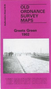
Greets Green 1902
Greets Green in 1902 in a fascinating series of reproductions of old Ordnance Survey plans in the Alan Godfrey Editions, ideal for anyone interested in the history of their neighbourhood or family. The map covers the Greets Green area, west of West Bromwich, and extends westward to Tividale (bottom left corner) and Dudley Port station (near top right). Other districts include New Town, Swan Village, Albion and Tividale. Features include Birmingham Canal Navigation, Wolverhampton Level canal, Union Arm canal, Gower Branch canal, Dunkirk Branch canal, Balls Hill Branch, Ryders Green Locks, Netherton Tunnel Branch canal, LNWR Stour Valley line with Albion and Dudley Port stations, short stretch of LNWR South Staffordshire line, Stour Valley New Brick Works, Pumphouse Brick
Works, Farley Park, old coal shafts, Ryders Green Tar Works, remains of old industry and coalfield, St Peter`s church, Automatic Glass Blowing Works, Groveland Colliery (disused), etc. Entries A toC of a West Bromwich trade directory are on the reverse.About the Alan Godfrey Editions of the 25” OS Series:Selected towns in Great Britain and Ireland are covered by maps showing the extent of urban development in the last decades of the 19th and early 20th century. The plans have been taken from the Ordnance Survey mapping and reprinted at about 15 inches to one mile (1:4, 340). On the reverse most maps have historical notes and many also include extracts from contemporary directories. Most maps cover about one mile (1.6kms) north/south, one and a half miles (2.4kms) across;
adjoining sheets can be combined to provide wider coverage.FOR MORE INFORMATION AND A COMPLETE LIST OF ALL AVAILABLE TITLES PLEASE CLICK ON THE SERIES LINK.

Product Description
Reviews/Comments
Add New
Vouchers
No voucher codes found.
Do you know a voucher code for this product or supplier? Add it to Insights for others to use.
Do you know a voucher code for this product or supplier? Add it to Insights for others to use.
 Denmark