-
Home
-
Contributors
-
International
-
Account
-
Information
More From Contributor
Includes:: Aveley, Bulphan, Chadwell St. Mary, East Tilbury & Purfleet. Current edition of this title was published in 2016. To see other titles in this series of A-Z street atlases of towns & cities please click on the series link. A-Z also publish a series of County Street Atlases
- for a list of titles in that series please search for SI00000917.A-Z street atlases present motorways plus A & B roads highlighted by colouring & shown with route numbers. One way or restricted access streets & car parks are marked, as are in more recently published titles locations of speed cameras. Also shown are selected cycleway routes. Where appropriate, A & B roads are annotated with selected house numbers for easier identification of addresses. Railway lines are shown with stations & level crossings. Colouring indicates different types of buildings: educational, hospitals & healthcare, industrial, leisure & recreational, shopping centres & markets, public buildings, & places of interest. Symbols mark locations of facilities usually indicated on street mapping: post offices, emergency services, public toilets, etc. Also marked are postcode & local authority boundaries. Each page has the lines & coordinates of the British National Grid. The indexes list streets, places & areas, hospitals, industrial estates, blocks of flats on housing estates, railway stations, & selected places o interest; the latter are printed in contrasting colouring to make them easier to find. ...
Includes:: Travel Guides, Maps & Road Atlases, presently ...
Includes:: English.IMPORTANT, PLEASE READ BEFORE ORDERING: most titles come with booklets in GERMAN containing extensive additional information including an index of main locations, suggestions for walks (often accompanied by route profiles) & other recreational activities, lists of mountain huts & other recommended accommodation, etc. Unless specified in the title’s individual description, all the information is in German only & no English language version of the booklet is available. Some titles carry similar information on the reverse. ...
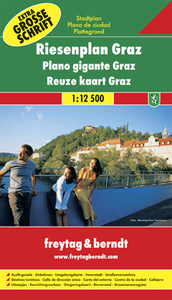
Includes:: English. This map covers a large area, extending out to the city boundary. Railway, tram & bus lines are marked & pedestrian zones, places of interest & notable public buildings are highlighted. Street numbers are also included, at intervals, on the map. As well as the town centre enlargement, there is a 1:100, 000 road map showing Graz & surroundings. The index booklet
Includes:: notes, in English, on local places of interest. ...
- Schöckl – Teichalm- Stubenbergsee area of south-eastern Austria presented at 1:50, 000 in a series of contoured ...
- this is the convincing formula of the brand new Supertrail Maps. For the first time ever, these unique topographic maps make the knowledge of locals available to others. All the trails on a map have been biked & rated in five difficulty levels for up- & downhill separately by specially trained authors. This consistent rating facilitates tour planning & spares a user from getting into sketchy situations on the trails. In addition to the difficulty rating, extraordinary nice trails are marked with a «highlight»-pictogram. The maps in a scale of 1:50 000 show all information required for tour planning & orienting oneself on the trails, such as: difficulty, highlight-trails, mountain railways with mountain bike transport, mountain bike shuttles, dangerous falls, restaurants, bike shops, emergency numbers & touristic infopoints. Thanks to the especially chosen map section, one map covers the whole area. The Supertrail Maps are printed on tear- & waterproof foil which makes them very sturdy. On the back of any map, additional information about the area & the use of a Supertrail Map are presented in two languages. Folded
Dimensions of 10x 15cm allow the map to fit into any pocket without squeezing. ...
- in the meantime, for areas other than those shown on the attached grid please use CNIG’s topographic survey at 1:50, 000 by searching for ‘SI00000832’. Each 25K map covers one quarter of the corresponding 50K map, with the numbering system: I = NW quarter, II = NE quarter, III = SW quarter & IV = SE quarter. CNIG maps in the Provincial Road Maps series at 1:200, 000 are overprinted with the grid for the 1:50, 000 survey & can be used to see the area covered by each 50K or 25K title in more detail. To see the list of titles in this series please click on the series grid
- for map numbers not yet listed on our website please contact us by email. ...

Graz Freytag & Berndt Atlas - SPIRAL-BOUND
This page now acts as a permanent archive for this product. Add more information using the comments box below to ensure it can still be found by future generations.
Use our search facility to see if it is available from an alternative contributor.
- Availability: Out Of Stock
- Supplier: Stanfords
- SKU: 9783850840156
Product Description
The street mapping in this atlas extends to the city boundary & occupies 40 pages. The cartography is the same as that used in the folded map of Graz by this publisher, but reproduced in this format at an enlarged scale for clarity. Railway, tram & bus lines are marked & pedestrian zones, places of interest & notable public buildings are highlighted. Street numbers are also included, at intervals, on the map.A simplified plan of Graz highlights the through-routes, & there is a city-centre plan at Approx. 1:5, 600. An additional diagram shows the local bus & tram network. The street index also
Includes:: post offices, hospitals & pharmacies. Legend
Includes:: English.
Reviews/Comments
Add New
Intelligent Comparison
We couldn't find anything!
Perhaps this product's unique.... Or perhaps we are still looking for comparisons!
Click to bump this page and we'll hurry up.
Price History
Vouchers
Do you know a voucher code for this product or supplier? Add it to Insights for others to use.


 United Kingdom
 France
 Germany
 Netherlands
 Sweden
 USA
USA
 Italy
Italy
 Spain
Spain


 Denmark