More From Contributor

£5.99
If you explore our churchyards & cemeteries you will be astonished at how much you can discover, not only about the people who are buried there & their standing in the local community but also about the history of the area. Trevor Yorke explains burial practices down the ages & details the development of the churchyard & the cemetery. He looks at the period styles of gravestones & tombs, & the shapes & features that help to date them. Using a wide range of photographs & line illustrations, he examines the carvings & symbols that can be found & offers clues to their possible meanings. ...
Archived Product
£16.95
This book follows on from the well-received Death in London. Generations of Londoners lie beneath the city, hidden or forgotten
-
...
Archived Product
£9.99
” The greatest, wildest author of his generation”. (” Guardian”). We could tell you the year is 1944, that the main character is called Tyrone Slothrop & that he has a problem because bombs are falling across Europe & crashing to earth at the exact locations of his sexual conquests. But that doesn`t really begin to cover it. Reading this book is like falling down a rabbit hole into an outlandish, sinister, mysterious, absurd, compulsive netherworld. As the ” Financial Times” said, `you must forget earlier notions about life & letters & even the Novel.` Forty years since publication, ” Gravity`s Rainbow” has lost none of its power to enthral. ...
Archived Product
£11.50
Topographic survey of France at 1:25, 000 in IGN`s excellent TOP25 / Série Bleue series. All the maps are GPS compatible, with a 1km UTM grid plus latitude & longitude lines at 5’ intervals. Contours are at 5m intervals except for mountainous areas where the maps have contours at 10m intervals, vividly enhanced by hill shading & graphics for rocky terrain. Colouring with graphics indicates different types of vegetation or land use (deciduous or coniferous forests, moors, orchards, vineyards, etc). PLEASE NOTE: coverage of France at this scale is currently being revised – the format & the presentation of each title are indicated by the letters at the end of its Sheet Reference number (e.g. 0416ET, 3531ETR, 1923SB, etc.)MAPS WITH FULL TOURIST OVERPRINT & AN ENGLISH MAP LEGEND: all TOP25 maps & the SB editions of Série Bleue have an overprint highlighting waymarked walking trails including long-distance GR routes &, where appropriate, ski routes. Symbols indicate campsites, gîtes d’etape, refuges, equestrian centres & other recreational facilities or sites, tourist information centres, cultural heritage, etc. Towns & locations of particular interest are highlighted.- ET or OT = single-sided TOP25 map covering approx. 29x 21 km / 18x 13 miles.- ETR or OTR = waterproof & tear resistant TOP25 map covering the same area as the corresponding ET or OT number, but double-sided, printed on a smaller size sheet with a good overlap between the sides.- SB = Série Bleue map with full tourist overprint; these maps, first introduced in summer 2014, each cover approx. 29x 24km / 18x 15 miles.SÉRIE BLEUE maps with numbers ending in E (Est) or O (Ouest): most editions now indicate the GR routes, but do not show any other tourist information. Map legend is in French only. Each map covers approx. 14x 20km / 9x 12 miles. ...
Archived Product
£4.95
Grays. Thurrock, Corringham, South Ockendon, Stanford-le-Hope & Tilbury Street Atlas from the Geographers` A-Z Map Company in a paperback format slightly smaller than A5. Map scale is 1:15, 840 (4” to a mile). Coverage

Includes::
Aveley, Bulphan, Chadwell St. Mary, East Tilbury & Purfleet. Current edition of this title was published in 2016. To see other titles in this series of A-Z street atlases of towns & cities please click on the series link. A-Z also publish a series of County Street Atlases
- for a list of titles in that series please search for SI00000917.A-Z street atlases present motorways plus A & B roads highlighted by colouring & shown with route numbers. One way or restricted access streets & car parks are marked, as are in more recently published titles locations of speed cameras. Also shown are selected cycleway routes. Where appropriate, A & B roads are annotated with selected house numbers for easier identification of addresses. Railway lines are shown with stations & level crossings. Colouring indicates different types of buildings: educational, hospitals & healthcare, industrial, leisure & recreational, shopping centres & markets, public buildings, & places of interest. Symbols mark locations of facilities usually indicated on street mapping: post offices, emergency services, public toilets, etc. Also marked are postcode & local authority boundaries. Each page has the lines & coordinates of the British National Grid. The indexes list streets, places & areas, hospitals, industrial estates, blocks of flats on housing estates, railway stations, & selected places o interest; the latter are printed in contrasting colouring to make them easier to find.


...
Archived Product
£9.99
Graz & Environs area of south-eastern Austria presented at 1:50, 000 in a series of contoured & GPS compatible outdoor leisure map from Freytag & Berndt with hiking & cycling routes, mountain huts, campsites & youth hostels, local bus stops, plus other tourist information. To see the list of currently available titles in this series please click on the series link. Freytag & Berndt’s outdoor leisure maps cover the whole of Austria at 1:50, 000, with selected popular areas also presented with 50K cartography enlarged to 1:35, 000 for larger print & clearer legibility. The maps have contours at 100m intervals in the mountainous areas & 50m elsewhere, enhanced by shading, graphic relief & colouring for woodlands. The overprint highlighting waymarked hiking trails is graded into three types: easy walks, mountain paths, & more difficult alpine sections. Waymarked trails including long-distance routes are annotated with their numbers and/or signs. The maps also highlight cycling & mountain biking routes, cross-country ski tracks, & Nordic walking tracks. Symbols indicate mountain huts, youth hostels, campsites & countryside hotels/inns, bus stops on local roads, car parks plus various facilities & places of interest. The maps have a 2-km UTM grid, plus latitude & longitude margin ticks at 5’ intervals. Selected titles also have in the accompanying booklet (see below) an additional list of GPS waypoints indicated on the map. Map legend

Includes::
English.IMPORTANT, PLEASE READ BEFORE ORDERING: most titles come with booklets in GERMAN containing extensive additional information including an index of main locations, suggestions for walks (often accompanied by route profiles) & other recreational activities, lists of mountain huts & other recommended accommodation, etc. Unless specified in the title’s individual description, all the information is in German only & no English language version of the booklet is available. Some titles carry similar information on the reverse.

...
Archived Product
£4.99
Graz in a series of handy pocket street plans from Freytag & Berndt. Each map is laminated, so waterproof & tear-resistant, & highlights the publishers’ recommendations of five best choices in five categories: shopping, restaurants & cafes, culture, nightlife & sights. On one side is an indexed street plan annotated with colour-coded markers highlighting the publishers’ recommendations, all listed on the reverse of the map with brief notes in several languages. In larger cities the plans cover only the central districts. Also provided are a small road map of the city’s environs, if appropriate a diagram of the metro network, & a Fact Box with phone numbers for tourist offices, car hire & emergency services. Map legend & notes on the recommendations include English. To see other titles in this series please click on the series link. ...
Archived Product
£9.95
The street mapping in this atlas extends to the city boundary & occupies 40 pages. The cartography is the same as that used in the folded map of Graz by this publisher, but reproduced in this format at an enlarged scale for clarity. Railway, tram & bus lines are marked & pedestrian zones, places of interest & notable public buildings are highlighted. Street numbers are also included, at intervals, on the map.A simplified plan of Graz highlights the through-routes, & there is a city-centre plan at Approx. 1:5, 600. An additional diagram shows the local bus & tram network. The street index also

Includes::
post offices, hospitals & pharmacies. Legend

Includes::
English.


...
Archived Product
£9.99
Freytag & Berndt, Austria`s leading map publishers, produce a series of street plans covering the country`s main cities. All the plans are indexed & show public transport system. Plans of cities in the mountainous parts of the country are contoured to indicate the terrain. Most plans have enlargements showing the town centre in greater detail. Some plans include a black & white map of the city overprinted with cycle routes. Map legend

Includes::
English. This map covers a large area, extending out to the city boundary. Railway, tram & bus lines are marked & pedestrian zones, places of interest & notable public buildings are highlighted. Street numbers are also included, at intervals, on the map. As well as the town centre enlargement, there is a 1:100, 000 road map showing Graz & surroundings. The index booklet

Includes::
notes, in English, on local places of interest.


...
Archived Product
£9.99
Graz Highlighands
- Schöckl – Teichalm- Stubenbergsee area of south-eastern Austria presented at 1:50, 000 in a series of contoured
...
Archived Product

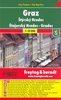
Graz & Styria Travel Pack

The highly successful Globetrotter Travel Series, which includes Travel Guides, Maps and Road Atlases, presently covers more than 80 destinations worldwide. The packs are excellent value, including both a guidebook and a softcover version of the fold-out Globetrotter map of the region, in a printed plastic wallet.The handy pocket-size guide is packed with useful information, tips and recommendations, accompanied by colour photographs, charts and maps for the first-time traveller who wants to experience the major highlights that Graz ans Styria has to offer.This travel book surpasses other guides in that it incorporates essential information in an easy-to-carry and easy-to-read format that is attractive and useful at the same time. It provides a visitor with an invaluable
introduction to Ireland by concisely highlighting the region's 'must see' areas in a practical and user-friendly format, thus encouraging the tourist to make the most of his/her available time. All the essential information you need to get around an unfamiliar region is compacted into useful and practical 'At-a-Glance' sections at the end of each chapter.The fold-out map of Austria is ideal for tourists and visitors. In addition to the main map of Austria, which highlights scenic routes, it features 2 detailed area maps and 10 town plans.
RIP - This product is no longer available on our network. It was last seen on 25.09.2019

This page now acts as a permanent archive for this product. Add more information using the comments box below to ensure it can still be found by future generations.

Use our search facility to see if it is available from an alternative contributor.
  • External links may include paid for promotion
  • Availability: Out Of Stock
  • Supplier: Stanfords
  • SKU: 9781847731845
Availability: In Stock
£8.99

Product Description

The highly successful Globetrotter Travel Series, which

Includes::
Travel Guides, Maps & Road Atlases, presently covers more than 80 destinations worldwide. The packs are excellent value, including both a guidebook & a softcover version of the fold-out Globetrotter map of the region, in a printed plastic wallet. The handy pocket-size guide is packed with useful information, tips & recommendations, accompanied by colour photographs, charts & maps for the first-time traveller who wants to experience the major highlights that Graz ans Styria has to offer. This travel book surpasses other guides in that it incorporates essential information in an easy-to-carry & easy-to-read format that is attractive & useful at the same time. It provides a visitor with an invaluable introduction to Ireland by concisely highlighting the region's 'must see' areas in a practical & user-friendly format, thus encouraging the tourist to make the most of his/her available time. All the essential information you need to get around an unfamiliar region is compacted into useful & practical ' At-a-Glance' sections at the end of each chapter. The fold-out map of Austria is ideal for tourists & visitors. In addition to the main map of Austria, which highlights scenic routes, it features 2 detailed area maps & 10 town plans.

Reviews/Comments

Add New

Intelligent Comparison

Oooops!
We couldn't find anything!
Perhaps this product's unique.... Or perhaps we are still looking for comparisons!
Click to bump this page and we'll hurry up.

Price History

Vouchers

No voucher codes found.
Do you know a voucher code for this product or supplier? Add it to Insights for others to use.

Facebook

Jargon Buster

Plastic - A generic term for a synthetic product used in the manufacture of products
Colour - The categorised spectrum of light visable to humans
Size - is the measurement of how big an object is in space.
Road - a manmade lane or a path that is used to speed up travel.
Practical - Weather a task is easy to carry out and realistically succeed.
Experience - To gain further knowledge by practising.
Pocket - A bag shaped insert in clothing used to carry items
Invaluable - Something that cannot be replaces as it is indispensable.
Ideal - Something that satisfies a perfect criteria.

Supplier Information

Stanfords
Stanfords was established in 1853 and opened their iconic Covent Garden flagship store in 1901. They have become the top retailer of maps, travel books and accessories in the UK and arguably offer the largest selection of maps and travel books worldwide. Famous names such as Captain Robert Falcon Scott, Ranulph Fiennes and Michael Palin have purchased from Stanfords. They now have a shop in Bristol and both stores together with other venues operate a calendar of events including talks, book signings and exhibitions. As a specialist map retailer, the map selection is comprehensive and includes road maps, street maps and walking maps from worldwide destinations, as well as a selection of world atlases and wall maps. Books include travel guides and travel literature. Stanfords also stock globes, from miniatures made of blue marble to magnificent floor-standing globes. The website features a selection of interesting articles on travel topics.
Page Updated: 2023-11-12 20:15:36

Community Generated Product Tags

Oh No! The productWIKI community hasn't generated any tags for this product yet!
Menu