
 United Kingdom
 France
 Germany
 Netherlands
 Sweden
 USA
USA
 Italy
Italy
 Spain
Spain
More From Contributor
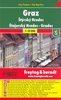

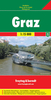


Graz Supertrail Map
The new Supertrail Maps show the best singletrails in Europe’s hottest mountain bike spots. These unique topographic maps make the knowledge of locals available to other mountain bikers. Consistent difficulty rating and useful additional information prevent the user from critical situations on the trails. The best singletrails in the best mountain bike spots throughout Europe - this is the convincing formula of the brand new Supertrail Maps.For the first time ever, these unique topographic maps make the knowledge of locals available to others. All the trails on a map have been biked and rated in five difficulty levels for up- and downhill separately by specially trained authors. This consistent rating facilitates tour planning and spares a user from getting into sketchy situations on
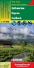
the trails. In addition to the difficulty rating, extraordinary nice trails are marked with a «highlight»-pictogram. The maps in a scale of 1:50 000 show all information required for tour planning and orienting oneself on the trails, such as: difficulty, highlight-trails, mountain railways with mountain bike transport, mountain bike shuttles, dangerous falls, restaurants, bike shops, emergency numbers and touristic infopoints.Thanks to the especially chosen map section, one map covers the whole area. The Supertrail Maps are printed on tear- and waterproof foil which makes them very sturdy. On the back of any map, additional information about the area and the use of a Supertrail Map are presented in two languages. Folded dimensions of 10x15cm allow the map to fit into any
pocket without squeezing.

Product Description
Reviews/Comments
Add New
Vouchers
No voucher codes found.
Do you know a voucher code for this product or supplier? Add it to Insights for others to use.
Do you know a voucher code for this product or supplier? Add it to Insights for others to use.
 Denmark