
 United Kingdom
 France
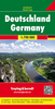
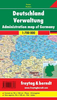
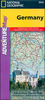
 Germany
 Netherlands
 Sweden
 USA
USA
 Italy
Italy
 Spain
Spain
More From Contributor


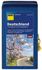

Germany AA Road Map
Fully updated, the maps combine clear design and an easy-to-read scale with more road detail to ensure you never lose your way.Designed especially for the British motorist, all motorways are clearly shown in blue and toll motorways are highlighted. Distance markers and service stations are included, with towns of interest identified to help you plan the best route.The mapping shown on the country titles includes touring information and visitor attractions including national parks, ski resorts, beaches, top museums and churches. Roads unsuitable for caravans are also indicated, together with steep gradients. A place name index and large scale city plans, featuring street names and places of interest, complete the sheet map.

Product Description
Reviews/Comments
Add New
Vouchers
No voucher codes found.
Do you know a voucher code for this product or supplier? Add it to Insights for others to use.
Do you know a voucher code for this product or supplier? Add it to Insights for others to use.
 Denmark