
 United Kingdom
 France
 Germany
 Netherlands
 Sweden
 USA
USA
 Italy
Italy
 Spain
Spain
More From Contributor


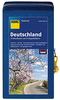


Germany Administrative Freytag & Berndt Wall Map
An administrative wall map of Germany from Freytag & Berndt, 96 x 128cm (3ft 2” x 4ft 2” approx), showing the country at 1:700, 000 with each state in a different colour. Within the states the map shows internal divisions into regions (Regierungsbezirke) and districts (Kreise) with names of the regions. Towns also indicate their administrative status. The base map shows the country’s road and rail networks. The map comes with a separate index booklet listing all locations with their postcodes. The booklet also includes street plans of central Berlin, Bremen, Cologne, Dresden, Düsseldorf, Erfurt, Frankfurt, Hamburg, Hannover, Kiel, Leipzig, Magdeburg, Mainz, Munich, Potsdam, Saarbrücken, Schwerin, Stuttgart and Wiesbaden.

Product Description
Reviews/Comments
Add New
Intelligent Comparison
Archived Product
Italy Postcode Freytag & Berndt Wall Map Stanfords
£13.99
Vouchers
No voucher codes found.
Do you know a voucher code for this product or supplier? Add it to Insights for others to use.
Do you know a voucher code for this product or supplier? Add it to Insights for others to use.
 Denmark