
 United Kingdom
 France
 Germany
 Netherlands
 Sweden
 USA
USA
 Italy
Italy
 Spain
Spain
More From Contributor


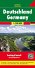

Germany 2011
Germany at 1:750, 000 from Michelin, with information on driving regulations, plus a distance and journey time table. The map is an enlargement of cartography prepared to cover a wider area, so has larger that usual print and greater clarity.Roads network includes local roads and is graded according to the number of lanes. Motorways indicate toll routes and junctions show full or partial interchanges. Toll barriers, steep gradients and seasonal restrictions are marked, scenic routes are highlighted. Railway lines are not included.Relief shading is used to indicate the topography, with colouring for forested areas. Selected regional parks are also marked. Small symbols indicate various landmarks or places of interest, but the map is not designed to highlight tourist sights. The map
has no geographical coordinates. Multilingual map legend includes English. The index is printed on the same side as the map.Also provided is basic information on Germany
has no geographical coordinates. Multilingual map legend includes English. The index is printed on the same side as the map.Also provided is basic information on Germany
Product Description
Reviews/Comments
Add New
Intelligent Comparison
Archived Product
Germany 2012 Stanfords
£5.99
Archived Product
Germany 1846 Stanfords
£120.00
Archived Product
Germany Stanfords
£15.99
Archived Product
Germany Stanfords
£14.50
Archived Product
Germany Stanfords
£12.50
Archived Product
Germany Stanfords
£5.99
Archived Product
Germany Stanfords
£13.59
Archived Product
Germany Stanfords
£13.59
Vouchers
No voucher codes found.
Do you know a voucher code for this product or supplier? Add it to Insights for others to use.
Do you know a voucher code for this product or supplier? Add it to Insights for others to use.
 Denmark