
 United Kingdom
 France
 Germany
 Netherlands
 Sweden
 USA
USA
 Italy
Italy
 Spain
Spain
More From Contributor

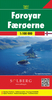


Faroe Islands Topographic Atlas
Faroe Islands on topographic maps at 1:100, 000, with cartography produced by the Danish national survey organization, Kort og Matrikelstyrelsen, combined into an atlas with an index and a table showing various facilities found in local towns and settlements.The islands are shown on six 30 x 29 cm maps, with the whole atlas folded in half into a 15 x 29 cm format. Contours are at 25m intervals, with relief shading and spot heights. Graphics and colouring indicate peat bogs, sand, tidal flats and cultivated areas. The maps show local roads and tracks, plus ferry connections between the islands. Symbols mark various landmarks and places of interest, including campsites, youth hostels, museums and tourist information centres. Latitude lines are drawn at 5
Product Description
Reviews/Comments
Add New
Intelligent Comparison
Archived Product

Faroe Islands: 20K Topographic Survey Maps Stanfords
£19.90
Vouchers
No voucher codes found.
Do you know a voucher code for this product or supplier? Add it to Insights for others to use.
Do you know a voucher code for this product or supplier? Add it to Insights for others to use.
 Denmark