More From Contributor

£35.00
Official charts for the Faroe Islands produced by the Danish Hydrographic Office. The charts are ordered upon customer dem&, therefore please contact us if you require the charts urgently. For any further information, you can contact maritime@stanfords.co.uk. ...
Archived Product
£17.95
Faroe Islands on topographic maps at 1:100, 000, with cartography produced by the Danish national survey organization, Kort og Matrikelstyrelsen, combined into an atlas with an index & a table showing various facilities found in local towns & settlements. The islands are shown on six 30 x 29 cm maps, with the whole atlas folded in half into a 15 x 29 cm format. Contours are at 25m intervals, with relief shading & spot heights. Graphics & colouring indicate peat bogs, s&, tidal flats & cultivated areas. The maps show local roads & tracks, plus ferry connections between the islands. Symbols mark various landmarks & places of interest, including campsites, youth hostels, museums & tourist information centres. Latitude lines are drawn at 5 ...
Archived Product
£19.90
Topographic survey of Faroe Islands at 1:20, 000 prepared by the Danish national mapping agency Kort og Matrikelstyrelsen. The islands’ topography is vividly presented by contours at 5 metre intervals, enhanced by relief shading plus colouring and/or graphics for different types of terrain or vegetation (scree, boulders, etc). The maps show all the detail expected of the topographic mapping at this scale & have a 1-km UTM grid, plus margin ticks for latitude & longitude at 1’ & 2` respectively. Map legend is in Danish only. The maps are available either separately or as sets of five of more sheets, each covering the main island group: Vagar, Sandoy, Suduroy, Nordoyar, Streymoy & Eysturoy. ...
Archived Product
£28.50
This third edition of Faroe, Iceland & Greenland contains extensive revisions as well as enhanced information on the three areas that the pilot covers. Much of this new data has been provided by Royal Cruising Club members who have visited the area since the first edition was published. The editor, Willy Ker, has drawn heavily upon their notes & sketch charts to provide what is the only comprehensive compendium of information on these cruising grounds in the northernmost part of the Atlantic Ocean. Willy Ker has cruised in the whole area for more than 20 years, including the West Coast of Greenland from Cape Farewell to Thule & exploring most of the little known East Coast as well. Willy is a Fellow of the Royal Institute of Navigation & a recipient of the CCA Blue Water Medal & the Tilman Trophy. Contents: Foreword; Introduction; Faroe; Iceland; Iceland; Greenland; Appendix ...
Archived Product
£3.99
The Lonely Planet Farsi Phrasebook is not only an extensive list of useful phrases, but also an ideal tool to start getting to grips with a language & beginning two-way communication. Containing excellent sections on language basics such as numbers, question phrases, dates, phrase construction, grammar & pronunciation, as well as containing concise but well-rounded two-way dictionaries, Lonely Planet phrasebooks enable you to quickly & confidently construct your own phrases in addition to those given. The given phrases cover all the essential travel & tourism categories such as transport, communications, business meetings & accommodation, as well as in-depth categories such as health, food & social interaction. The phrasebooks are designed to enable more than just simple question-answer communication, allowing the start of two-way conversations
- putting you comfortably on your way to learning the language & understanding its speakers. True to Lonely Planet
...
Archived Product
£3.50
Farsley in 1915 in a fascinating series of reproductions of old Ordnance Survey plans in the Alan Godfrey Editions, ideal for anyone interested in the history of their neighbourhood or family. The map covers the small town of Farsley, west of Leeds. Most of the town centre is shown & coverage

Includes::
Farsley Beck Bottom & Bagley, continuing north to the western tip of Rodley & westward to Woodhall Hill. Features include Sunny Bank Mill, St John`s church (at foot of map), Springfield Mills, The Green, Bank Bottom Mills, Wadlands Hall, Holly Park Mills (near top left corner), Peel Ings Foundry, Broom Mills, etc. On the reverse is a 1922 directory of Farsley. About the Alan Godfrey Editions of the 25” OS Series: Selected towns in Great Britain & Ireland are covered by maps showing the extent of urban development in the last decades of the 19th & early 20th century. The plans have been taken from the Ordnance Survey mapping & reprinted at about 15 inches to one mile (1:4, 340). On the reverse most maps have historical notes & many also include extracts from contemporary directories. Most maps cover about one mile (1.6kms) north/south, one & a half miles (2.4kms) across; adjoining sheets can be combined to provide wider coverage.FOR MORE INFORMATION & A COMPLETE LIST OF ALL AVAILABLE TITLES PLEASE CLICK ON THE SERIES LINK.

...
Archived Product
£23.99
Map No. 10001, Farsund, in the new topographic survey of Norway at 1:50, 000 covering the country on 195 double-sided sheets & first published by Nordeca in 2011
- 2012; fully GPS compatible, indicating waymarked footpaths, campsites, tourist huts, illuminated ski runs, etc. The maps, now published by Nordeca, the successors to Statens Kartverk & its subsequent owners the Ugland Group, are printed on light, waterproof & tear-resistant synthetic paper. Each map covers an area of 62x 45 kilometres (39 x 28 miles approx.), with a 2-km overlap between the sheets. The maps have contours at 20m intervals (10m glacier contours), plus colouring & graphics to show cultivated areas, bogs, forests, etc. In addition to all the information expected of topographic mapping at this scale the maps distinguish between waymarked & unmarked footpaths & show campsites, tourist huts (serviced/self service/no supplies), country hotels & restaurants, & illuminated ski trails. The series uses EUREF89 (WGS84) datum & the maps have a 1-km UTM grid. Map legend is in Norwegian & English. Each title comes in a sturdy protective card envelope.
...
Archived Product
£7.99
A young boy, bewitched by his fathers unrelenting passion to fly; a desperate craving that absorbs his every waking minute, finds himself entranced by the dream. When his father goes to war & does not return it seems the spell is broken.. Much later, the boy, now a young man finds himself drawn once more to his fathers drawings & failed experiments. Finally able to make his fathers dream a reality he flies. Will his own son be visited by this unrelenting passion? ...
Archived Product
£10.99
A young boy is entranced by his father`s ambition to fly. When his father goes off to war & doesn`t return, the boy takes up that dream & makes it come true. Grown up, & with a son of his own, he then wonders to what amazing places this dream, passed down from generation to generation, will take his son
- perhaps to the stars?
...
Archived Product
£20.00
Europe in 1884 on a cloth-backed reproduction of a map published by Edward Stanford, presenting the continent at the height of its great empires: imperial Russia with Finland & much of Pol&, united Germany including Alsace & part of Lorraine, the Austro-Hungarian Empire (although already post the Compromise, still shown here as one country) with north-western Balkans, & the Ottomans still with Albania & much of the present-day Greece. Hachures indicating the mountain ranges are in most places printed very faintly so names of towns & numerous geographical region marked on the map are easy to read. The map also has an unusually large number of names of smaller rivers. Latitude & longitude lines are drawn at 5° intervals. Each individual cloth-backed map is sold folded in a colourful case covered with a unique design marbled paper – no two cases are identical.PLEASE NOTE: this title is also available as a wall map in two different sizes in the “ Stanfords Classics Collection of Historical Maps”. To see the list of all the titles in this series from the Old Folding Maps please click on the series link. ...
Archived Product

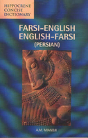
Farsi - English Concise Dictionary

Farsi, also known as Persian, is the official language of Iran. This bilingual dictionary of the Persian language contains over 8, 000 total entries. For use by both native English and Farsi speakers, pronunciation and part of speech are indicated for each entry.
RIP - This product is no longer available on our network. It was last seen on 25.09.2019

This page now acts as a permanent archive for this product. Add more information using the comments box below to ensure it can still be found by future generations.

Use our search facility to see if it is available from an alternative contributor.
  • Availability: Out Of Stock
  • Supplier: Stanfords
  • SKU: 9780781808606
Availability: In Stock
£11.50

Product Description

Farsi, also known as Persian, is the official language of Iran. This bilingual dictionary of the Persian language contains over 8, 000 total entries. For use by both native English & Farsi speakers, pronunciation & part of speech are indicated for each entry.

Reviews/Comments

Add New

Intelligent Comparison

Oooops!
We couldn't find anything!
Perhaps this product's unique.... Or perhaps we are still looking for comparisons!
Click to bump this page and we'll hurry up.

Price History

Vouchers

No voucher codes found.
Do you know a voucher code for this product or supplier? Add it to Insights for others to use.

Facebook

Jargon Buster

Language - the method of communication used in different areas. Humans and computers have many different languages.
Language - The way humans communicate either written and spoken.

Supplier Information

Stanfords
Stanfords was established in 1853 and opened their iconic Covent Garden flagship store in 1901. They have become the top retailer of maps, travel books and accessories in the UK and arguably offer the largest selection of maps and travel books worldwide. Famous names such as Captain Robert Falcon Scott, Ranulph Fiennes and Michael Palin have purchased from Stanfords. They now have a shop in Bristol and both stores together with other venues operate a calendar of events including talks, book signings and exhibitions. As a specialist map retailer, the map selection is comprehensive and includes road maps, street maps and walking maps from worldwide destinations, as well as a selection of world atlases and wall maps. Books include travel guides and travel literature. Stanfords also stock globes, from miniatures made of blue marble to magnificent floor-standing globes. The website features a selection of interesting articles on travel topics.
Page Updated: 2023-11-12 20:15:36

Community Generated Product Tags

Oh No! The productWIKI community hasn't generated any tags for this product yet!
Menu