More From Contributor

£17.99
Topographic survey of Portugal at 1:50, 000 from the Instituto Geográfico Português, the country’s civilian survey organisation. The maps have contours at 25m intervals & in addition to the standard features shown on topographic mapping at this scale also indicate various types of vegetation (vineyards, olive groves, etc). Each sheet covers an area of 32 x 20km (20 x 12.5miles approx). The maps have latitude & longitude margin ticks at 1’ intervals & UTM coordinates for the map corners – each sheet also shows conversion details from BBLx (Bessel-Bonnie system, Datum Lisbon) to UTM. Map legend is in Portuguese only.EDITION DATES: most titles in this series have now been updated in the 1990s or later. To see all the titles in this series please click on the series link. ...
Archived Product
£25.00
We are able to source a wide range of courtesy flags. Flags are available in many sizes & can be sewn or printed on 100% Ministry Of Defence Standard Woven & Knitted Polyester. Flags are supplied with rope & toggle. If you would like more information, have a custom size request or cannot find a desired product, please email us at maritime@stanfords.co.uk. We will be glad to help! ...
Archived Product
£9.99
Indexed map of the Faeroe Islands with hill shading & spot heights to show the topography. Main local paths are included & driving distances are marked on roads. Car & passenger ferry routes between the islands are shown & symbols mark locations of local airports & heliports, tourist information offices, campsites & youth hostels. The map has a UTM grid with margin ticks for latitude & longitude at 20` & 30` intervals respectively & an index of place names including geographical features. Map legend

Includes::
English.

...
Archived Product
£45.00
During his first trip to Iceland in 1991, the Swiss Photographer Marco Paoluzzo stayed on the Faroe Isles for two days. He was immediately mesmerised by the solitary group of islands in the North Atlantic. More birds & sheep than people live on the isles that can be found over 1300 kilometres off the Danish coast. It rains over 300 days a year there yet the climate by no means affects the magic of the sinister & mysterious scenery. Each time the photographer visited the isles, he came closer to their essence & unspoiled wild beauty. He discovered a place beyond time, a refuge where you can dream & enjoy life, a spot that offers peace & a space that seems to stretch forever. ...
Archived Product
£16.99
Faeroe Islands at 1:100, 000 on a large, indexed map from Freytag & Berndt with excellent presentation of their topography through contours at 50m intervals enhanced by relief shading, places of interest & ferry connections, etc, plus a street plan of Tórshavn. The map, published by F&B in cooperation with the locally based Henrik Solberg, shows all the islands in their proper geographical locations rather than on separate panels. Topography is vividly presented by contours with hill shading, plus numerous spot heights. Car and/or passenger only ferry connections are marked. Road network

Includes::
country tracks & gives distances on main routes. The map also

Includes::
local footpaths & highlights several hiking trails. Symbols mark various facilities & places of interest including campsites, youth hostels & other tourist accommodation, picturesque towns, etc. Latitude & longitude lines are drawn at 5’ intervals. The index is next to the map. Map legend

Includes::
English. The map

Includes::
a street plan of Tórshavn, plus several colour photos.


...
Archived Product
£1.99
The perfect patriotic accessory to wave the Jubilee Festival in with, these Union Jack flags will make a great addition to your street party or day out on the town. The first choice accessory this summer for the urbane street partier rather than the last refuge of a scoundrel... ...
Archived Product
£35.00
Official charts for the Faroe Islands produced by the Danish Hydrographic Office. The charts are ordered upon customer dem&, therefore please contact us if you require the charts urgently. For any further information, you can contact maritime@stanfords.co.uk. ...
Archived Product
£17.95
Faroe Islands on topographic maps at 1:100, 000, with cartography produced by the Danish national survey organization, Kort og Matrikelstyrelsen, combined into an atlas with an index & a table showing various facilities found in local towns & settlements. The islands are shown on six 30 x 29 cm maps, with the whole atlas folded in half into a 15 x 29 cm format. Contours are at 25m intervals, with relief shading & spot heights. Graphics & colouring indicate peat bogs, s&, tidal flats & cultivated areas. The maps show local roads & tracks, plus ferry connections between the islands. Symbols mark various landmarks & places of interest, including campsites, youth hostels, museums & tourist information centres. Latitude lines are drawn at 5 ...
Archived Product
£19.90
Topographic survey of Faroe Islands at 1:20, 000 prepared by the Danish national mapping agency Kort og Matrikelstyrelsen. The islands’ topography is vividly presented by contours at 5 metre intervals, enhanced by relief shading plus colouring and/or graphics for different types of terrain or vegetation (scree, boulders, etc). The maps show all the detail expected of the topographic mapping at this scale & have a 1-km UTM grid, plus margin ticks for latitude & longitude at 1’ & 2` respectively. Map legend is in Danish only. The maps are available either separately or as sets of five of more sheets, each covering the main island group: Vagar, Sandoy, Suduroy, Nordoyar, Streymoy & Eysturoy. ...
Archived Product
£28.50
This third edition of Faroe, Iceland & Greenland contains extensive revisions as well as enhanced information on the three areas that the pilot covers. Much of this new data has been provided by Royal Cruising Club members who have visited the area since the first edition was published. The editor, Willy Ker, has drawn heavily upon their notes & sketch charts to provide what is the only comprehensive compendium of information on these cruising grounds in the northernmost part of the Atlantic Ocean. Willy Ker has cruised in the whole area for more than 20 years, including the West Coast of Greenland from Cape Farewell to Thule & exploring most of the little known East Coast as well. Willy is a Fellow of the Royal Institute of Navigation & a recipient of the CCA Blue Water Medal & the Tilman Trophy. Contents: Foreword; Introduction; Faroe; Iceland; Iceland; Greenland; Appendix ...
Archived Product

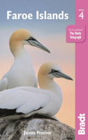
Faroe Islands Bradt Guide

This English-language guide to the Faroe Islands, covers everything from succulent fish suppers to remote hideaways.The Bradt guide is ideal for visitors wishing to discover the 18 islands of this North Atlantic archipelago. Covering hands-on information about where to stay and eat, how to get around - be it by mailboat, helicopter or hire car - and what to see and do, this new fourth edition has been thoroughly updated and includes details of the amazing birdlife, where to walk some of Europe`s least-known hiking trails, and how to make the most of village life among the turf-roofed houses. Also included are details of how to reach even the remotest corners by bus using a travelcard, the latest information on falling seabird numbers in the North Atlantic, and details of where to
go sea angling, rapelling and horse riding. Suggestions for using the island of Suduroy are detailed, plus updated reviews of all accommodation, eating and drinking options. Fourteen clear and easy-to-use maps are also featured.
RIP - This product is no longer available on our network. It was last seen on 25.09.2019

This page now acts as a permanent archive for this product. Add more information using the comments box below to ensure it can still be found by future generations.

Use our search facility to see if it is available from an alternative contributor.
  • Availability: Out Of Stock
  • Supplier: Stanfords
  • SKU: 9781784770136
Availability: In Stock
£16.99

Product Description

This English-language guide to the Faroe Islands, covers everything from succulent fish suppers to remote hideaways. The Bradt guide is ideal for visitors wishing to discover the 18 islands of this North Atlantic archipelago. Covering hands-on information about where to stay & eat, how to get around
- be it by mailboat, helicopter or hire car
- & what to see & do, this new fourth edition has been thoroughly updated &

Includes::
details of the amazing birdlife, where to walk some of Europe`s least-known hiking trails, & how to make the most of village life among the turf-roofed houses. Also included are details of how to reach even the remotest corners by bus using a travelcard, the latest information on falling seabird numbers in the North Atlantic, & details of where to go sea angling, rapelling & horse riding. Suggestions for using the island of Suduroy are detailed, plus updated reviews of all accommodation, eating & drinking options. Fourteen clear & easy-to-use maps are also featured.

Reviews/Comments

Add New

Intelligent Comparison

Oooops!
We couldn't find anything!
Perhaps this product's unique.... Or perhaps we are still looking for comparisons!
Click to bump this page and we'll hurry up.

Price History

Vouchers

No voucher codes found.
Do you know a voucher code for this product or supplier? Add it to Insights for others to use.

Facebook

Jargon Buster

Hiking - An outdoor activity envolving walking in nature
Car - A machine used for transport which runs on roads
Language - the method of communication used in different areas. Humans and computers have many different languages.
Fish - A creature that lives in water. A fish uses gills to breath unlike mammals
Horse - A large animal with four legs that tends to be ridden.
Accommodation - A room in which someone can live in, for example in a hotel
Ideal - Something that satisfies a perfect criteria.
Language - The way humans communicate either written and spoken.

Supplier Information

Stanfords
Stanfords was established in 1853 and opened their iconic Covent Garden flagship store in 1901. They have become the top retailer of maps, travel books and accessories in the UK and arguably offer the largest selection of maps and travel books worldwide. Famous names such as Captain Robert Falcon Scott, Ranulph Fiennes and Michael Palin have purchased from Stanfords. They now have a shop in Bristol and both stores together with other venues operate a calendar of events including talks, book signings and exhibitions. As a specialist map retailer, the map selection is comprehensive and includes road maps, street maps and walking maps from worldwide destinations, as well as a selection of world atlases and wall maps. Books include travel guides and travel literature. Stanfords also stock globes, from miniatures made of blue marble to magnificent floor-standing globes. The website features a selection of interesting articles on travel topics.
Page Updated: 2023-11-12 20:15:36

Community Generated Product Tags

Oh No! The productWIKI community hasn't generated any tags for this product yet!
Menu