More From Contributor
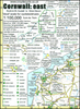
£2.99
The eastern half of Cornwall at 1:100, 000 on a handy size, 50x 35cm, double-sided contoured map from Croydecycle, printed on waterproof & tear-resistant synthetic paper & showing National Cycle routes & numerous local facilities, including campsites, pubs, etc. Coverage extends from St Austell, Wadebridge & Port Isaac to Plymouth & Tavistock, &

Includes::
the Eden Project. Contours are at 30m intervals, with colouring for woodlands (indicating those with public access), sandy or pebble beaches, plus moors & common or other access l&. Interesting landscape & man- made features are highlighted with grading. Road network indicates A & B road numbers & has gradient markings. On roads which are part of the National Cycle Network route numbers are marked. Symbols indicate numerous facilities: campsites & caravan sites, pubs & cafes, car parks & picnic sites, local shops, cycle hire, tourist information, etc. National Grid coordinates are marked in the margins. Small panels provide street plans of Looe, Saltash, Liskeard, Launceston, Bude, Bodmin, Lostwithiel & Fowey. To see other titles in this series please click on the series link.

...
Archived Product
£9.95
In 2007, Mike Kent fulfilled a long-standing ambition to walk the whole of the coast path of his Cornish homel&, from Marsland to Cremyll. During the 16-day journey, walking for up to 14 hours each day, & occasionally camping wild on remote & rugged cliffs, Mike recorded his thoughts & observations about various things Cornish. On his return, Mike & Merryn Kent dug deeper to uncover more about the places & people, landscapes & wildlife that caught his imagination along the way. Some are as world famous as Tintagel Castle & the tin mines of Levant. Others, like the cliffside hut built by poet & playwright Robert Duncan, are equally fascinating but barely known. Handsomely illustrated with many photographs & maps, this book aims to capture the authors' shared passion for Cornwall's rich coastal heritage. ...
Archived Product
£16.99
Cornwall in Photographs captures a range of stunning landscapes that make up this most south-westerly part of Engl&. The coastline ...
Archived Product
£4.99
Cornwall in the Compact Guide series from Insight is an accessible & handy reference guide, describing main sites & cultural highlights. Each illustrated guide

Includes::
an introductory chapter with a selection of the top ten things to do & gives visitors an insight into history, culture & geography. An extensive

...
Archived Product
£5.99
Street by Street Cornwall Midi has been fully updated with a stylish new cover design, in a handy glovebox size. Quick to navigate & easy-to-use, the maps clearly show AA recommended restaurants, pubs, hotels, one-way streets & car parks. Featuring a clever use of colour to ensure it can be read under street lighting, & National Grid referencing, Street by Street Cornwall Midi is all you need to keep you on the move. ...
Archived Product
£4.99
Cornwall presented at 1:100, 000 on an indexed Ordnance Survey Tour Map with extensive tourist information including highlighting for national & regional cycle routes. Town navigation maps show main traffic arteries, tourist facilities & sights in Bodmin, Bude, Falmouth, Fowey, Helston, Hugh Town, Newquay, Launceston, Loo, Padstow, Penzance, Truro, St Austell & St Ives. The northernmost part of the county around Bude is on an inset, as are the Scilly Isles. The map

Includes::
a glossary of Cornish names, plus lists of market days, farmers markets & selected main sights. Current edition of this title was published in February 2016. To see the list of titles in this series please click on the series list – Ordnance Survey’s Tour maps have extra clear, uncluttered cartography. Topography is shown by altitude colouring & relief shading, plus names of local hill or mountain ranges & heights of important peaks. Additional colouring indicates woodlands; boundaries of National Parks or designated Areas of Outstanding Natural Beauty are also marked. Road information very clearly distinguishes between different types of roads, from motorways to small local roads, with distances on main routes. Scenic routes are highlighted; motorway services, tolls, gradients on steep roads & level crossings are marked & towns used in motorway signs as Primary Route Destinations are indicated. Railway lines are shown with stations &, where appropriate, ferry routes are marked. Roads which are part of the national or regional cycle network are highlighted & shown with route numbers; the maps also show the National Trail long-distance hiking paths. An extensive range of symbols indicate various places of interest, including campsites/caravan parks & youth hostels/bunkhouses, historic buildings, sport & recreational facilities, country pubs, etc. The maps have lines of the British National Grid. The place names index is supplemented by a list of selected places of interest plus, in most titles, of market days and/or farmers markets. The maps also include city navigation maps, highlighting main traffic arteries, car parks, principal sights & facilities, etc. For more information please see descriptions & coverage images of individual maps.

...
Archived Product
£12.99
Pathfinder (R) Cornwall covering Land`s End, Prussia Cove & Bodmin Moor. This selection offers interest, regional variety & balance of routes in Cornwall providing the best walks in the area. From an easy stroll along Falmouth Bay to the much more challenging walks along Looe Bar this volume contains something for everyone. Covering walks through the whole of Cornwall both popular & little know scenic routes including St Agnes, Tintagel & Portloe. -See walk locations by Looking Inside Inside: -28 great walks in Cornwall from 2 to 10 miles -Clear, large scale Ordnance Survey route maps -GPS reference for all Cornwall waypoints -Where to park, good pubs & places of interest en route -All routes have been fully researched & written by expert outdoor writers -Beautiful photography of scenes from the walks Pathfinder (R) Guides are Britain`s best loved walking guides. Made with durable covers, they are the perfect companion for countryside walks throughout Britain. Each title features circular walks with easy-to-follow route descriptions, large-scale Ordnance Survey route maps & GPS waypoints. With over 70 titles in the series, they offer essential information for walkers throughout the country. Contents* Mylor, Restronguet Creek & the Pandora Inn* Men-an-tol, the Nine Maidens & Lanyon Quoit* Prussia Cover & Cudden Point* West pentire, the Kelseys & Holywell Bay* Lerryn & St Winnow* Porthcurno, Porthgwarra & St Levan`s Church* Polruan & Lanteglos* Helford, Little Dennis & Manaccan* Efford Down & the Bude Canal* Land`s End & Nanjizal from Sennen Cove* Falmouth Bay & the Helford River* Hawker Country
- Morwenstow & Marsland Mouth* Mount Edgcumbe, the Sound & Cawsand* The Cheesewring & Kilmar Tor* Around St Agnes* Little Petherick Creek, Dennis Hill & the Carnel Trail* Polkerris, Readymoney Cove & Gribbin Head* Stepper Point from Trevone* Looe, Kilminorth Wood & Talland Bay* Portloe & Veryan* Lizard Point, Kynance Cove & Cadgwith* Dizzard Point, St Gennys & Millook Water* Chun Quoit, Pendeen Watch & Botallack* Lamoma, St Loy`s & the Merry Maidens* Zennor to St Ives by the Coffin Path* Trebarwith & Delabole* Tintagel, Boscastle & St Nectan`s Glen* The Dodman, Gorran Haven & Portmellon.
...
Archived Product
£25.00
Cornwall Pevsner Architectural Guide, in a series of publications begun with the express aim of providing up-to-date guides to the most significant buildings in every part of the country, suitable for both general reader & specialist. Each volume provides an introductory overview of the architecture of the area, followed by a descriptive gazetteer arranged alphabetically by place. Whilst cathedrals & their furnishings, great country houses & their parks form the grand set pieces, the books demonstrate the enjoyable diversity of architecture in the British Isles in accounts of rural churches & farmsteads, Victorian public buildings & industrial monuments. A continuing programme of publication keeps the series up-to-date with new information on older buildings & recent architecture while maintaining the tradition of Pevsner's own succinct accounts. Each book has over 100 photographs, mostly specially commissioned, numerous maps & plans, a glossary & indexes. ...
Archived Product
£12.99
This fully updated Philip`s street atlas of Cornwall & Plymouth gives comprehensive & detailed coverage of the region in a convenient spiral-bound format. The route planner shows all the A & B roads, & can be used when driving to get close to the destination before turning to the relevant large-scale street map. The street maps show every named road, street & lane very clearly, with major roads picked out in colour. The maps are at a scale of 1.75 inches to 1 mile, with the more densely populated urban areas at 3.5 inches to 1 mile. Plymouth city centre is shown at 7 inches to 1 mile. Other information on the maps

Includes::
postcode boundaries, car parks, railway & bus stations, post offices, schools, colleges, hospitals, police & fire stations, places of worship, leisure centres, footpaths & bridleways, camping & caravan sites, golf courses, & many other places of interest. The comprehensive index lists street names & postcodes, plus schools, hospitals, railway stations, shopping centres & other such features picked out in red, with other places of interest shown in blue. Philip`s Street Atlas Cornwall & Plymouth is suitable for both business & leisure use.

...
Archived Product
£10.95
A unique celebration of one of Britain's most beloved regions, beautifully bound & printed in colour. The perfect guide, gift or souvenir for visitors
- or an inspiration to anyone planning a trip to Cornwall. Illustrated & written by Jim Watson, a celebrated artist & writer with a number of award-winning books to his name. The latest title in the ' Sketchbook' series (including the Lake District, Cotswolds & London). Cornwall is one of Britain's most popular regions, attracting over 5 million visitors a year.
...
Archived Product

Cornwall Mini Guide

Cornwall in the AA Mini Guide series; comprising a selection of handy, pocket sized guides to a range of British regions and includes recommended walks, activities and principal sights. Each guide provides a useful overview of the area, taking in the region
RIP - This product is no longer available on our network. It was last seen on 25.09.2019

This page now acts as a permanent archive for this product. Add more information using the comments box below to ensure it can still be found by future generations.

Use our search facility to see if it is available from an alternative contributor.
  • Availability: Out Of Stock
  • Supplier: Stanfords
  • SKU: 9780749568818
Availability: In Stock
£4.99

Product Description

Cornwall in the AA Mini Guide series; comprising a selection of handy, pocket sized guides to a range of British regions &

Includes::
recommended walks, activities & principal sights. Each guide provides a useful overview of the area, taking in the region

Reviews/Comments

Add New

Price History

Vouchers

No voucher codes found.
Do you know a voucher code for this product or supplier? Add it to Insights for others to use.

Facebook

Jargon Buster

Pocket - A bag shaped insert in clothing used to carry items

Supplier Information

Stanfords
Stanfords was established in 1853 and opened their iconic Covent Garden flagship store in 1901. They have become the top retailer of maps, travel books and accessories in the UK and arguably offer the largest selection of maps and travel books worldwide. Famous names such as Captain Robert Falcon Scott, Ranulph Fiennes and Michael Palin have purchased from Stanfords. They now have a shop in Bristol and both stores together with other venues operate a calendar of events including talks, book signings and exhibitions. As a specialist map retailer, the map selection is comprehensive and includes road maps, street maps and walking maps from worldwide destinations, as well as a selection of world atlases and wall maps. Books include travel guides and travel literature. Stanfords also stock globes, from miniatures made of blue marble to magnificent floor-standing globes. The website features a selection of interesting articles on travel topics.
Page Updated: 2023-11-12 20:15:36

Community Generated Product Tags

Oh No! The productWIKI community hasn't generated any tags for this product yet!
Menu