-
Home
-
Contributors
-
International
-
Account
-
Information
More From Contributor
...
Includes:: a glossary of Cornish names, plus lists of market days, farmers markets & selected main sights. Current edition of this title was published in February 2016. To see the list of titles in this series please click on the series list – Ordnance Survey’s Tour maps have extra clear, uncluttered cartography. Topography is shown by altitude colouring & relief shading, plus names of local hill or mountain ranges & heights of important peaks. Additional colouring indicates woodlands; boundaries of National Parks or designated Areas of Outstanding Natural Beauty are also marked. Road information very clearly distinguishes between different types of roads, from motorways to small local roads, with distances on main routes. Scenic routes are highlighted; motorway services, tolls, gradients on steep roads & level crossings are marked & towns used in motorway signs as Primary Route Destinations are indicated. Railway lines are shown with stations &, where appropriate, ferry routes are marked. Roads which are part of the national or regional cycle network are highlighted & shown with route numbers; the maps also show the National Trail long-distance hiking paths. An extensive range of symbols indicate various places of interest, including campsites/caravan parks & youth hostels/bunkhouses, historic buildings, sport & recreational facilities, country pubs, etc. The maps have lines of the British National Grid. The place names index is supplemented by a list of selected places of interest plus, in most titles, of market days and/or farmers markets. The maps also include city navigation maps, highlighting main traffic arteries, car parks, principal sights & facilities, etc. For more information please see descriptions & coverage images of individual maps. ...
- Morwenstow & Marsland Mouth* Mount Edgcumbe, the Sound & Cawsand* The Cheesewring & Kilmar Tor* Around St Agnes* Little Petherick Creek, Dennis Hill & the Carnel Trail* Polkerris, Readymoney Cove & Gribbin Head* Stepper Point from Trevone* Looe, Kilminorth Wood & Talland Bay* Portloe & Veryan* Lizard Point, Kynance Cove & Cadgwith* Dizzard Point, St Gennys & Millook Water* Chun Quoit, Pendeen Watch & Botallack* Lamoma, St Loy`s & the Merry Maidens* Zennor to St Ives by the Coffin Path* Trebarwith & Delabole* Tintagel, Boscastle & St Nectan`s Glen* The Dodman, Gorran Haven & Portmellon. ...
- or an inspiration to anyone planning a trip to Cornwall. Illustrated & written by Jim Watson, a celebrated artist & writer with a number of award-winning books to his name. The latest title in the ' Sketchbook' series (including the Lake District, Cotswolds & London). Cornwall is one of Britain's most popular regions, attracting over 5 million visitors a year. ...
Includes:: 14 pages atlas of this region. The guide highlights the prettiest scenic villages, pinpointing contemporary art galleries, magnificent churches & manor houses, historic building & sites, most stunning local walks & a full range of activities to get involved in. A wide range of interesting & quirky places to stay is presented with a brief introduction & contact details, from organic camp sites, hostelries & traditional country inn, to luxurious B&B & country house hotels. At the back of the book you will find a useful calendar of event & 14 pages road atlas for the whole Conrwall at 1:100, 000/1:120, 000 Approx.. The mapping offers road & topographic information & a wealth of symbols to locate places of interests, from historical building to campsites & Walk/ Nature trails. This pocket guide selects the best things to see & do in this region; it is the perfect companion for short breaks. ...

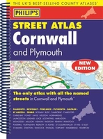
Cornwall Philip`s Street Atlas
leisure centres, footpaths and bridleways, camping and caravan sites, golf courses, and many other places of interest. The comprehensive index lists street names and postcodes, plus schools, hospitals, railway stations, shopping centres and other such features picked out in red, with other places of interest shown in blue.Philip`s Street Atlas Cornwall and Plymouth is suitable for both business and leisure use.
This page now acts as a permanent archive for this product. Add more information using the comments box below to ensure it can still be found by future generations.
Use our search facility to see if it is available from an alternative contributor.
- External links may include paid for promotion
- Availability: Out Of Stock
- Supplier: Stanfords
- SKU: 9781849073646
Product Description
This fully updated Philip`s street atlas of Cornwall & Plymouth gives comprehensive & detailed coverage of the region in a convenient spiral-bound format. The route planner shows all the A & B roads, & can be used when driving to get close to the destination before turning to the relevant large-scale street map. The street maps show every named road, street & lane very clearly, with major roads picked out in colour. The maps are at a scale of 1.75 inches to 1 mile, with the more densely populated urban areas at 3.5 inches to 1 mile. Plymouth city centre is shown at 7 inches to 1 mile. Other information on the maps
Includes:: postcode boundaries, car parks, railway & bus stations, post offices, schools, colleges, hospitals, police & fire stations, places of worship, leisure centres, footpaths & bridleways, camping & caravan sites, golf courses, & many other places of interest. The comprehensive index lists street names & postcodes, plus schools, hospitals, railway stations, shopping centres & other such features picked out in red, with other places of interest shown in blue. Philip`s Street Atlas Cornwall & Plymouth is suitable for both business & leisure use.
Reviews/Comments
Add New
Intelligent Comparison
We couldn't find anything!
Perhaps this product's unique.... Or perhaps we are still looking for comparisons!
Click to bump this page and we'll hurry up.
Price History
Vouchers
Do you know a voucher code for this product or supplier? Add it to Insights for others to use.


 United Kingdom
 France
 Germany
 Netherlands
 Sweden
 USA
USA
 Italy
Italy
 Spain
Spain


 Denmark