More From Contributor

£5.95
Cornwall is a special place. It generates a fierce pride among its native sons & daughters, & a passionate attachment from newcomers. Dreams of Cornwall can also inspire the Cornish overseas, descendants of nineteenth-century emigrants. But why? ” Cornwall & the Cornish” reveals the meanings of some of the places that inspire an identity with Cornwall. It explains why Cornwall is so often viewed as a distinctive place, & where the Cornish identity comes from. ...
Archived Product
£11.99
All-in-one hiking route guide, maps & accommodations for the 288-mile footpath that runs around the entire coastline of Cornwall: from Bude to Plymouth. Part 2 of the South West Coast Path, a 630-mile national trail from Minehead to Poole.

Includes::
142 large-scale maps (3 1/8 inches to 1 mile); 24 town plans & 16 overview maps. Full details of all accommodations & campsites, restaurants & pubs; plus full public transport information.

Includes::
day-walks. This second part of the South West Coast Path around the south-western tip of Britain

Includes::
some of the best coastal walking in Europe. With constantly changing scenery, the footpath takes in secluded coves, tiny fishing villages, rocky headlands, bustling resorts, wooded estuaries & golden surf-washed beaches. It is an area rich in wildlife with seabirds, wild flowers, dolphins & seals.. 24 town plans, 16 overview maps & 142 large-scale walking maps at just under 1:20, 000 showing route times, places to stay, places to eat, points of interest & much more. These are not general-purpose maps but fully-edited maps drawn by walkers for walkers.. Itineraries for all walkers whether walking the route in its entirety over a week to 10 days or sampling the highlights on day walks & short breaks. Practical information for all budgets camping, bunkhouses, hostels, B& Bs, pubs & hotels; where to stay, where to eat, what to see, plus detailed street plans. Comprehensive public transport information for all access points on the coast path. Flora & fauna four page full color flower guide, plus an illustrated section on local wildlife. Green hiking understanding the local environment & minimizing our impact on it.

Includes::
downloadable gps waypoints Plus extra colour sections: 16pp colour introduction & 16pp of colour mapping for stage sections (one stage per page) with trail profiles.”


...
Archived Product
£2.99
Handy little full colour map of Cornwall. Excellent value & very detailed for its size.
Features:* Clear mapping
...
Archived Product
£6.99
Cornwall Cycling Country Lanes Map at 1:126, 720 (1” to 2 miles) from Goldeneye in their series covering popular regions of England & Wales on waterproof & tear-resistant, double-sided cycling maps designed to highlight a selection of recommended cycle routes on country lanes & off-road. An overprint indicates the course of the Cornish Way
- part of Sustrans National Cycle Network, 21 cycling circuits recommended by the publishers, 7 traffic-free family routes, & 6 mineral tramways trails. All are listed in an information panel with distances & brief descriptions. Also shown are 17 cycle hire facilities. Locations along the coastline are annotated with notes about beaches, surfing, & facilities. The map shows camping & caravan sites, youth hostels, boat trips, & numerous other places of interest. Current edition of this map was published in 2012. Maps in the Goldeneye Cycling Country Lanes series use altitude colouring to show the topography, with spot heights & plenty of names of geographical features such as moors, hills, etc. Road network

Includes::
local country tracks & railway lines are shown with stations. All the maps highlight recommended cycle routes but, as series is currently being revised, presentation and/or classification of the routes varies
- please refer to the individual descriptions. Symbols highlight locations of various facilities, such as campsites or caravan parks, & a wide selection of places of interest. Unless indicated to the contrary in the individual description, the maps are indexed & have no GPS coordinates.


...
Archived Product
£8.99
Cornwall in the Frommer's Day By Day series is a pocket-sized guide ideal for short trips, covering a variety of budgets. The best sights of each destination are listed in convenient full-day tours for one, two or three days such as: thematic tours for interests including art, architecture & history are described, allowing you to get the most out of your time; walking tours take you around each destination ...
Archived Product
£9.95
In 2007, Mike Kent fulfilled a long-standing ambition to walk the whole of the coast path of his Cornish homel&, from Marsland to Cremyll. During the 16-day journey, walking for up to 14 hours each day, & occasionally camping wild on remote & rugged cliffs, Mike recorded his thoughts & observations about various things Cornish. On his return, Mike & Merryn Kent dug deeper to uncover more about the places & people, landscapes & wildlife that caught his imagination along the way. Some are as world famous as Tintagel Castle & the tin mines of Levant. Others, like the cliffside hut built by poet & playwright Robert Duncan, are equally fascinating but barely known. Handsomely illustrated with many photographs & maps, this book aims to capture the authors' shared passion for Cornwall's rich coastal heritage. ...
Archived Product
£16.99
Cornwall in Photographs captures a range of stunning landscapes that make up this most south-westerly part of Engl&. The coastline ...
Archived Product
£4.99
Cornwall in the Compact Guide series from Insight is an accessible & handy reference guide, describing main sites & cultural highlights. Each illustrated guide

Includes::
an introductory chapter with a selection of the top ten things to do & gives visitors an insight into history, culture & geography. An extensive

...
Archived Product
£5.99
Street by Street Cornwall Midi has been fully updated with a stylish new cover design, in a handy glovebox size. Quick to navigate & easy-to-use, the maps clearly show AA recommended restaurants, pubs, hotels, one-way streets & car parks. Featuring a clever use of colour to ensure it can be read under street lighting, & National Grid referencing, Street by Street Cornwall Midi is all you need to keep you on the move. ...
Archived Product
£4.99
Cornwall in the AA Mini Guide series; comprising a selection of handy, pocket sized guides to a range of British regions &


...
Archived Product

Cornwall East: Bodmin/St Austell To West Devon Cycle Map

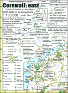
The eastern half of Cornwall at 1:100, 000 on a handy size, 50x35cm, double-sided contoured map from Croydecycle, printed on waterproof and tear-resistant synthetic paper and showing National Cycle routes and numerous local facilities, including campsites, pubs, etc. Coverage extends from St Austell, Wadebridge and Port Isaac to Plymouth and Tavistock, and includes the Eden Project. Contours are at 30m intervals, with colouring for woodlands (indicating those with public access), sandy or pebble beaches, plus moors and common or other access land. Interesting landscape and man- made features are highlighted with grading. Road network indicates A and B road numbers and has gradient markings. On roads which are part of the National Cycle Network route numbers are marked. Symbols
indicate numerous facilities: campsites and caravan sites, pubs and cafes, car parks and picnic sites, local shops, cycle hire, tourist information, etc. National Grid coordinates are marked in the margins. Small panels provide street plans of Looe, Saltash, Liskeard, Launceston, Bude, Bodmin, Lostwithiel and Fowey.To see other titles in this series please click on the series link.
RIP - This product is no longer available on our network. It was last seen on 25.09.2019

This page now acts as a permanent archive for this product. Add more information using the comments box below to ensure it can still be found by future generations.

Use our search facility to see if it is available from an alternative contributor.
  • Availability: Out Of Stock
  • Supplier: Stanfords
  • SKU: 9781909117068
Availability: In Stock
£2.99

Product Description

The eastern half of Cornwall at 1:100, 000 on a handy size, 50x 35cm, double-sided contoured map from Croydecycle, printed on waterproof & tear-resistant synthetic paper & showing National Cycle routes & numerous local facilities, including campsites, pubs, etc. Coverage extends from St Austell, Wadebridge & Port Isaac to Plymouth & Tavistock, &

Includes::
the Eden Project. Contours are at 30m intervals, with colouring for woodlands (indicating those with public access), sandy or pebble beaches, plus moors & common or other access l&. Interesting landscape & man- made features are highlighted with grading. Road network indicates A & B road numbers & has gradient markings. On roads which are part of the National Cycle Network route numbers are marked. Symbols indicate numerous facilities: campsites & caravan sites, pubs & cafes, car parks & picnic sites, local shops, cycle hire, tourist information, etc. National Grid coordinates are marked in the margins. Small panels provide street plans of Looe, Saltash, Liskeard, Launceston, Bude, Bodmin, Lostwithiel & Fowey. To see other titles in this series please click on the series link.

Reviews/Comments

Add New

Intelligent Comparison

Oooops!
We couldn't find anything!
Perhaps this product's unique.... Or perhaps we are still looking for comparisons!
Click to bump this page and we'll hurry up.

Price History

Vouchers

No voucher codes found.
Do you know a voucher code for this product or supplier? Add it to Insights for others to use.

Facebook

Jargon Buster

Paper - A thin sheet mainly used for writing. Available in a variety of colours. Made mainly from wood pulp.
Waterproof - Resistant to water, usualy specified by depth in metres
Plymouth - A city on the coast of Devon
Car - A machine used for transport which runs on roads
Size - is the measurement of how big an object is in space.
Network - A link and communication between things. Often computers or people.
Small - something that takes up less space than normal.
Road - a manmade lane or a path that is used to speed up travel.
Resistant - Something that can repel against something.

Supplier Information

Stanfords
Stanfords was established in 1853 and opened their iconic Covent Garden flagship store in 1901. They have become the top retailer of maps, travel books and accessories in the UK and arguably offer the largest selection of maps and travel books worldwide. Famous names such as Captain Robert Falcon Scott, Ranulph Fiennes and Michael Palin have purchased from Stanfords. They now have a shop in Bristol and both stores together with other venues operate a calendar of events including talks, book signings and exhibitions. As a specialist map retailer, the map selection is comprehensive and includes road maps, street maps and walking maps from worldwide destinations, as well as a selection of world atlases and wall maps. Books include travel guides and travel literature. Stanfords also stock globes, from miniatures made of blue marble to magnificent floor-standing globes. The website features a selection of interesting articles on travel topics.
Page Updated: 2023-11-12 20:15:36

Community Generated Product Tags

Oh No! The productWIKI community hasn't generated any tags for this product yet!
Menu