More From Contributor

£8.99
The ninth book in the classic Martin Beck detective series from the 1960s & 70s
- the novels that shaped the future of Scandinavian
...
Archived Product
£6.95
Topographic coverage of mainland Spain at 1:50, 000 in the MTN50 (Mapa Topográfico Nacional) series from the Centro Nacional de Información Geografica, the country’s civilian survey organization. The maps have contours at 20m intervals, enhanced by relief shading, plus colouring and/or graphics to show different types of terrain, vegetation or land use. Boundaries of national parks & other protected areas are marked. In addition to all the usual information featured on topographic mapping at this scale, detailed presentation of the road & rail networks, rural tracks & paths, etc, the maps also show campsites & mountain refuges. On more recent editions some GRs, the official long-distance hiking routes, are also marked (although not as clearly as on hiking maps from other publishers). Each map covers 29.5x 18.5 km (with adjustments in the border or coastal areas). The maps have a 1-km UTM grid, plus margin ticks for latitude & longitude at 1` intervals. Map legend is in Spanish only.HOW TO CHOOSE THE RIGHT 50K MAP: all the titles in CNIG’s 200K Provincial Road Maps series at 1:200, 000 are overprinted with the grid for the 1:50, 000 maps & can be used to see the area covered by each 50K title. TO SEE THE LIST OF TITLES IN THIS SERIES PLEASE CLICK ON THE SERIES LINK.PLEASE NOTE
- MAP TITLES: the grids shown on our website serve both the civilian & the military 1:50, 000 topographic series. Although the areas covered by maps in both series are identical (apart from some border or coastal sheets), occasionally map titles differ – only one title is shown on the grid, usually the military one. In Galicia, the Basque country & in the Catalan speaking areas the tendency now is to use local place names rather than the often better known Castilian ones. Where possible, both versions are included in our titles. Map titles listed on our website are based on information received by us at the time of publication, but sometimes maps arrive showing a completely different title! As long as the map number is as ordered, the correct map has been supplied.
...
Archived Product
£8.95
Street plan of the city from Amagerbro & Vestre Kirkegård in the south to Tuborg Havn & Dyssegårdsparken in the north, & from Christianshavn in the east to Moseparken in the west. Colours distinguish land use eg. cemeteries, parks, shopping areas, institutions, industrial zones. Pedestrian zones, car parks, post offices, hospitals, police stations, churches, tourist information offices, museums & other sites of interest are indicated. Water taxi routes & railways are marked, including S-Tog & Metro routes & stations. The plan also

Includes::
a diagram of the metro & S-Tog network.

Includes::
street index.


...
Archived Product
£10.39
Copenhagen in the Countries, Regions & Cities series from Rough Guides; comprehensively detailed guidebooks specifically designed for independent travellers & serving a range of worldwide destinations. Widely recognised for their free editorial style, Rough Guide authors are allowed to express their personal opinions on a range of subjects. Although sometimes controversial, this editorial stance allows readers to experience more detailed & personal takes on each destination, a feature often more limited in other guidebooks. Cultural & historical nuances are explored in significant depth throughout the text & descriptions on the ambience of individual settings alongside personal recommendations, particularly in cities, are notably prevalent. Each Rough Guide in the Countries, Regions & Cities series has a similar layout. A ...
Archived Product
£29.99
Topographic survey of Denmark at 1:100, 000 from Kort & Matrikelstyrelsen, the country’s national survey organization. The maps have contours at 5 metre intervals, with colouring and/or graphics showing various types of terrain & land use: woodlands, orchards, heath, sand & dunes, tidal flats, meadows & marshl&, etc. The maps provide detailed presentation of the road & rail networks & other information expected of topographic mapping at this scale. No specifically tourist information such as waymarked cycling or hiking routes is shown. Standard size sheets cover an area of 56 x 45km / 35x 28 miles approx. Map legend

Includes::
English. To see other titles in this series please click on the series link.IMPORTANT – PLEASE NOTE BEFORE ORDERING:AVAILABILITY: all the maps are now printed on dem&. Delivery from Denmark can take over 4 weeks. Once an order has been placed we cannot accept any returns for credit.COORDINATES: although the maps are meant to have UTM coordinates for EUREF 89 (WGS 84) datum, sheets are sometimes delivered printed without any grid or margin ticks for UTM or latitude & longitude.

...
Archived Product
£180.00
Copenhagen, an original antique map by S.D.U.K., published in London, 1844. Steel plate, uncoloured. Map size 39 x 32 cm, overall mounted size 53.5 x 47 cm.A detailed map of Copenhagen published by the Society for the Diffusion of Useful Knowledge. The Society was founded by John, Earl Russell, & Henry Brougham, later Lord Chancellor of England in 1827. The Society's main purpose was to encourage universal literacy by publishing numbers of books of good quality that would be affordable to all. These town plans were published in perhaps the grandest of the Society's publications
- their atlas entitled Maps Of The Society For The Diffusion Of Useful Knowledge, first issued by Baldwin & Cradock, & then re-issued by other publishers, including Chapman & Hall & latterly Edward Stanford. The map

Includes::
a vignette view of Copenhagen. The map was engraved by J. Henshall after W.B. Clarke. Antique maps from various original publishers are presented on the Stanford


...
Archived Product
£5.95
Copenhagen in the Wallpaper City Guide series, published by Phaidon & encompassing a collection of pocket-size guides dedicated to the best design elements in major cities. Compiled by experts at the Wallpaper magazine, the guides are widely recognized for appealing to design-conscious travellers & are aimed at those interested in art, design & architecture. Each guide identifies the best bars, restaurants, hotels, places to shop, leisure activities & excursions with a unique emphasis on the finest examples of unusual architecture & design. Each Wallpaper City Guide has the same layout, with separate tabs allowing readers & travellers to access individual sections easily. The tabs consist of Landmarks, Hotels, 24 Hours, Urban Life, Architour, Shopping, Sports & Escapes. High quality colour photographs appear alongside brief descriptions of each hotel, bar or attraction, highlighting distinctive & unusual styles of architecture & design. Extra pages are provided at the back of each guide, allowing readers to record their own notes & sketches. ...
Archived Product
£8.99
Excellent laminated & waterproof map for visitors to Copenhagen, combining a plan of the city with a map of its outer suburbs & a map of Sjæll&. The street plan at 1:11, 000 covers the city centre & the surrounding districts, extending north to include the whole of the Fælledparken, south to Amagerbro district, west to beyond the Frederiksberg Have park & east to the city walls along the Stadsgraven. The plan shows metro stations, one way streets & car parks, selected accommodation, places of interest, etc. On the reverse is a map at 1:115, 000 covering the city with its outer suburbs & surrounding area. A road map at 1:700, 000 shows the whole of Sjælland island with road connections to the mainl&, Lolland & the Swedish coast, including the bridge to Malmö. The map highlights numerous places of interest including Roskilde & Hamlet’s castle at Helsingør, campsites, beaches, etc. Both the plan & the two maps are indexed with lists of streets/localities plus main sights & places of interest. Also included is a list of the city’s & the region’s top 30 sights, all highlighted on the plan & the road maps, a diagram of the metro & rail networks, a small administrative map of the Denmark, & information on the city’s climate ...
Archived Product
£10.00
Copenhagen Crumpled City Map from a collection of street plans of major cities printed on soft, very lightweight (approximately only 20g) & yet extremely tear-resistant & 100% waterproof material, specifically designed to be scrunched & crammed into pockets, handbags & backpacks, either on its own or in the pouch from the same material provided with each map. Creases are a fully intentional part of the quirkiness of the Crumpled City maps – the more battered they are they better they look. Parks & other green spaces are highlighted, as are metro stations, & important buildings are named. Each map also highlights 10 recommended “soulsights”, imaginatively chosen to present the essence of each city rather than the most obvious tourist destinations. The accompanying index placed next to the map lists locations of tourist interest: selected streets & squares, monuments & historical places, museums & galleries, parks, etc. Whilst cartographically these Crumpled City maps provide perhaps not the most precise representation of the street network, they are handy for sightseeing, light & durable, can be used as a table cloth when picnicking in the Luxembourg Gardens, Hyde Park, the Retiro or the Central Park, or just as an unusual decoration… Selected cities are also presented on more colourful ‘junior’ maps, specially designed for children. Drawings highlight not only important buildings & famous locations but also places which will specifically appeal to children: toy shops, bookshops, best ice cream, etc. Each title has a list of the recommended not-to-be missed locations with addresses &, where available, websites. To see the full list of cities covered by this unique series please click on the series link. ...
Archived Product
£8.99
Copenhagen in the Frommer's Day By Day series is a pocket-sized guide ideal for short trips, covering a variety of budgets. The best sights of each destination are listed in convenient full-day tours for one, two or three days such as: thematic tours for interests including art, architecture & history are described, allowing you to get the most out of your time; walking tours take you around each destination ...
Archived Product

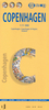
Copenhagen & The Best Of Denmark Snapshot Guide

Copenhagen & the best of Denmark in Rick Steves' Snapshot Guides, which consist of the best chapters of Rick Steves' European country guidebooks. Published in the UK by Avalon, comprise a range of titles focussing on destinations in Great Britain and Europe. As one of the leading American guide book publishers to European destinations, Rick Steves
RIP - This product is no longer available on our network. It was last seen on 25.09.2019

This page now acts as a permanent archive for this product. Add more information using the comments box below to ensure it can still be found by future generations.

Use our search facility to see if it is available from an alternative contributor.
  • Availability: Out Of Stock
  • Supplier: Stanfords
  • SKU: 9781612381985
Availability: In Stock
£6.99

Product Description

Copenhagen & the best of Denmark in Rick Steves' Snapshot Guides, which consist of the best chapters of Rick Steves' European country guidebooks. Published in the UK by Avalon, comprise a range of titles focussing on destinations in Great Britain & Europe. As one of the leading American guide book publishers to European destinations, Rick Steves

Reviews/Comments

Add New

Intelligent Comparison

Oooops!
We couldn't find anything!
Perhaps this product's unique.... Or perhaps we are still looking for comparisons!
Click to bump this page and we'll hurry up.

Price History

Vouchers

No voucher codes found.
Do you know a voucher code for this product or supplier? Add it to Insights for others to use.

Facebook

Jargon Buster

UK - United Kingdom - An island nation in Europe
Denmark - A country in Scandinavia, Northern Europe.

Supplier Information

Stanfords
Stanfords was established in 1853 and opened their iconic Covent Garden flagship store in 1901. They have become the top retailer of maps, travel books and accessories in the UK and arguably offer the largest selection of maps and travel books worldwide. Famous names such as Captain Robert Falcon Scott, Ranulph Fiennes and Michael Palin have purchased from Stanfords. They now have a shop in Bristol and both stores together with other venues operate a calendar of events including talks, book signings and exhibitions. As a specialist map retailer, the map selection is comprehensive and includes road maps, street maps and walking maps from worldwide destinations, as well as a selection of world atlases and wall maps. Books include travel guides and travel literature. Stanfords also stock globes, from miniatures made of blue marble to magnificent floor-standing globes. The website features a selection of interesting articles on travel topics.
Page Updated: 2023-11-12 20:15:36

Community Generated Product Tags

Oh No! The productWIKI community hasn't generated any tags for this product yet!
Menu