More From Contributor
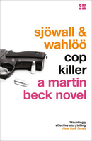
£12.99
From Amontillado to Apple-Water, Claret Cup to Cobblers, Pale Ale to Parfait Amour
- welcome to the world of delightful drinks,
...
Archived Product
£3.50
Coombe & Norbiton in 1911 in a fascinating series of reproductions of old Ordnance Survey plans in the Alan Godfrey Editions, ideal for anyone interested in the history of their neighbourhood or family. The map covers the area east of Kingston upon Thames, including much of Coombe & Norbiton. Coverage stretches from Wolverton Avenue & Norbiton station eastward to Coombe Cottage & Coombe Warren, & from Crescent Road southward to Woodside Road. Features include Coombe House, Coombe End, Ballard Coombe, Coombe Farm, Cornwall Lodge, Kingston Workhouse, Kingston Infirmary, Kingston Victoria Hospital, etc. On the reverse are extracts from a 1905 Kingston directory, including entries for Coombe Road, Coombe Warren, Crescent Road, Gloucester Road & Kingston Hill. About the Alan Godfrey Editions of the 25” OS Series: Selected towns in Great Britain & Ireland are covered by maps showing the extent of urban development in the last decades of the 19th & early 20th century. The plans have been taken from the Ordnance Survey mapping & reprinted at about 15 inches to one mile (1:4, 340). On the reverse most maps have historical notes & many also include extracts from contemporary directories. Most maps cover about one mile (1.6kms) north/south, one & a half miles (2.4kms) across; adjoining sheets can be combined to provide wider coverage.FOR MORE INFORMATION & A COMPLETE LIST OF ALL AVAILABLE TITLES PLEASE CLICK ON THE SERIES LINK. ...
Archived Product
£3.50
Coombeswood in 1914 in a fascinating series of reproductions of old Ordnance Survey plans in the Alan Godfrey Editions, ideal for anyone interested in the history of their neighbourhood or family. The map covers part of the Halesowen hamlets of Hill, Cakemore & Coombeswood. Coverage stretches from Lewis Lane eastward to Ridgacre Road, & from Maltmill Lane southward to Furnace Lane. Features include a short stretch of the GWR Netherton & Halesowen line, The Furnace, Heywood Forge with mineral railway, Mucklow Hill, Greenhill Farm, Long Lane area, Coombeswood Tube Works, Gorsty Hill, Cockshot, Olivehill Farm, Haggs Farm, Coombes Wood Colliery, Dudley Canal, etc. On the reverse is a section of the 1st Edition 1883 map for the Mucklow Hill area westward to The Furnace. About the Alan Godfrey Editions of the 25” OS Series: Selected towns in Great Britain & Ireland are covered by maps showing the extent of urban development in the last decades of the 19th & early 20th century. The plans have been taken from the Ordnance Survey mapping & reprinted at about 15 inches to one mile (1:4, 340). On the reverse most maps have historical notes & many also include extracts from contemporary directories. Most maps cover about one mile (1.6kms) north/south, one & a half miles (2.4kms) across; adjoining sheets can be combined to provide wider coverage.FOR MORE INFORMATION & A COMPLETE LIST OF ALL AVAILABLE TITLES PLEASE CLICK ON THE SERIES LINK. ...
Archived Product
£7.99
` Let fly jib sheet! Slack away main! Fenders out!` Dick & Dorothea
- also known as The Ds
- arrive in Norfolk all ready to

...
Archived Product
£7.99
Tom Dudgeon has cast off a motor cruiser from its moorings to protect a coot`s nest, but now the cruiser is searching high & low for him
- even offering a reward. Tom accepts an invitation for a week`s cruise to teach his new friends, Dick & Dorothea how to sail. You couldn`t get a better sailor than Tom but can he really stay one jump ahead of his pursuers long enough to complete the voyage?
...
Archived Product
£6.95
Topographic coverage of mainland Spain at 1:50, 000 in the MTN50 (Mapa Topográfico Nacional) series from the Centro Nacional de Información Geografica, the country’s civilian survey organization. The maps have contours at 20m intervals, enhanced by relief shading, plus colouring and/or graphics to show different types of terrain, vegetation or land use. Boundaries of national parks & other protected areas are marked. In addition to all the usual information featured on topographic mapping at this scale, detailed presentation of the road & rail networks, rural tracks & paths, etc, the maps also show campsites & mountain refuges. On more recent editions some GRs, the official long-distance hiking routes, are also marked (although not as clearly as on hiking maps from other publishers). Each map covers 29.5x 18.5 km (with adjustments in the border or coastal areas). The maps have a 1-km UTM grid, plus margin ticks for latitude & longitude at 1` intervals. Map legend is in Spanish only.HOW TO CHOOSE THE RIGHT 50K MAP: all the titles in CNIG’s 200K Provincial Road Maps series at 1:200, 000 are overprinted with the grid for the 1:50, 000 maps & can be used to see the area covered by each 50K title. TO SEE THE LIST OF TITLES IN THIS SERIES PLEASE CLICK ON THE SERIES LINK.PLEASE NOTE
- MAP TITLES: the grids shown on our website serve both the civilian & the military 1:50, 000 topographic series. Although the areas covered by maps in both series are identical (apart from some border or coastal sheets), occasionally map titles differ – only one title is shown on the grid, usually the military one. In Galicia, the Basque country & in the Catalan speaking areas the tendency now is to use local place names rather than the often better known Castilian ones. Where possible, both versions are included in our titles. Map titles listed on our website are based on information received by us at the time of publication, but sometimes maps arrive showing a completely different title! As long as the map number is as ordered, the correct map has been supplied.
...
Archived Product
£8.95
Street plan of the city from Amagerbro & Vestre Kirkegård in the south to Tuborg Havn & Dyssegårdsparken in the north, & from Christianshavn in the east to Moseparken in the west. Colours distinguish land use eg. cemeteries, parks, shopping areas, institutions, industrial zones. Pedestrian zones, car parks, post offices, hospitals, police stations, churches, tourist information offices, museums & other sites of interest are indicated. Water taxi routes & railways are marked, including S-Tog & Metro routes & stations. The plan also

Includes::
a diagram of the metro & S-Tog network.

Includes::
street index.


...
Archived Product
£10.39
Copenhagen in the Countries, Regions & Cities series from Rough Guides; comprehensively detailed guidebooks specifically designed for independent travellers & serving a range of worldwide destinations. Widely recognised for their free editorial style, Rough Guide authors are allowed to express their personal opinions on a range of subjects. Although sometimes controversial, this editorial stance allows readers to experience more detailed & personal takes on each destination, a feature often more limited in other guidebooks. Cultural & historical nuances are explored in significant depth throughout the text & descriptions on the ambience of individual settings alongside personal recommendations, particularly in cities, are notably prevalent. Each Rough Guide in the Countries, Regions & Cities series has a similar layout. A ...
Archived Product
£29.99
Topographic survey of Denmark at 1:100, 000 from Kort & Matrikelstyrelsen, the country’s national survey organization. The maps have contours at 5 metre intervals, with colouring and/or graphics showing various types of terrain & land use: woodlands, orchards, heath, sand & dunes, tidal flats, meadows & marshl&, etc. The maps provide detailed presentation of the road & rail networks & other information expected of topographic mapping at this scale. No specifically tourist information such as waymarked cycling or hiking routes is shown. Standard size sheets cover an area of 56 x 45km / 35x 28 miles approx. Map legend

Includes::
English. To see other titles in this series please click on the series link.IMPORTANT – PLEASE NOTE BEFORE ORDERING:AVAILABILITY: all the maps are now printed on dem&. Delivery from Denmark can take over 4 weeks. Once an order has been placed we cannot accept any returns for credit.COORDINATES: although the maps are meant to have UTM coordinates for EUREF 89 (WGS 84) datum, sheets are sometimes delivered printed without any grid or margin ticks for UTM or latitude & longitude.

...
Archived Product
£6.99
Copenhagen & the best of Denmark in Rick Steves' Snapshot Guides, which consist of the best chapters of Rick Steves' European country guidebooks. Published in the UK by Avalon, comprise a range of titles focussing on destinations in Great Britain & Europe. As one of the leading American guide book publishers to European destinations, Rick Steves ...
Archived Product

Cop Killer

The ninth book in the classic Martin Beck detective series from the 1960s and 70s - the novels that shaped the future of Scandinavian crime writing. Hugely acclaimed, the Martin Beck series were the original Scandinavian crime novels and have inspired the writings of Stieg Larsson, Henning Mankell and Jo Nesbo. In a Swedish country town, a woman is brutally murdered and left buried in a swamp. On a quiet suburban street a midnight shootout takes place between three cops and two teenage boys. Detective Inspector Martin Beck and his partner Lennart Kollberg are called in on both cases. In the unfamiliar small-town setting, they encounter figures from their earlier cases...
RIP - This product is no longer available on our network. It was last seen on 25.09.2019

This page now acts as a permanent archive for this product. Add more information using the comments box below to ensure it can still be found by future generations.

Use our search facility to see if it is available from an alternative contributor.
  • Availability: Out Of Stock
  • Supplier: Stanfords
  • SKU: 9780007439195
Availability: In Stock
£8.99

Product Description

The ninth book in the classic Martin Beck detective series from the 1960s & 70s
- the novels that shaped the future of Scandinavian crime writing. Hugely acclaimed, the Martin Beck series were the original Scandinavian crime novels & have inspired the writings of Stieg Larsson, Henning Mankell & Jo Nesbo. In a Swedish country town, a woman is brutally murdered & left buried in a swamp. On a quiet suburban street a midnight shootout takes place between three cops & two teenage boys. Detective Inspector Martin Beck & his partner Lennart Kollberg are called in on both cases. In the unfamiliar small-town setting, they encounter figures from their earlier cases...

Reviews/Comments

Add New

Intelligent Comparison

Oooops!
We couldn't find anything!
Perhaps this product's unique.... Or perhaps we are still looking for comparisons!
Click to bump this page and we'll hurry up.

Price History

Vouchers

No voucher codes found.
Do you know a voucher code for this product or supplier? Add it to Insights for others to use.

Facebook

Jargon Buster

Small - something that takes up less space than normal.
Classic - Something that is still like it was originally a high quality standard.

Supplier Information

Stanfords
Stanfords was established in 1853 and opened their iconic Covent Garden flagship store in 1901. They have become the top retailer of maps, travel books and accessories in the UK and arguably offer the largest selection of maps and travel books worldwide. Famous names such as Captain Robert Falcon Scott, Ranulph Fiennes and Michael Palin have purchased from Stanfords. They now have a shop in Bristol and both stores together with other venues operate a calendar of events including talks, book signings and exhibitions. As a specialist map retailer, the map selection is comprehensive and includes road maps, street maps and walking maps from worldwide destinations, as well as a selection of world atlases and wall maps. Books include travel guides and travel literature. Stanfords also stock globes, from miniatures made of blue marble to magnificent floor-standing globes. The website features a selection of interesting articles on travel topics.
Page Updated: 2023-11-12 20:15:36

Community Generated Product Tags

Oh No! The productWIKI community hasn't generated any tags for this product yet!
Menu