
 United Kingdom
 France
 Germany
 Netherlands
 Sweden
 USA
USA
 Italy
Italy
 Spain
Spain
More From Contributor


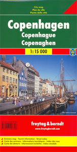
Copenhagen
Street plan of the city from Amagerbro & Vestre Kirkegård in the south to Tuborg Havn & Dyssegårdsparken in the north, and from Christianshavn in the east to Moseparken in the west.Colours distinguish land use eg. cemeteries, parks, shopping areas, institutions, industrial zones. Pedestrian zones, car parks, post offices, hospitals, police stations, churches, tourist information offices, museums and other sites of interest are indicated. Water taxi routes and railways are marked, including S-Tog and Metro routes & stations.The plan also includes a diagram of the metro & S-Tog network. Includes street index.
Product Description
Reviews/Comments
Add New
Intelligent Comparison
Archived Product
Copenhagen Stanfords
£10.39
Archived Product

Copenhagen Stanfords
£29.99
Archived Product
Copenhagen F&B Stanfords
£9.99
Archived Product

Copenhagen Noir Stanfords
£9.99
Archived Product
Copenhagen 1844 Stanfords
£180.00
Archived Product

Copenhagen Tales Stanfords
£10.99
Archived Product

Copenhagen Borch Stanfords
£8.99
Archived Product

Top 10 Copenhagen Stanfords
£8.99
Vouchers
No voucher codes found.
Do you know a voucher code for this product or supplier? Add it to Insights for others to use.
Do you know a voucher code for this product or supplier? Add it to Insights for others to use.
 Denmark