
 United Kingdom
 France
 Germany
 Netherlands
 Sweden
 USA
USA
 Italy
Italy
 Spain
Spain
More From Contributor

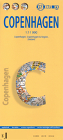
Copenhagen Borch
Excellent laminated and waterproof map for visitors to Copenhagen, combining a plan of the city with a map of its outer suburbs and a map of Sjælland. The street plan at 1:11, 000 covers the city centre and the surrounding districts, extending north to include the whole of the Fælledparken, south to Amagerbro district, west to beyond the Frederiksberg Have park and east to the city walls along the Stadsgraven. The plan shows metro stations, one way streets and car parks, selected accommodation, places of interest, etc. On the reverse is a map at 1:115, 000 covering the city with its outer suburbs and surrounding area. A road map at 1:700, 000 shows the whole of Sjælland island with road connections to the mainland, Lolland and the Swedish coast, including the bridge to Malmö.
The map highlights numerous places of interest including Roskilde and Hamlet’s castle at Helsingør, campsites, beaches, etc. Both the plan and the two maps are indexed with lists of streets/localities plus main sights and places of interest.Also included is a list of the city’s and the region’s top 30 sights, all highlighted on the plan and the road maps, a diagram of the metro and rail networks, a small administrative map of the Denmark, and information on the city’s climate
The map highlights numerous places of interest including Roskilde and Hamlet’s castle at Helsingør, campsites, beaches, etc. Both the plan and the two maps are indexed with lists of streets/localities plus main sights and places of interest.Also included is a list of the city’s and the region’s top 30 sights, all highlighted on the plan and the road maps, a diagram of the metro and rail networks, a small administrative map of the Denmark, and information on the city’s climate

Product Description
Reviews/Comments
Add New
Vouchers
No voucher codes found.
Do you know a voucher code for this product or supplier? Add it to Insights for others to use.
Do you know a voucher code for this product or supplier? Add it to Insights for others to use.
 Denmark