
 United Kingdom
 France
 Germany
 Netherlands
 Sweden
 USA
USA
 Italy
Italy
 Spain
Spain
More From Contributor


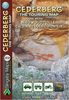
Cederberg
Cederberg region from Slingsby Maps, presenting the mountains at 1:160, 000 with more detailed enlargements of main hiking areas, street maps, and an overview map of the chain and the adjoining coastal region. The map is printed on light, waterproof and tear-resistant synthetic paper.On one side the main map at 1:160, 000 gives detailed presentation of the Cederberg and Koue Bokkveld ranges, with contours at 20 m intervals, elevation colouring, and numerous spot heights. Roads are differentiated according to the type of surface, indicating private sections accessible with permits only, mountain passes, locations of petrol stations and parking areas. Symbols convey a whole range of information: accommodation (hotels, lodges, B&B, self catering, hostels, caravan sites,
campsites), numerous sport facilities (golf, horse riding, mountain biking, paragliding, climbing sites, etc), game and other animal viewing places, fossils collecting, and other place of interest. Hiking trails across the mountains are clearly highlighted. Latitude and longitude grid is drawn at 5' intervals and numerous GPS waypoints are also provided.On the reverse there are enlargements at 1:50, 000 of the Central Cederberg, Heuningvlei Walk, and Agter-Pakhuis (Bushmans Kloof - Traveller
campsites), numerous sport facilities (golf, horse riding, mountain biking, paragliding, climbing sites, etc), game and other animal viewing places, fossils collecting, and other place of interest. Hiking trails across the mountains are clearly highlighted. Latitude and longitude grid is drawn at 5' intervals and numerous GPS waypoints are also provided.On the reverse there are enlargements at 1:50, 000 of the Central Cederberg, Heuningvlei Walk, and Agter-Pakhuis (Bushmans Kloof - Traveller
Product Description
Reviews/Comments
Add New
Intelligent Comparison
Archived Product
Weidenberg Stanfords
£11.50
Vouchers
No voucher codes found.
Do you know a voucher code for this product or supplier? Add it to Insights for others to use.
Do you know a voucher code for this product or supplier? Add it to Insights for others to use.
 Denmark