
 United Kingdom
 France
 Germany
 Netherlands
 Sweden
 USA
USA
 Italy
Italy
 Spain
Spain
More From Contributor


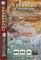
Cederberg Touring Map
The Cederberg region in the Western Cape Province of South Africa on a waterproof and tear-resistant, contoured and GPS compatible map from Slingsby Maps, presenting the mountains at 1:160, 000, with additional coverage at 1:200, 000 of the Bokkeveld Plateau extends coverage further north.On one side the main map at 1:160, 000 gives detailed presentation of the Cederberg and Koue Bokkveld ranges, with contours at 20 m intervals, elevation colouring, and numerous spot heights. Roads are differentiated according to the type of surface, indicating private sections accessible with permits only, mountain passes, locations of petrol stations and parking areas. Symbols convey a whole range of information: accommodation (hotels, lodges, B&B, self catering, hostels, caravan sites,
campsites), numerous sport facilities (golf, horse riding, mountain biking, paragliding, climbing sites, etc), game and other animal viewing places, fossils collecting, and other place of interest. Hiking trails across the mountains are clearly highlighted. Latitude and longitude grid is drawn at 5` intervals and numerous GPS waypoints are also provided.On the reverse, the Bokkenveld Plateau - an area further north beyond the border of the Northern Cape Province is presented with similar cartography but at 1:200, 000. Coverage extends from Vanrhynsdorp to Calvinia and includes the Hantam National Botanical Garden near Nieuwoudtville. Also provided is a more general overview road map at 1:1, 500, 000 showing the mountains with the coastal areas of Sandveld, indicating places of
interest, etc. The map was researched and drawn by Peter Slingsby - renowned environmental educator and cartographer.To see other titles in this series please click on the series link.

Product Description
Reviews/Comments
Add New
Vouchers
No voucher codes found.
Do you know a voucher code for this product or supplier? Add it to Insights for others to use.
Do you know a voucher code for this product or supplier? Add it to Insights for others to use.
 Denmark