
 United Kingdom
 France
 Germany
 Netherlands
 Sweden
 USA
USA
 Italy
Italy
 Spain
Spain
More From Contributor


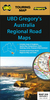

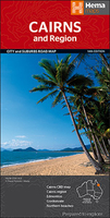
Cairns And Region Hema
Cairns and Region in a series of maps from Hema presenting Australia’s main cities with three maps: a detailed street plan of the central area, a road map of the city with its outer suburbs, plus a map of the wider surrounding region for out-of-town excursions. The Cairns map contains:- A small street plan of Cairn’s town centre between the city’s railway station and the Cruise Liner Terminal and the Marina.- Three separate panels providing continuous coverage with indexed suburban maps at 1:22, 500 from Palm Cove on the Northern Beaches, across Cairns, to Edmonton. Plus a similar mapping of the Gordonvale area further south. All four are indexed. - A regional map at approx 1:625, 000 covering the coastline south to Wongaling Beach and north to beyond Mossman, plus inland to
Mount Garnet in the Atherton Tableland. The map shows the road network indicating unsurfaced roads and tracks. Symbols mark roadside rest areas, campsites, various places of interest, etc. Topography is indicates by names of mountain ranges and selected peaks, plus rivers and lakes; national and state parks, conservation areas and reserves are all highlighted.To see other titles in this series please click on the series link.
Mount Garnet in the Atherton Tableland. The map shows the road network indicating unsurfaced roads and tracks. Symbols mark roadside rest areas, campsites, various places of interest, etc. Topography is indicates by names of mountain ranges and selected peaks, plus rivers and lakes; national and state parks, conservation areas and reserves are all highlighted.To see other titles in this series please click on the series link.

Product Description
Reviews/Comments
Add New
Vouchers
No voucher codes found.
Do you know a voucher code for this product or supplier? Add it to Insights for others to use.
Do you know a voucher code for this product or supplier? Add it to Insights for others to use.
 Denmark