
 United Kingdom
 France
 Germany
 Netherlands
 Sweden
 USA
USA
 Italy
Italy
 Spain
Spain
More From Contributor


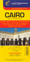
Cairo
Indexed map of central Cairo from Cartographia, with plans of central Alexandria, Heliopolis and Luxor, small plans of the three pyramid complexes around the city: Giza, Saqqara and Dahshur, plus an overview map of the Greater Cairo area.The plan of Cairo extends from Imbaba in the north to the churches and museums of Old Cairo in the south, and from the Orman Botanical Gardens in the east to Qaitbay. Details include one-way streets, railways and underground lines with stops, bus stations and riverboats landings. A series of symbols depicts public buildings, parks, various religious buildings, universities, information points, museums and monuments, embassies, theatres, hotels, etc. An inset shows a map of Greater Cairo area extending south to Saqqara, with small detailed
plans provided for the three pyramid complexes around the city: Giza, Saqqara and Dahshur. There are also plans the nearby Heliopolis at 1:13, 000, central Alexandria at 1:28, 000 and Luxor at 1:22, 000. Map legend includes English.
plans provided for the three pyramid complexes around the city: Giza, Saqqara and Dahshur. There are also plans the nearby Heliopolis at 1:13, 000, central Alexandria at 1:28, 000 and Luxor at 1:22, 000. Map legend includes English.

Product Description
Reviews/Comments
Add New
Intelligent Comparison
Archived Product
Cairo Stanfords
£8.95
Archived Product

Cairo F&B Stanfords
£9.99
Vouchers
No voucher codes found.
Do you know a voucher code for this product or supplier? Add it to Insights for others to use.
Do you know a voucher code for this product or supplier? Add it to Insights for others to use.
 Denmark