More From Contributor
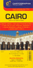
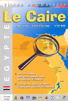
£9.99
Cairns, Atherton Tableland & The Daintree area of Queensland on a touring map at 1:500, 000 from UBD Gregory’s. The map covers coastline of Queensland from south of Innisfall to beyond Wujal Wujal, extending inland to the Great Dividing Range. The whole of the reverse side is covered by a large indexed street plan of Cairns with an enlargement for the town centre. Also included are plans of the Marlin Coast, Port Douglas, Mossman, Palm Cove, Kuranda, Mareeba, Atherton, Yungaburra & Malanda. To see other titles in this series of touring maps from UBD Gregory’s please click on the series link. ...
Archived Product
£9.99
Cairns & Region in a series of maps from Hema presenting Australia’s main cities with three maps: a detailed street plan of the central area, a road map of the city with its outer suburbs, plus a map of the wider surrounding region for out-of-town excursions. The Cairns map contains:- A small street plan of Cairn’s town centre between the city’s railway station & the Cruise Liner Terminal & the Marina.- Three separate panels providing continuous coverage with indexed suburban maps at 1:22, 500 from Palm Cove on the Northern Beaches, across Cairns, to Edmonton. Plus a similar mapping of the Gordonvale area further south. All four are indexed.
- A regional map at approx 1:625, 000 covering the coastline south to Wongaling Beach & north to beyond Mossman, plus inland to Mount Garnet in the Atherton Tablel&. The map shows the road network indicating unsurfaced roads & tracks. Symbols mark roadside rest areas, campsites, various places of interest, etc. Topography is indicates by names of mountain ranges & selected peaks, plus rivers & lakes; national & state parks, conservation areas & reserves are all highlighted. To see other titles in this series please click on the series link.
...
Archived Product
£7.99
Cairns & The Great Barrier Reef in the Pocket Guide series from Insight provides detailed commentary on a collection of itinerary based trips in a handy pocket format. Each guide has an historical & cultural introduction, profiling the growth of the region or city. There is also a large selection of localised & pedestrian friendly tour itineraries designed to take in the major sites, as well as a chapter on excursions to other destinations within easy reach. Further sections detail leisure activities including shopping, eating out, nightlife, festivals & local events with accompanying addresses & contact details where relevant. There is also practical guidance on transport, local services, language & accommodation. Each guide also has a large selection of colour photographs & a pull-out pocket map giving an overview of the region. ...
Archived Product
£8.95
Detailed road map highlighting attractions along the coast of the Great Barrier Reef between Cairns & Cooktown, & its immediate hinterland along the Peninsula Developmental Road. National parks, state forests & recreational areas are highlighted. Symbols show facilities in coastal resorts & inland towns, indicating various types of accommodation including campsites & youth hostels, places of interest, essential services, fuel supplies, etc. Also marked are ferry routes to islands & coral reefs. Geographical coordinates are given only for the map corners. On the reverse there are street plans of central Cairns plus a more general plan of the town with its suburbs, Cooktown, Daintree, Kuranda, Mareeba, Mossman & Port Douglas, plus a plan of the Northern Beaches area north of Cairns with a more detailed plan of Palm Cove. The map also

Includes::
descriptions of these towns, a table of facilities in the national parks, a distance table, & a climate chart. This title is part of Hema

...
Archived Product
£7.99
Indexed map of central Cairo from Cartographia, with plans of central Alexandria, Heliopolis & Luxor, small plans of the three pyramid complexes around the city: Giza, Saqqara & Dahshur, plus an overview map of the Greater Cairo area. The plan of Cairo extends from Imbaba in the north to the churches & museums of Old Cairo in the south, & from the Orman Botanical Gardens in the east to Qaitbay. Details include one-way streets, railways & underground lines with stops, bus stations & riverboats landings. A series of symbols depicts public buildings, parks, various religious buildings, universities, information points, museums & monuments, embassies, theatres, hotels, etc. An inset shows a map of Greater Cairo area extending south to Saqqara, with small detailed plans provided for the three pyramid complexes around the city: Giza, Saqqara & Dahshur. There are also plans the nearby Heliopolis at 1:13, 000, central Alexandria at 1:28, 000 & Luxor at 1:22, 000. Map legend

Includes::
English.

...
Archived Product
£8.99
Cairo & Nile Delta in the Footprint Focus Guides, which are targeted at cities, regions & countries worldwide that have no, or very limited, coverage from other publishers. Widely recognised for their reliability & independent writing style, Footprint Focus guides all have the same layout. Smaller than their sister Handbooks, the Focus guides are intended to streamline the information contained so that you have more of what you need, without losing Footprint’s signature unrestrictive editorial style that gives authors the freedom to capture & explore local cultures, sights & areas that are often not covered in other guides. An introductory section introduces the reader to the destination, with chapters on planning on your trip & essentials, including practical information & guidance on subjects such as when & where to go, itineraries, sport & activities, arts, getting there & around, eating & drinks, sleeping & a dedicated section on the anticipated carbon footprint involved in travelling to the destination. Essentially a condensed, straight-to-the-point version of their Handbook series. “ Sets the pace for all the rest to follow” Michael Palin. ...
Archived Product
£9.99
Double-sided map from ITMB combining a street plan of Cairo (1:12, 500) with, contrary to its title, coverage of the Nile Valley extending south to Luxor (1:700, 000). Clear, indexed street plan of the capital covers its inner districts, highlighting areas of particular interest to visitors, including Citadel & Mohammad Ali Mosque, Old Cairo with its Coptic churches, Islamic Cairo with the Han al-Halili Bazaar, etc. Metro & railway stations & stops of the river bus on the Nile are prominently marked. Overprint highlights locations of numerous mosques & other religious establishments, museums & public buildings, markets, embassies, etc. The plan is indexed. An inset covers the environs of Cairo including access to the city’s international airport & to Giza, & a detailed plan shows the pyramids & other surrounding monuments. Also included is a diagram of the city’s metro lines. On the reverse is an indexed map at 1:700, 000 of the Nile Valley from Luxor to the Delta, showing road & rail connections along the river & to the Gulf of Suez & Sinai & indicating locations of various archeological sites & other places of interest. Coverage along the Mediterranean coast extends west to include El Alamein, showing road access both from Cairo & Alexandria. The map indicates local administrative boundaries with names of the provinces & has a grid with latitude & longitude at intervals of 1º. ...
Archived Product
£10.39
Bulgaria in the Countries, Regions & Cities series from Rough Guides; comprehensively detailed guidebooks specifically designed for independent travellers & serving a range of worldwide destinations. Widely recognised for their free editorial style, Rough Guide authors are allowed to express their personal opinions on a range of subjects. Although sometimes controversial, this editorial stance allows readers to experience more detailed & personal takes on each destination, a feature often more limited in other guidebooks. Cultural & historical nuances are explored in significant depth throughout the text & descriptions on the ambience of individual settings alongside personal recommendations, particularly in cities, are notably prevalent. Each Rough Guide in the Countries, Regions & Cities series has a similar layout. A ...
Archived Product
£12.00
Cairo in the Cities of the Imagination guide series; providing an in-depth cultural & historical exploration of some of the great city landscapes of the world. Presented as a cultural & literary guide, each title in the series explores the history of the city, providing an overview of the city’s development from its earliest roots to the modern day. Particular emphasis is placed on the literary, poetic, architectural, cultural & historical elements that make up the city & each title is written & researched by an academic expert. An Epilogue offers thoughts on the future of the city, suggested further reading & indices of literary & historical names & famous places & attractions. ...
Archived Product
£7.99
Cairo & The Nile in the Eyewitness Top 10 series from Dorling Kindersley is a condensed format guide book featuring dozens of illustrated, top ten lists for the traveller regardless of their disposable budget. To save you time & money a Top 10 Things to Avoid is also included. Top 10 lists are given for things to see & do both in & around town, as well as the top ten features of particular locations or events. Practicalities are not forgotten as Top 10s are also provided for topics such as planning your trip, getting around & shopping. Accommodation lists provide the ten most recommended places to stay for a range of budgets, whilst restaurant top tens feature as the guide works its way through the location in question. Simple, small street plans illustrate the location of the top ten recommends within their neighbourhoods & basic, fold out maps form the inside covers. An additional pull out feature of the guide suggests ideas on how to spend your day & a phrase section is included which will help the traveller to acclimatise. ...
Archived Product

Cairo

Cairo Street Plan from Editions Laure Kane, a colourful and informative map for visitors to the city, highlighting main places of interest, locations of various trades within the Khan el-Khalili bazaar, selected hotels, etc.The plan covers the city’s central districts. extending from the Marioutya Canal in the west to include the University district across to the Citadel, the Khan el-Khalili bazaar and the el-Azhar University in the east, but also includes the Sinai bus terminal beyond it. North/south coverage is from the Inbaba bridge across the Nile to the Coptic churches and museums of Old Cairo.Metro stations are prominently marked and various places of interest are named and/or highlighted by symbols: selected hotels, youth hostels, museums and monuments, mosques and other
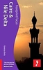
religious buildings, markets and shopping centres, etc. Within the famous Khan el-Khalili bazaar symbols indicate locations of various trades. Names of public institutions, etc. are given in French.The plan is indexed and its map legend includes English. Also provided is a plan showing the pyramids and other monuments at Giza, plus a small map of the environs of the city extending south to the Fayoum Oasis.
RIP - This product is no longer available on our network. It was last seen on 25.09.2019

This page now acts as a permanent archive for this product. Add more information using the comments box below to ensure it can still be found by future generations.

Use our search facility to see if it is available from an alternative contributor.
  • Availability: Out Of Stock
  • Supplier: Stanfords
  • SKU: 9782952104845
Availability: In Stock
£8.95

Product Description

Cairo Street Plan from Editions Laure Kane, a colourful & informative map for visitors to the city, highlighting main places of interest, locations of various trades within the Khan el-Khalili bazaar, selected hotels, etc. The plan covers the city’s central districts. extending from the Marioutya Canal in the west to include the University district across to the Citadel, the Khan el-Khalili bazaar & the el-Azhar University in the east, but also

Includes::
the Sinai bus terminal beyond it. North/south coverage is from the Inbaba bridge across the Nile to the Coptic churches & museums of Old Cairo. Metro stations are prominently marked & various places of interest are named and/or highlighted by symbols: selected hotels, youth hostels, museums & monuments, mosques & other religious buildings, markets & shopping centres, etc. Within the famous Khan el-Khalili bazaar symbols indicate locations of various trades. Names of public institutions, etc. are given in French. The plan is indexed & its map legend

Includes::
English. Also provided is a plan showing the pyramids & other monuments at Giza, plus a small map of the environs of the city extending south to the Fayoum Oasis.

Reviews/Comments

Add New

Intelligent Comparison

Oooops!
We couldn't find anything!
Perhaps this product's unique.... Or perhaps we are still looking for comparisons!
Click to bump this page and we'll hurry up.

Price History

Vouchers

No voucher codes found.
Do you know a voucher code for this product or supplier? Add it to Insights for others to use.

Facebook

Jargon Buster

Small - something that takes up less space than normal.

Supplier Information

Stanfords
Stanfords was established in 1853 and opened their iconic Covent Garden flagship store in 1901. They have become the top retailer of maps, travel books and accessories in the UK and arguably offer the largest selection of maps and travel books worldwide. Famous names such as Captain Robert Falcon Scott, Ranulph Fiennes and Michael Palin have purchased from Stanfords. They now have a shop in Bristol and both stores together with other venues operate a calendar of events including talks, book signings and exhibitions. As a specialist map retailer, the map selection is comprehensive and includes road maps, street maps and walking maps from worldwide destinations, as well as a selection of world atlases and wall maps. Books include travel guides and travel literature. Stanfords also stock globes, from miniatures made of blue marble to magnificent floor-standing globes. The website features a selection of interesting articles on travel topics.
Page Updated: 2023-11-12 20:15:36

Community Generated Product Tags

Oh No! The productWIKI community hasn't generated any tags for this product yet!
Menu