More From Contributor

£9.95
Cairn Gorm & Ben Avon area in the heart of the Scottish Highlands at 1:40, 000 on a waterproof & tear-resistant, pocket-size Ultramap from Harvey Map Services with the same cartography as their Superwalker map of the area. The peak of Cairn Gorm is on the eastern side of the map, with coverage extending north to Glanmore & the outskirts of Aviemore, west to Achlean & River Feshie & south to the Glenfeshire Forest & Sgòr Mòr. The reduction in the map scale of this Ultramaps means that place names are in smaller size print.PLEASE NOTE: this title is also available as a Superwalker map at 1:25, 000
- to see the list of titles available in this series please click on the series link. Maps in Harvey’s Superwalker series have contours at 15m intervals, with additional graphics for various types of terrain (crags, large boulders, scattered rocks) & colouring for different kinds of land use or vegetation (pastures, bogs, forests or woodl&, etc). The maps show local hiking paths, indicating where appropriate long-distance routes, & boundaries of national parks or other protected areas. Scottish titles also indicate Munro, Corbett & Graham hills. Some maps in addition highlight local cycle routes. A range of symbols mark various facilities for walkers including youth or independent hostels, campsites & caravan sites, information points, etc. Each map has a 1-km British or Irish national grid.
...
Archived Product
£5.99
This guide features 40 circular walks in the Cairngorms, once of the most dramatic mountain landscapes in Europe. The plateau that makes up much of the Cairngorms is defined by wild corries, long rivers & some of the highest mountains in Scotl&. The routes in this volume take in all of the Munros & many other great hills in & around this National Park. ...
Archived Product
£12.99
The Cairngorms cover 300 sq miles, making it the most mountainous area in Britain, with an equally wide range of wildlife. The native pine forest, one of the final retreats of the red squirrel, supports small, uncommon birds like crested tits, redwings & crossbills. Loch Garten is the RSPB osprey breeding site where in summer the birds fly over a considerable tract of country in search of food. In scenic contrast, there is also an ascent to the summit of Carn Daimh, part of the Speyside Way, with its splendid panorama of the countryside surrounding Glenlivet. ...
Archived Product
£15.95
Waterproof mountain map of the Caingorms & Lochnagar from Harvey at 1:40, 000, with a geological map of the region on the reverse, & advice on navigating the region safely.*MAIN MAP:* Topography is shown through clear altitude shading, spot heights, contours at 15m intervals, & index contours at 75m intervals. A variety of symbols are used to show terrain detail, such as caves/mines, major & climbing crags, shafts, sinkholes, cairns, & large boulders. The map is GPS compatible, with the National Grid overprinted on the cartography. Rights of way shown include tracks, long distance & intermittent paths. Road detail

Includes::
minor, residential & forest roads; railway lines & stops are marked, as are chairlifts & ski tows. Points of interest & facilities such as campsites, information points, & mountain rescue post are prominently highlighted.*GEOLOGICAL MAP:* The reverse shows a geological map of the region from the British Geological Survey, with detailed relief shading & colours used to denote different types of rock. There is additional written geological information, as well as a geological timeline of the region.*ADDITIONAL INFORMATION:* There is also information on emergency procedures, navigating the region safely, & useful contact numbers are provided. There are also lists of local climbing venues, mountaineering club huts, & mountain bothies. Printed on tough, hard-wearing polyethylene, the map is waterproof, tear-resistant, & comes in a clear plastic wallet.

...
Archived Product
£5.99
Cairngorms & the Moray Coast Cycle Map at 1:110, 000 from Sustrans, including Lochs & Glens North, Coast & Castles North, The Dava Way, & The Caledonia Way routes, plus two day rides: Around Glen Errochty & Loch-side Loop. Street plans show Inverness, Aviemore & Pitlochry. Maps is this Sustrans series show all the National & Regional Cycle Network routes clearly numbered & have the colouring distinguishing between the on-road & traffic-free sections. The publishers’ own recommendations are shown in contrasting colour &, in most titles, are in addition presented on the reverse side on separate panels where each circuit is annotated with useful notes. The maps have contours & altitude colouring to show the topography, with additional gradient markings. Towns along the routes are annotated with symbols indicating what facilities can be found there. Also marked are various places of interest, on or near the routes, & railway lines are shown with stations for access to the routes by rail. On the reverse each title also provides large, clear city centre street plans of main towns, highlighting the Cycle Network and/or the recommended routes. Also included are contact details of tourist information centres. To see the list of titles in this series please click on the series link. ...
Archived Product
£14.95
Walking in the Cairngorms is experienced walker Ronald Turnbull’s Cicerone guide exploring the Munro summits of the Cairngorm region & also the smaller hills outside the main range. The guide covers the main Cairngorm range between Speyside & Deeside, as well as Lochnagar & offers the best of the area’s rocky scrambles & the classic through-routes as well as easier, sandy trails along the banks of the rivers Spey, Nethy & Dee. There are also routes to the region’s 23 Munro summits. The guide is structured in 7 main sections
- Aviemore & the Spey, Glen More, Badenoch, Glenlivet & Tomintoul, Donside, Deeside Braemar & Balmoral & Lochnagar
- encompoassing a total of 102 walks. There are also ‘ Summit Summaries’ for the main ranges
- Cairn Gorm, Shelter Stone, Braeriach, Cairn Toul & Lochnagar. There are also suggestions for longer routes such as the Cairngorms 4000s & the Lairig Ghru. Individual walks have a general overview of the route & an information box providing details of starting & finishing points, total distance, approximate times, maximum altitude & terrain. A detailed introduction gives practical guidance on walking conditions, when to go, safety in the mountains & recommended maps. Detailed route descriptions are accompanied by Ordnance Survey extract mapping the route in addition to colour photographs illustrating some of the highlights of the region.


...
Archived Product
£11.99
Cairngorms Walks in the Pathfinder Guides series, produced in association with Ordnance Survey & published by Crimson; comprising a range of walking guides to popular British destinations. Each Pathfinder guide

Includes::
28 varied walks ranging from easy strolls to exhilarating hikes & is accompanied by 1:25, 000 Ordnance Survey mapping with marked, colour-coded routes. Introductory sections profile the county or region covered, with recommendations on the best time to visit & a brief explanation of GPS. An

...
Archived Product
£16.95
Allen Fyffe’s Cicerone guide to Winter Climbs in the Cairngorms is the eagerly awaited sixth edition of this climbing guide. It features the best places to climb in winter in the Cairngorms, Lochnagar & Creag Meagaidh. Organized in 18 sections detailing different sets of climbs, each section has a large hand drawn map of the mountain with an indexed key illustrating where each climb is in relation to each other. Individual climb descriptions are supplemented by information such as difficulty grading & height. Colour photographs also illustrate some of the more difficult climbs. ...
Archived Product
£9.99
Cairns, Atherton Tableland & The Daintree area of Queensland on a touring map at 1:500, 000 from UBD Gregory’s. The map covers coastline of Queensland from south of Innisfall to beyond Wujal Wujal, extending inland to the Great Dividing Range. The whole of the reverse side is covered by a large indexed street plan of Cairns with an enlargement for the town centre. Also included are plans of the Marlin Coast, Port Douglas, Mossman, Palm Cove, Kuranda, Mareeba, Atherton, Yungaburra & Malanda. To see other titles in this series of touring maps from UBD Gregory’s please click on the series link. ...
Archived Product
£9.99
Cairns & Region in a series of maps from Hema presenting Australia’s main cities with three maps: a detailed street plan of the central area, a road map of the city with its outer suburbs, plus a map of the wider surrounding region for out-of-town excursions. The Cairns map contains:- A small street plan of Cairn’s town centre between the city’s railway station & the Cruise Liner Terminal & the Marina.- Three separate panels providing continuous coverage with indexed suburban maps at 1:22, 500 from Palm Cove on the Northern Beaches, across Cairns, to Edmonton. Plus a similar mapping of the Gordonvale area further south. All four are indexed.
- A regional map at approx 1:625, 000 covering the coastline south to Wongaling Beach & north to beyond Mossman, plus inland to Mount Garnet in the Atherton Tablel&. The map shows the road network indicating unsurfaced roads & tracks. Symbols mark roadside rest areas, campsites, various places of interest, etc. Topography is indicates by names of mountain ranges & selected peaks, plus rivers & lakes; national & state parks, conservation areas & reserves are all highlighted. To see other titles in this series please click on the series link.
...
Archived Product

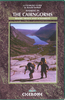
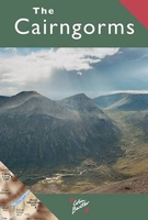
Cairngorms Reference Map

Cairngorm Mountains on an overview map from Colin Baxter presenting at 1:85, 000 an area from Aviemore and Kincraig in the north-west to Braemar in the south-east. Bold colouring and relief shading shows the topography, with names of numerous peaks, glens, etc.The map indicates main paths in the mountains and facilities available in various locations, but is annotated by the publishers “Do not use this map for walking in the mountains – use a larger scale map such as Harvey’s 1:25, 000 Superwalker Cairngorms”,
RIP - This product is no longer available on our network. It was last seen on 25.09.2019

This page now acts as a permanent archive for this product. Add more information using the comments box below to ensure it can still be found by future generations.

Use our search facility to see if it is available from an alternative contributor.
  • Availability: Out Of Stock
  • Supplier: Stanfords
  • SKU: 9781841073828
Availability: In Stock
£3.95

Product Description

Cairngorm Mountains on an overview map from Colin Baxter presenting at 1:85, 000 an area from Aviemore & Kincraig in the north-west to Braemar in the south-east. Bold colouring & relief shading shows the topography, with names of numerous peaks, glens, etc. The map indicates main paths in the mountains & facilities available in various locations, but is annotated by the publishers “ Do not use this map for walking in the mountains – use a larger scale map such as Harvey’s 1:25, 000 Superwalker Cairngorms”,

Reviews/Comments

Add New

Intelligent Comparison

Oooops!
We couldn't find anything!
Perhaps this product's unique.... Or perhaps we are still looking for comparisons!
Click to bump this page and we'll hurry up.

Price History

Vouchers

No voucher codes found.
Do you know a voucher code for this product or supplier? Add it to Insights for others to use.

Facebook

Jargon Buster

Reference - To prove evidence with a back up source.

Supplier Information

Stanfords
Stanfords was established in 1853 and opened their iconic Covent Garden flagship store in 1901. They have become the top retailer of maps, travel books and accessories in the UK and arguably offer the largest selection of maps and travel books worldwide. Famous names such as Captain Robert Falcon Scott, Ranulph Fiennes and Michael Palin have purchased from Stanfords. They now have a shop in Bristol and both stores together with other venues operate a calendar of events including talks, book signings and exhibitions. As a specialist map retailer, the map selection is comprehensive and includes road maps, street maps and walking maps from worldwide destinations, as well as a selection of world atlases and wall maps. Books include travel guides and travel literature. Stanfords also stock globes, from miniatures made of blue marble to magnificent floor-standing globes. The website features a selection of interesting articles on travel topics.
Page Updated: 2023-11-12 20:15:36

Community Generated Product Tags

Oh No! The productWIKI community hasn't generated any tags for this product yet!
Menu