
 United Kingdom
 France
 Germany
 Netherlands
 Sweden
 USA
USA
 Italy
Italy
 Spain
Spain
More From Contributor


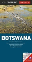
Botswana Pocket Map
A small pocket map with enlargements of the Okavango Delta/ Chobe and the Northern Tuli Conservation Area, and an indexed street plan of Gaborone. The main map shows the whole country at a scale of 1:2, 550, 000, highlighting national parks and game reserves, places of interest, and selected accommodation and campsites. Road network includes secondary roads but does not indicate 4x4 tracks. An index of towns and settlements inlcudes places of interest. On the reverse there are enlargements of the Okavango Delta/Chobe area at 1:1, 000, 000 and the Northern Tuli Conservation Area at 1:300, 000, and an indexed street plan of Gaborone.
Product Description
Reviews/Comments
Add New
Intelligent Comparison
Archived Product
Scotland Pocket Map Stanfords
£1.99
Archived Product

Bohinj Pocket Map Stanfords
£8.99
Archived Product

Botswana Tourist Map Stanfords
£11.99
Archived Product

Botswana InfoMap Stanfords
£13.99
Archived Product

Kranj Pocket Map Stanfords
£4.99
Archived Product
Brighton Pocket Map Stanfords
£1.50
Archived Product
Botswana Globetrotter Map Stanfords
£4.99
Archived Product
London Pocket Map Stanfords
£1.99
Vouchers
No voucher codes found.
Do you know a voucher code for this product or supplier? Add it to Insights for others to use.
Do you know a voucher code for this product or supplier? Add it to Insights for others to use.
 Denmark