
 United Kingdom
 France
 Germany
 Netherlands
 Sweden
 USA
USA
 Italy
Italy
 Spain
Spain
More From Contributor


Tarangire National Park
Tarangire National Park at 1:40, 000 on a map from Veronica Roodt Publications presenting the area on a base derived from satellite imagery. Extra panels provide additional information for visitors including an enlargement of the central area.On one side is a map of the whole park showing its network of roads and tracks for viewing animals. A panel provides GPS waypoints for 50 junctions or facilities, and driving distances are marked. Symbols indicate locations of lodges, ranger posts, campsites, picnic sites, etc. Also marked are locations of fuel supplies.On the reverse the central part of the park along the Tarangire River is shown in greater detail with 42 GPS waypoints.The title includes general information about the area and tips for the visitors, photos of over 50 local
mammals with details of their size, habitat, etc, 120 photos of common local birds, plus a map and notes about the Tarangire ecosystem and the annual migratory routes.This title is part of a series of maps from Veronica Roodt Publications covering Tanzania
mammals with details of their size, habitat, etc, 120 photos of common local birds, plus a map and notes about the Tarangire ecosystem and the annual migratory routes.This title is part of a series of maps from Veronica Roodt Publications covering Tanzania
Product Description
Reviews/Comments
Add New
Intelligent Comparison
Archived Product
Tatra National Park Stanfords
£6.95
Archived Product
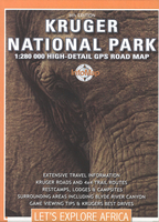
Kruger National Park Stanfords
£13.99
Archived Product
Sareks National Park Stanfords
£14.95
Archived Product
Sareks National Park Stanfords
£14.95
Archived Product
Kruger National Park Stanfords
£4.99
Archived Product
Serengeti National Park Stanfords
£10.95
Archived Product
Banff National Park Stanfords
£8.95
Archived Product

Dartmoor National Park Stanfords
£10.95
Vouchers
No voucher codes found.
Do you know a voucher code for this product or supplier? Add it to Insights for others to use.
Do you know a voucher code for this product or supplier? Add it to Insights for others to use.
 Denmark