
 United Kingdom
 France
 Germany
 Netherlands
 Sweden
 USA
USA
 Italy
Italy
 Spain
Spain
More From Contributor

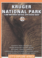
Kruger National Park
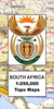
Kruger National Park in a series of double-sided touring maps of popular tourist regions of South Africa, with GPS coordinates for selected road junctions, villages and accommodation. Rather basic cartography, with bold elevation tinting, spot heights and rivers (often without names), is designed to highlight the road network and the coordinates provided on the maps. Each map gives GPS waypoints for selected road junctions, small towns or settlements, and places of interest. Recommended accommodation, including campsites, inns, lodges, etc, is also shown with GPS waypoints, as well as contact details and symbols indicating various facilities available there. The maps also indicate other outdoor and recreational facilities, fuel supplies, aerodromes and landing strips, etc.
National parks and protected areas are highlighted.*In this title:* Kruger National Park and the adjoining areas of the Limpopo and Mpumalanga provinces. Latitude and longitude lines are drawn at 30’ intervals.
National parks and protected areas are highlighted.*In this title:* Kruger National Park and the adjoining areas of the Limpopo and Mpumalanga provinces. Latitude and longitude lines are drawn at 30’ intervals.

Product Description
Reviews/Comments
Add New
Intelligent Comparison
Archived Product
Arusha National Park Stanfords
£10.95
Archived Product
Serengeti National Park Stanfords
£10.95
Archived Product
Tarangire National Park Stanfords
£10.95
Archived Product
Svizzer National Park Stanfords
£12.95
Archived Product

Triglav National Park Stanfords
£9.95
Archived Product

Chobe National Park Stanfords
£9.99
Archived Product
Kootenay National Park Stanfords
£10.50
Archived Product
Gaujas National Park Stanfords
£5.95
Vouchers
No voucher codes found.
Do you know a voucher code for this product or supplier? Add it to Insights for others to use.
Do you know a voucher code for this product or supplier? Add it to Insights for others to use.
 Denmark