More From Contributor
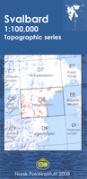
£17.99
The 1:50, 000 topographic map gives a more general picture of the ground features than a basic map. It shows settlements, houses, roads, cultivated areas, waterways, cutting areas, mires, rock exposures, & relief. One map sheet covers an area of 30 x 40 km & one centimetre corresponds to 500 metres on the ground. The 1:50, 000 topographic map is also an ideal complement to nautical charts as it provides useful information about the land areas adjacent to waterways. For example, all Finnish sea areas are covered by 1:50, 000 topographic map sheets. ...
Archived Product
£6.95
Map No. 104, Krkonose, in a series of GPS compatible topographic maps of the Czech Republic at 1:75.000 from Shocart highlighting both signposted cycling routes & other local cycling paths, with route profiles & additional tourist information. Relief is shown by contour lines, spot heights, & subtle hill-shading. The maps show roads, tracks, railways, cable cars, chairlifts, & a range of natural landscape features & landmarks. Coloured symbols depict plenty of additional tourist features e.g. information centres, places of interest, antiquities, shelters, campsites, accommodation, bicycle services etc. An overprint highlights both signposted routes & other recommended routes which have no terrain markers. For all bike routes intermediate distances are shown. Hiking paths are also highlighted. Latitude & longitude margin ticks are at 5' intervals. Each map is accompanied by a booklet containing general information on the Czech cycle route network, elevation profile diagram for selected routes, plus an index for locations of historical & geographical interest, bicycle service workshops, information centres, & tourist attractions. Map legend & text are in English, German & Czech. ...
Archived Product
£11.99
Waterproof & tear-resistant map No. 2087, Krkonoše, in a series of contoured, GPS compatible maps at 1:50, 000 from Kompass covering popular hiking & recreational areas of the Czech Republic. The maps have contours at 20m intervals. An overprint highlights footpaths, indicating their waymarking, cycling routes, & where appropriate, ski routes. A wide range of symbols indicate various types of accommodation including campsites & youth hostels, places of interest, local landmarks, etc. The maps have a 2km UTM grid. Map legend

Includes::
English. All the titles come with a separate 79-page booklet, in Czech & German only, with photos & descriptions of 64 local wild flowers (Latin names are provided)
- no English language booklets are available with this series.


...
Archived Product
£11.50
Kronach in a series of GPS compatible recreational editions of the Bavarian topographic survey at 1:25, 000, with waymarked hiking trails & cycling routes, campsites & youth hostels, etc. Coverage

Includes::
Teuschnitz, Stockheim, Wilhelmsthal, Pressig, Marktrodach, Mitwitz. Contours used in this map vary between 5 to 20m according to the terrain, with 20m interval predominantly used for hilly areas. Varied colouring show different types of landscape: woods, vineyards, fields etc. Maps in this series feature extensive overprint highlighting local & long-distance footpaths & cycle routes, including King Ludwig Way or different variants of the Way of St James, indicating their way marking. Symbols highlight different types of accommodation (campsites, youth hostels, refuges, etc), sport & recreational facilities, various places of interest, etc. The maps have a 1-km UTM grid. Map legend & all the text are in German only. To see other titles in this series please click on the series link.

...
Archived Product
£29.99
Map No. 2726, Kroonstad, in South Africa’s official topographic survey at 1:250, 000 from the country’s national survey organization, the Chief Directorate of Surveys & Mapping. The maps have altitude colouring & contours at 50m or 100m intervals, depending on the map edition, plus spot heights. Deserts, marshes, dry pans, perennial & seasonal water features, etc, as well as protected areas are shown. The maps present the country’s road & rail networks & include the usual information expected on topographic mapping at this scale, although in more rapidly developing areas road information may not necessarily be up to date. Also indicated are magisterial district & provincial boundaries. Latitude & longitude values are shown in the margins at 5` intervals together with South African grid co-ordinates. Typically, each sheet covers an area of one degree of latitude & two degrees of longitude. The projection used is Gauss Conformal. The legend is in English & Afrikaans. ...
Archived Product
£13.99
Kruger National Park in a series of double-sided touring maps of popular tourist regions of South Africa, with GPS coordinates for selected road junctions, villages & accommodation. Rather basic cartography, with bold elevation tinting, spot heights & rivers (often without names), is designed to highlight the road network & the coordinates provided on the maps. Each map gives GPS waypoints for selected road junctions, small towns or settlements, & places of interest. Recommended accommodation, including campsites, inns, lodges, etc, is also shown with GPS waypoints, as well as contact details & symbols indicating various facilities available there. The maps also indicate other outdoor & recreational facilities, fuel supplies, aerodromes & landing strips, etc. National parks & protected areas are highlighted.* In this title:* Kruger National Park & the adjoining areas of the Limpopo & Mpumalanga provinces. Latitude & longitude lines are drawn at 30’ intervals. ...
Archived Product
£4.99
The highly successful Globetrotter Travel Series, which

Includes::
Travel Guides, Travel Maps, Road Atlases,

...
Archived Product
£9.99
The highly successful Globetrotter Travel Series, which

Includes::
Travel Guides, Travel Maps, Road Atlases,

...
Archived Product
£4.99
Kruger National Park at double-sided map at 1:200, 000 in the Globetrotter imprint from New Holl&, with additional panels showing in detail the park’s tourist accommodation camps, plus thematic maps, entry & closing time tables, climate charts, etc. Cartography is designed to show main roads & tracks leading to accommodation areas & various places of interest rather than to present the topography in greater detail. Road network indicates untarred routes, gives driving distances & shows locations with fuel supplies & emergency repair services. Symbols indicate various places of interest & facilities including different types of accommodation. The map has no geographical coordinates. Enlargement presents in detail tourist accommodation camps: Punda Maria, Shingwedzi, Mopani, Olifants, Letaba, Satara, Orpen, Lower Sabie, Pretoriuskop, Sukukuza, Berg-en-Dal & Crocodile Bridge. Another enlargement shows the Sukukuza area, & also provided are an overview map of north-western South Africa showing road access to the park from Johannesburg, rainfall & vegetation maps of the park, climate charts for various locations, a wilderness trails locator, tables with opening & closing times of entry gates, a distance table, plus a QR code for downloading more information. ...
Archived Product
£12.99
The Kruger National Park Visitor’s Guide is your GPS companion. The Visitor’s Guide is an informative guide along with detailed maps of the best routes & GPS points. Included in the Visitor’s Guide is a list of the ‘top’ 50 mammals & 100 common birds. In fact, there are 146 mammal species in the park & some 500 bird species. The Visitor’s Guide provides detailed fauna & flora descriptions throughout, illustrates dominant topography regions, detailed description of the Big Five, a checklist for birds & mammals & a wildlife identification guide. There are over 100 colour illustrations of Kruger’s birds with names & sizes for easy identification & over 50 colour illustrations of the Kruger National Park’s mammals with names & sizes for easy identification. Also included with the Visitor’s Guide: handy hints & tips, visitor’s facilities, gate times & phone numbers, contact details & booking information. The guide lists travel times between camps & a distance chart. The main maps within the guide include:– Mpumalanga & Panorama Route– Kruger National Park eco-zones & topography– Kruger driving map Crocodile Bridge to Skukuza– Kruger driving map Paul Kruger to Sweni– Kruger driving map Orpen to Olifants– Kruger driving map Letabe to Mopani– Kruger driving map Bateleur to Sirheni– Kruger driving map Punda Maria to Pafuri ...
Archived Product

Krossfjorden

One of the titles in the topographic survey of the Svalbard group published in a colour version, available for the western coast, central and southern part of Spitzbergen, plus two small islands of Svenskøya and Kongsøya. The map has contours at 25-metre intervals, bold relief shading and spot heights, and shows settlements, roads and tracks, working and disused mines, airfields, lighthouses and radio beacons, etc. A grid gives UTM co-ordinates plus latitude in steps of 10` and longitude in 20’.The rest of Spitzbergen, Nordaustlandet, Edgeøya and other small islands are covered by black and white maps with contours only. Most of these maps show no geographical names, as indicated in the individual descriptions of each title.
RIP - This product is no longer available on our network. It was last seen on 25.09.2019

This page now acts as a permanent archive for this product. Add more information using the comments box below to ensure it can still be found by future generations.

Use our search facility to see if it is available from an alternative contributor.
  • Availability: Out Of Stock
  • Supplier: Stanfords
  • SKU: XL00000081632
Availability: In Stock
£17.99

Product Description

One of the titles in the topographic survey of the Svalbard group published in a colour version, available for the western coast, central & southern part of Spitzbergen, plus two small islands of Svenskøya & Kongsøya. The map has contours at 25-metre intervals, bold relief shading & spot heights, & shows settlements, roads & tracks, working & disused mines, airfields, lighthouses & radio beacons, etc. A grid gives UTM co-ordinates plus latitude in steps of 10` & longitude in 20’. The rest of Spitzbergen, Nordaustlandet, Edgeøya & other small islands are covered by black & white maps with contours only. Most of these maps show no geographical names, as indicated in the individual descriptions of each title.

Reviews/Comments

Add New

Intelligent Comparison

Oooops!
We couldn't find anything!
Perhaps this product's unique.... Or perhaps we are still looking for comparisons!
Click to bump this page and we'll hurry up.

Price History

Vouchers

No voucher codes found.
Do you know a voucher code for this product or supplier? Add it to Insights for others to use.

Facebook

Jargon Buster

Black - A colour which does not emit any colour of the spectrum. Black absorbs all frequencies of the spectrum.
White - A colour combining all colours
Radio - A device used for listening to audio transmissions
Colour - The categorised spectrum of light visable to humans
edge - Enhanced data rates for GSM evolution also known as enhanced GPRS. A mobile phone technology with improved data transmission rates.
edge - The point at which two surfaces meet
Small - something that takes up less space than normal.
Metre - 100cm. A unit of length.
Individual - A single separate item or person.

Supplier Information

Stanfords
Stanfords was established in 1853 and opened their iconic Covent Garden flagship store in 1901. They have become the top retailer of maps, travel books and accessories in the UK and arguably offer the largest selection of maps and travel books worldwide. Famous names such as Captain Robert Falcon Scott, Ranulph Fiennes and Michael Palin have purchased from Stanfords. They now have a shop in Bristol and both stores together with other venues operate a calendar of events including talks, book signings and exhibitions. As a specialist map retailer, the map selection is comprehensive and includes road maps, street maps and walking maps from worldwide destinations, as well as a selection of world atlases and wall maps. Books include travel guides and travel literature. Stanfords also stock globes, from miniatures made of blue marble to magnificent floor-standing globes. The website features a selection of interesting articles on travel topics.
Page Updated: 2023-11-12 20:15:36

Community Generated Product Tags

Oh No! The productWIKI community hasn't generated any tags for this product yet!
Menu