
 United Kingdom
 France
 Germany
 Netherlands
 Sweden
 USA
USA
 Italy
Italy
 Spain
Spain
More From Contributor

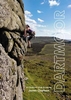


Dartmoor National Park
This book is a celebration of Dartmoor National Park - highlighting its dramatic beauty, captivating wildlife and the cultural heritage of its landscape and inhabitants. One of England`s greatest expanses of wild country, Dartmoor attracts countless visitors each year, who are keen to experience its vast open and ancient scenery, high craggy tors and secluded valleys; its peace, tranquillity and humbling splendour. This is a landscape largely created and maintained by generations of people whose lives are deeply entwined with a wild and beautiful place. Dartmoor National Park paints a colourful picture of Dartmoor today, featuring stories by people passionate about their work and life on the moor. Their accounts reflect their emotional or spiritual attachment to some very special
places, offering a fascinating insight into the history of the land and demonstrating the benefits and pleasures the National Park brings to both visitors and the local community. The book features chapters on Dartmoor`s geology, history and archaeology, and describes the important role played by farming and livestock in managing the land.Beautiful colour photographs, including stunning panoramas, illustrate the magnificence of one of Britain`s first and finest national parks.
places, offering a fascinating insight into the history of the land and demonstrating the benefits and pleasures the National Park brings to both visitors and the local community. The book features chapters on Dartmoor`s geology, history and archaeology, and describes the important role played by farming and livestock in managing the land.Beautiful colour photographs, including stunning panoramas, illustrate the magnificence of one of Britain`s first and finest national parks.

Product Description
Reviews/Comments
Add New
Vouchers
No voucher codes found.
Do you know a voucher code for this product or supplier? Add it to Insights for others to use.
Do you know a voucher code for this product or supplier? Add it to Insights for others to use.
 Denmark