
 United Kingdom
 France
 Germany
 Netherlands
 Sweden
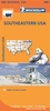
 USA
USA
 Italy
Italy
 Spain
Spain
More From Contributor


Southeastern Europe
Europe s sea-and sun-blessed southeast is ripe for adventure. Explore epic Greek remains, sophisticated Croatian resorts, Turkish spice bazaars the wild forests of Romania and the medieval towns of Montenegro. Getting you to the heart of a place
- Amazing
Product Description
- Amazing experiences Inspirational images, author recommendations & the best of local knowledge. Plan the perfect trip Planning features & top itineraries give you the freedom to create your ideal trip. Find hidden travel gems Our authors uncover local secrets that will make your trip unique. Special Features Countries at a glance Region-wide itineraries Practical tips Tours of top sights We tell it like it is Our job is to make amazing travel experiences happen. We visit the places we write about each & every edition. We never take freebies for positive coverage, so you can always rely on us to tell it like it is.
Reviews/Comments
Add New
Vouchers
No voucher codes found.
Do you know a voucher code for this product or supplier? Add it to Insights for others to use.
Do you know a voucher code for this product or supplier? Add it to Insights for others to use.
 Denmark