More From Contributor

£17.99
Europe s sea-and sun-blessed southeast is ripe for adventure. Explore epic Greek remains, sophisticated Croatian resorts, Turkish spice bazaars the wild forests of Romania & the medieval towns of Montenegro. Getting you to the heart of a place
    Amazing experiences Inspirational images, author recommendations & the best of local knowledge. Plan the perfect trip Planning features & top itineraries give you the freedom to create your ideal trip. Find hidden travel gems Our authors uncover local secrets that will make your trip unique. Special Features Countries at a glance Region-wide itineraries Practical tips Tours of top sights We tell it like it is Our job is to make amazing travel experiences happen. We visit the places we write about each & every edition. We never take freebies for positive coverage, so you can always rely on us to tell it like it is.
...
Archived Product
£3.99
Part of the American Road Map series, this is a map designed for the independent traveller. Containing practical details such as inset street maps for major cities, it also

Includes::
a useful touring section, place/street name index, index of national parks & more. Scenic routes are highlighted & airports, lakes & reservoirs, places of interest & campsites are also marked. City maps include tourist details such as top attractions & AAA approved hotels whilst place/street names are indexed for ease of reference.

...
Archived Product
£5.99
Southeastern USA at 1:2, 400, 000 is a fully indexed map in the Michelin Regional USA series for motorists & tourists which is comprised of three maps at 1:2, 400, 000 covering the USA & southern Canada & two maps at a more detailed scale of 1:500, 000 which cover the north-eastern seaboard from northern Virginia & DC to Southern Maine. Road classification as interstate or state highways include details of the number of lanes, intermediate driving distances, toll roads & rest areas. Minor & un-surfaced roads are also shown, as are ferry routes & airports. Scenic routes are highlighted where applicable. Native Indian land & land belonging to the U.S military are clearly designated on the maps, as are state capitals & boundaries, border crossings & time zone limits. Minimal grey relief shading is shown, as is each state ...
Archived Product
£6.99
Southeastern USA on an overview road map from the National Geographic with 16 panels showing road access to main towns, street plans of central Washington DC & New Orleans, maps of main national parks, & general notes about the states covered by the map. The main map at approx. 1:3, 500, 000 shows extends south from Philadelphia & Pittsburg & west to the Mississippi, covering Southern Pennsylvania & Ohio, the Virginias, Kentucky, Tennessee, the Carolinas, Georgia, Alabama, Mississippi & Florida. The map shows the network of the interstate highways & connecting main roads & highlights national parks & various other places of interest. An enlargement presents the Washington – Baltimore area in greater detail, plus 16 more panels show main roads in & around: Richmond plus Norfolk – Virginia Beach – Newport News VA, Charleston WV, Lexington & Louisville KY, Raleigh & Charlotte NC, Charleston SC, Savanna & Atlanta GA, Memphis & Nashville TN, Jackson MS, Birmingham AL, Orlando with Disney World, Tampa – St. Petersburg & the Miami – Fort Lauderdale – West Palm Beach in Florida. Street plan cover central DC plus the French Quarter of New Orleans. Also included are overview maps of Shenandoah, Great Smoky Mountains & Everglades National Parks. All are annotated with places of interest. ...
Archived Product
£5.99
South-eastern USA at 1:2, 400, 000 (1” to 38 miles) on an indexed road map from Michelin with coverage extending southwards from Washington DC, Indianapolis & Denver, & from the Atlantic coast westwards to Albuquerque in New Mexico & El Paso in Texas. The map is part of Michelin’s series covering USA on three maps at this scale. Road network indicates toll roads & clearly shows road numbers of interstate & state highways plus on selected local roads. Driving distances are marked on main routes in both miles & kilometres, & on selected state roads in kilometres only. State borders are clearly marked & the maps also show time zone boundaries. Topography is indicated by relief shading, with colouring for national/state parks & forests, Indian lands & restricted entry military zones. The maps have no geographical coordinates; each title is indexed. To see all the titles in this series, including more detailed coverage of New England & the Mid-Atlantic States, please click on the series link. ...
Archived Product
£4.95
Southend Street Atlas at 1:19, 000 / 3.33 to a mile, in an indexed, glove box size paperback format, with national grid referencing. Street atlas covers Southend-on-Sea, Basildon, Billericay, Burnham-on-Crouch, Canvey Isl&, Rayleigh, Rochford, Southminster, Wickford, South Woodham Ferrers & Stanford-le-Hope. Motorways, A roads, B roads, dual carriageways, one way streets, pedestrianized/restricted access roads & car parks are shown. The run of street numbers on A & B roads is also indicated, as are the locations of fixed speed cameras & their mph limits. Tracks & footpaths are mapped, as are selected cycleways, railways, stations, level crossings & rail bridges. Colour coding distinguishes land use, e.g. shopping centre, educational establishment or industrial building. Post offices, churches, tourist information centres & emergency services are located, as are public toilets with & without disabled access. Post town & postcode boundaries are demarcated & the atlas is indexed by street name & places of particular interest. Current edition of this atlas
- 2009
...
Archived Product
£3.50
Southend Village in 1914 in a fascinating series of reproductions of old Ordnance Survey plans in the Alan Godfrey Editions, ideal for anyone interested in the history of their neighbourhood or family. The Ordnance Survey did not include this area in their London Series until this 1914 edition & many would still regard it as part of Kent. The map covers the village of Southend, south of Catford, & even in 1914 it is largely rural. However at the north of the map building is taking place along Bellingham Road, while the tramway extends down to Southend where new roads have been laid out. There is a stretch of railway down the western side of the map with Bellingham & Beckenham Hill stations. There are also several sports grounds, including Foxgrove Golf Course, & beyond that countryside. The map is slightly grey, the fault of the original & not the reproduction, &

Includes::
directories for Bellingham Road, Bromley Road & Southend. About the Alan Godfrey Editions of the 25” OS Series: Selected towns in Great Britain & Ireland are covered by maps showing the extent of urban development in the last decades of the 19th & early 20th century. The plans have been taken from the Ordnance Survey mapping & reprinted at about 15 inches to one mile (1:4, 340). On the reverse most maps have historical notes & many also include extracts from contemporary directories. Most maps cover about one mile (1.6kms) north/south, one & a half miles (2.4kms) across; adjoining sheets can be combined to provide wider coverage.FOR MORE INFORMATION & A COMPLETE LIST OF ALL AVAILABLE TITLES PLEASE CLICK ON THE SERIES LINK.

...
Archived Product
£14.99
Southend-on-Sea, Basildon, Brentwood & Billericay area on a detailed topographic & GPS compatible map No. 175, waterproof version, from the Ordnance Survey’s 1:25, 000 Explorer series.MOBILE DOWNLOADS: this title & all the other OS Explorer maps include a code for downloading after purchase the digital version onto your smartphone or tablet for viewing on the OS smartphone app.OS EXPLORER SERIES: to see the list of all the titles in the OS Explorer series, both paper & waterproof versions, please click on the series link. The Explorer series, Ordnance Survey’s most detailed maps recommended for anyone enjoying outdoor activities, provides topographic coverage of Great Britain at 1:25, 000 on GPS compatible maps with hiking trails, cycling routes & extensive tourist information. Each printed map is available either on paper or as a waterproof & tear-resistant OS Active Map, as indicated in its title. Britain’s National Parks & other areas of particular tourist interest are presented on often double-sided OL (Outdoor Leisure) maps, whilst most standard format Explorers cover an area of 30 x 20km (approx. 19 x 12 miles). All three versions (paper, waterproof & digital) are the same & provide plenty of recreational & tourist information, indicating the traditional public right of way paths (except in Scotland where different laws apply), including bridleways & byways. National Trails & other long-distance paths are marked, as well as permissive footpaths or bridleways & on-road or traffic-free cycle routes with, where appropriate, their National/ Regional Cycle Network numbers. Boundaries of access land are clearly marked. A wide range of symbols provides additional tourist information, highlighting camping & caravanning sites, information offices & visitors’ centres, parking & picnicking places, country pubs, sport & recreational facilities including cycle hire locations & mountain biking trails, historic buildings & museums, etc. Exceptionally clear presentation of the landscape is provided by contours at 5m or in the uplands at 10m intervals, with additional spot heights plus colouring and/or graphics for different types of woodlands, orchards, heath, marshl&, scree or boulders, & other topographic features. For GPS users the maps have British National Grid lines at 1km intervals, with latitude & longitude given by margin ticks at 1`. Clearly laid out map legend

Includes::
French & German translations for the tourist information symbols.

...
Archived Product
£8.99
Southend-on-Sea, Basildon, Brentwood & Billericay area on a detailed topographic & GPS compatible map No. 175, paper version, from the Ordnance Survey’s 1:25, 000 Explorer series. MOBILE DOWNLOADS: this title & all the other OS Explorer maps include a code for downloading after purchase the digital version onto your smartphone or tablet for viewing on the OS smartphone app.OS EXPLORER SERIES: to see the list of all the titles in the OS Explorer series, both paper & waterproof versions, please click on the series link. The Explorer series, Ordnance Survey’s most detailed maps recommended for anyone enjoying outdoor activities, provides topographic coverage of Great Britain at 1:25, 000 on GPS compatible maps with hiking trails, cycling routes & extensive tourist information. Each printed map is available either on paper or as a waterproof & tear-resistant OS Active Map, as indicated in its title. Britain’s National Parks & other areas of particular tourist interest are presented on often double-sided OL (Outdoor Leisure) maps, whilst most standard format Explorers cover an area of 30 x 20km (approx. 19 x 12 miles). All three versions (paper, waterproof & digital) are the same & provide plenty of recreational & tourist information, indicating the traditional public right of way paths (except in Scotland where different laws apply), including bridleways & byways. National Trails & other long-distance paths are marked, as well as permissive footpaths or bridleways & on-road or traffic-free cycle routes with, where appropriate, their National/ Regional Cycle Network numbers. Boundaries of access land are clearly marked. A wide range of symbols provides additional tourist information, highlighting camping & caravanning sites, information offices & visitors’ centres, parking & picnicking places, country pubs, sport & recreational facilities including cycle hire locations & mountain biking trails, historic buildings & museums, etc. Exceptionally clear presentation of the landscape is provided by contours at 5m or in the uplands at 10m intervals, with additional spot heights plus colouring and/or graphics for different types of woodlands, orchards, heath, marshl&, scree or boulders, & other topographic features. For GPS users the maps have British National Grid lines at 1km intervals, with latitude & longitude given by margin ticks at 1`. Clearly laid out map legend

Includes::
French & German translations for the tourist information symbols.

...
Archived Product
£6.39
A detailed topographic map of Southend-on-Sea & Basildon from the Ordnance Survey Explorer series, covering Brentwood & Billericay. Edition A2; Publication date March 2009 About this series: These highly detailed maps show all the administrative boundaries, settlements as small as isolated farms, the road network down to unfenced roads & country tracks, & field boundaries (hedges & drystone walls) which make navigation across the countryside much easier. Steep gradients on roads are indicated. Various landmarks, e.g. powerlines, archaeological sites, windmills, churches & lighthouses are shown & additional graphics indicate natural terrain features such as cliffs, scree, mud & vegetation variations. The contour interval is 5 metres in the lower parts of the country & 10 metres in the uplands, & spot heights are marked. Each map covers an area of 30 x 20km (i.e. approx. 19 x 12 miles), with some double-sided maps covering more, as indicated in the individual descriptions. The maps are fully GPS compatible, with the National Grid shown at 1km intervals & latitude & longitude indicated by margin ticks at 1'. The Explorer series has replaced the earlier, green-cover Pathfinder maps. The Explorer series is now complete & covers all of Engl&, Wales & Scotl&. Some sheets for popular areas like the National Parks are still branded as Outdoor Leisure (OL) maps, but are now included in this series as the cartography is the same as that in the Explorer Maps. The Explorer maps offer a substantial improvement on the Pathfinder series, with greater use of colour, larger area per map, & stronger emphasis on information for ramblers & tourists. This series is ideal for walking & other outdoor pursuits & each map shows a large amount of information for ramblers & tourists. Public rights of way are shown (except in Scotland), together with other routes with public access: National Trails & Recreational Paths, permitted paths & bridleways, & selected cycle routes. Open access land created under the Countryside & Rights of Way Act 2000 is marked. Tourist information

Includes::
caravan & campsites, Park & Ride locations, recreation/leisure/sport centres, museums, historic buildings, English Heritage & National Trust sites, rural pubs, etc. The map legend is in English only, except for the tourist information content which is also in French & German.

...
Archived Product

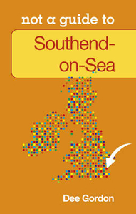
Southend On Sea: Not A Guide

This is NOT a guide book. This little book brings together past and present to offer a taste of Southend-on-Sea. Learn more about the movers and shakers who shaped this fantastic city. The great and the good; the bad and the ugly. Small wonders, tall stories, TRIUMPH and tragedy BEST places - Worst Places Local lingo, architecture, green spaces, events, traditions, fact, fiction Origins, evolution, FUTURE Written by a local who knows what makes SOUTHEND-on-SEA tick!
RIP - This product is no longer available on our network. It was last seen on 25.09.2019

This page now acts as a permanent archive for this product. Add more information using the comments box below to ensure it can still be found by future generations.

Use our search facility to see if it is available from an alternative contributor.
  • Availability: Out Of Stock
  • Supplier: Stanfords
  • SKU: 9780752465685
Availability: In Stock
£5.99

Product Description

This is NOT a guide book. This little book brings together past & present to offer a taste of Southend-on-Sea. Learn more about the movers & shakers who shaped this fantastic city. The great & the good; the bad & the ugly. Small wonders, tall stories, TRIUMPH & tragedy BEST places
- Worst Places Local lingo, architecture, green spaces, events, traditions, fact, fiction Origins, evolution, FUTURE Written by a local who knows what makes SOUTHEND-on-SEA tick!

Reviews/Comments

Add New

Intelligent Comparison

Oooops!
We couldn't find anything!
Perhaps this product's unique.... Or perhaps we are still looking for comparisons!
Click to bump this page and we'll hurry up.

Price History

Vouchers

No voucher codes found.
Do you know a voucher code for this product or supplier? Add it to Insights for others to use.

Facebook

Jargon Buster

Small - something that takes up less space than normal.

Supplier Information

Stanfords
Stanfords was established in 1853 and opened their iconic Covent Garden flagship store in 1901. They have become the top retailer of maps, travel books and accessories in the UK and arguably offer the largest selection of maps and travel books worldwide. Famous names such as Captain Robert Falcon Scott, Ranulph Fiennes and Michael Palin have purchased from Stanfords. They now have a shop in Bristol and both stores together with other venues operate a calendar of events including talks, book signings and exhibitions. As a specialist map retailer, the map selection is comprehensive and includes road maps, street maps and walking maps from worldwide destinations, as well as a selection of world atlases and wall maps. Books include travel guides and travel literature. Stanfords also stock globes, from miniatures made of blue marble to magnificent floor-standing globes. The website features a selection of interesting articles on travel topics.
Page Updated: 2023-11-12 20:15:36

Community Generated Product Tags

Oh No! The productWIKI community hasn't generated any tags for this product yet!
Menu